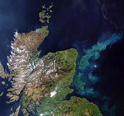
Space for the oceans
Oceans cover 71% of Earth's surface and are vital for our survival. But they are under stress from climate change, pollution and ocean acidification, which all affect ecosystems and biodiversity. UN Sustainable Development Goal (SDG) 14 – Life below water – focuses on the conservation and sustainable use of oceans, seas and marine resources.
With its fleet of Earth observation satellites, ESA watches over the ocean to support humanity to monitor and protect the environment, as well as to adapt to any changes. From temperature to wave height, through sea level, sea ice, saltiness and phytoplankton, these satellites take stock of the ocean in many different ways. ESA also supports over 50 projects that directly contribute to SDG14, a few of which we present in this article.
Animals and plants
Millions of species live in the oceans, from single-celled microorganisms to the biggest whales and sharks. One of the most critical ocean-dwellers is phytoplankton, which generates about half of the atmosphere's oxygen and is the first step in the food chain. Project PhysioGlob is using satellite observations to understand and monitor how phytoplankton responds to global warming.
Another widespread ocean plant is sargassum, a type of seaweed that provides a habitat for marine animals but can be a nuisance when it washes up on beaches as it smells bad and obstructs fishermen trying to get their boats in and out of the water. Incoming rafts can also damage life inside the seaweed. One project used satellite data to monitor floating sargassum in the Caribbean to estimate its drift and coastal landings.
It is not only plants that can be supported by space. Biological hotspots for whales have been identified with satellite data, which has contributed to the management of marine protected areas. Using satellite measurements of ocean environmental data, it is possible to map variables that impact the presence and movement of whales.
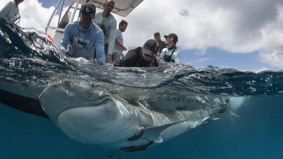
Most projects that support the oceans use mainly Earth observation data, but telecommunications satellites can also support marine life. This was demonstrated by the SHARC project that developed tracking devices for marine animals. The devices have already been tested on tiger sharks and are much cheaper and longer-lasting than more traditional trackers.
The Arctic

The Arctic is warming faster than anywhere else in the world. As the region is remote and conditions are harsh, it is hard to access with onsite instruments, so satellite data are vital for environmental monitoring. ESA supports a number of Arctic-related projects, with one dedicated to developing Earth observation services that support stakeholder needs.
The Arctic contains sea ice and icebergs made of almost pure water that reduce the saltiness of the surrounding sea water as they melt. One project has been looking into using measurements from ESA's SMOS and NASA's SMAP satellites of the salinity of the sea surface in the Arctic to monitor melting and freezing sea ice. Another has measured sea ice thickness directly using ESA's CryoSat mission; the project focuses on the summer months for which little information is currently available because CryoSat's radar cannot measure thickness effectively when melt ponds form on the sea ice.
Coastal areas
Coastal areas are often densely populated with people and marine life, and face many challenges – including pollution, climate change and natural hazards. Aside from supporting a dedicated Thematic Exploitation Platform for coastal areas, ESA is also developing and demonstrating a portfolio of Earth observation information services to support investment from international development banks that address marine and coastal issues.
Several projects are currently looking at improving our ability to measure sea level in coastal areas using satellite instruments that send out and receive pulses of radio waves to map Earth's surface. One of these projects, SCOOP, is focusing on the instruments already on board the Copernicus Sentinel-3 satellite.
Combining Earth observation, telecommunication and navigation data, information on coastal waters in the Mediterranean is being provided to assist coastal surveillance and water quality monitoring. And to help coastal development planning and risk assessments, project BathySent used Copernicus Sentinel-2 data to develop a way to automatically map water depths close to shorelines.
Human waste
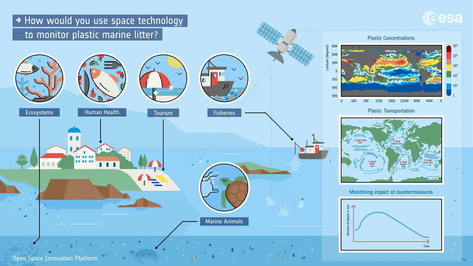
Every year around ten million tonnes of plastic ends up in the ocean with the potential to endanger marine animals and enter the global food chain. Several projects have recently kicked off to directly detect and monitor seaborne plastic from space; one goal is to create a global map of litter concentrations.
Oil spills are also an issue; another project used Earth observation satellite data to support environmental surveillance and safety offshore, including detecting and monitoring oil spills and minimising the resulting damage.
Ocean currents
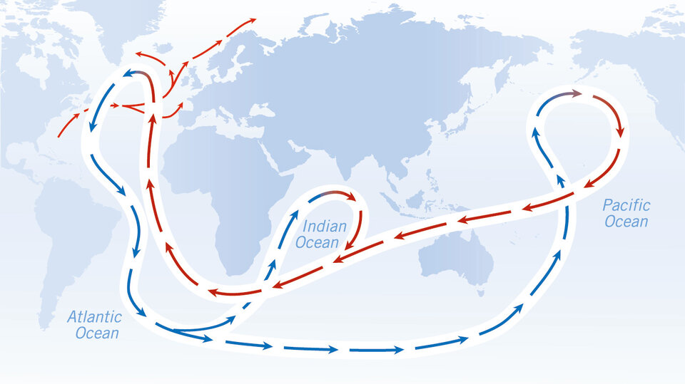
Not only do ocean currents play an important role in the climate, they are critical for sea life, impact many ocean properties and they transport marine litter around the world. At the moment no satellite provides direct measurements of ocean surface currents, but as they shape sea level, transport salt, affect surface temperature and much more, currents can be indirectly inferred from satellite observations of these other properties. The CIRCOL project is investigating how to improve our knowledge of surface currents from sea level and ocean colour measurements, and the World Ocean Circulation project has just kicked off to combine information from different satellites to monitor currents for applications such as generating renewable energy, monitoring pollution and ecosystem health, and ensuring safety at sea.
Water conditions
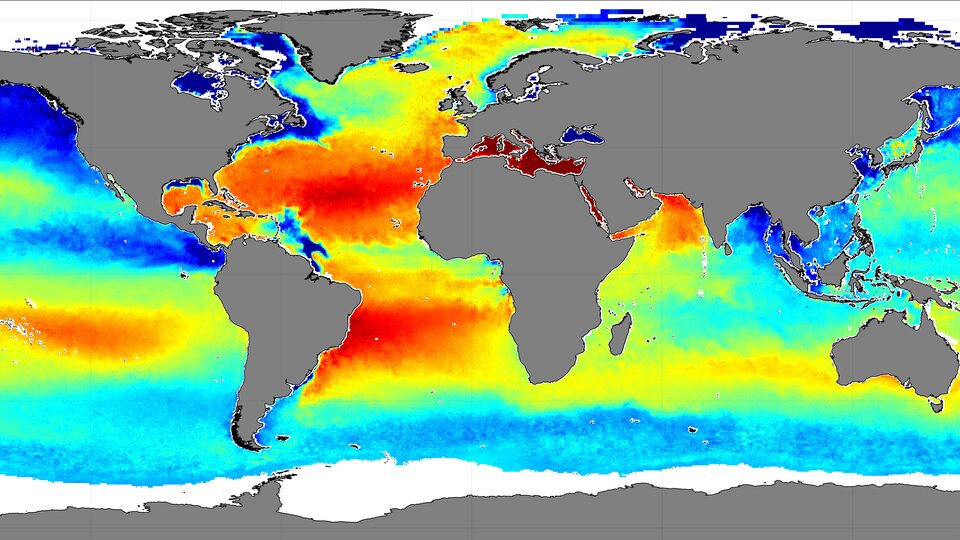
The salinity of sea water – driven by rainfall, evaporation, and freshwater from rivers – affects its density – and therefore the circulation of ocean currents. ESA supports several projects that investigate salinity at the sea surface, including three focusing respectively on the Baltic Sea, Mediterranean Sea and Black Sea, all using data from SMOS.
As oceans absorb much of the excess carbon dioxide that humans emit into the atmosphere, it is vital to look at what happens to the water conditions as a result. Launched this year, the BICEP project uses space data and local measurements to better understand how carbon dioxide sinks deep into the ocean and is transformed into organic matter. As water absorbs carbon dioxide, it becomes more acidic, which impacts marine ecosystems. Project OceanSODA uses Earth observation data to monitor how ocean acidity is changing, working with environmental organisations to ensure this data can be used for environmental conservation.
Sea level
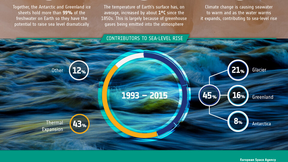
Global average sea level rise has averaged around three millimetres per year since satellite measurements began in 1993 and is now up to nearly five millimetres per year. Waters are rising faster in some places than in others, with Southeast Asia being one of the worst-affected regions. The resulting higher flood risk is severely impacting coastal and island communities through damage to coastal infrastructure, agriculture and even tourism and recreational activities.
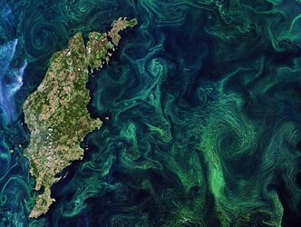
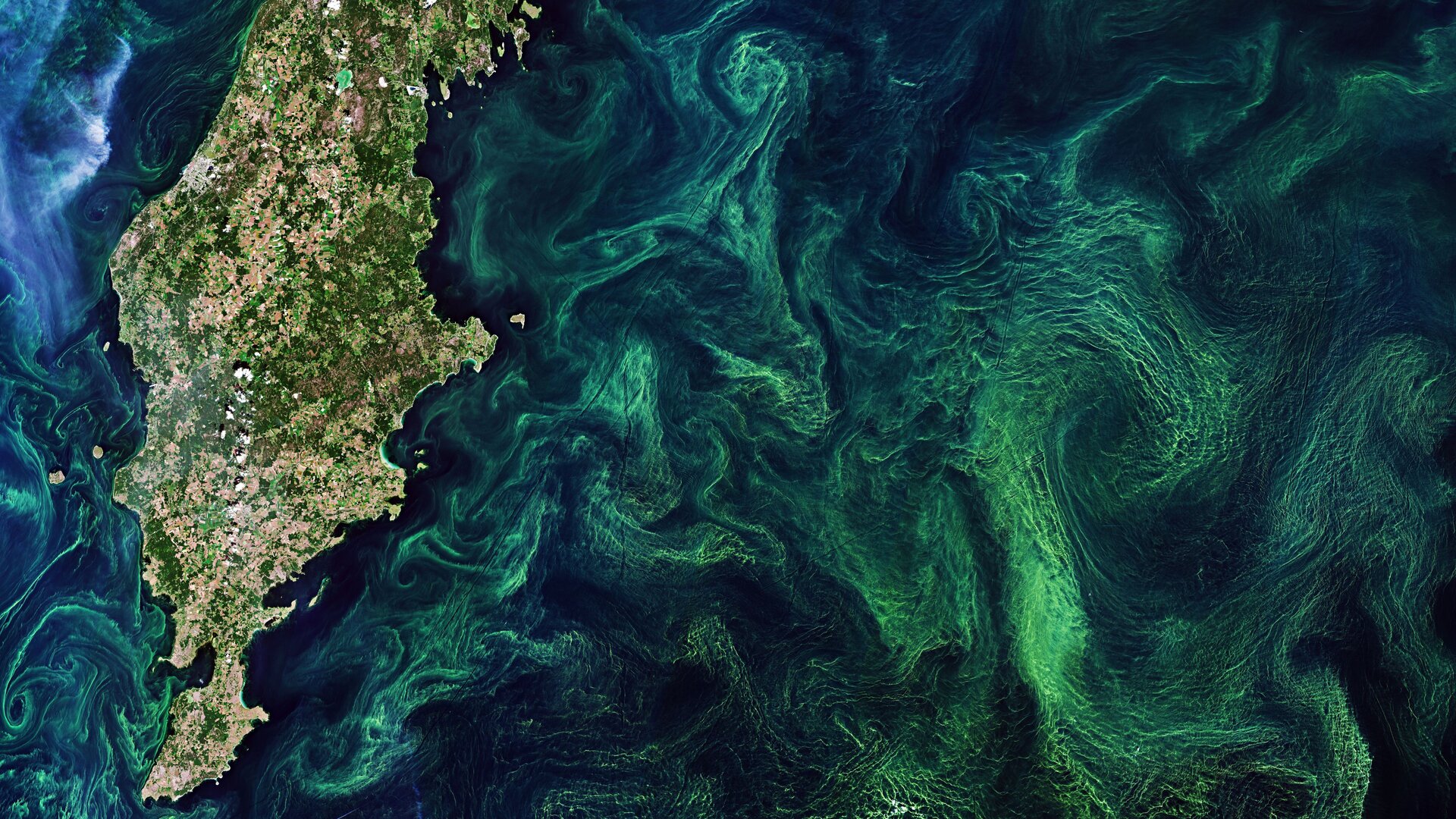
With its complex coastline and seasonal sea ice, the Baltic Sea is the perfect test environment for developing advanced sea level monitoring using satellite radar instruments. Project Baltic SEAL used satellite data to improve our knowledge of the sea level in the Baltic, where water level is actually decreasing compared to the coast in some places as the land rises gradually after the melting of huge ice sheets that formed during the last ice age.
Rising sea levels are mainly due to melting land ice and glaciers. One project used data from the CryoSat satellite to find out exactly how much mountain glaciers around the world are melting and how much this is causing sea levels to rise. Another – Sea Level Budget Closure, which is part of ESA's Climate Change Initiative – is aiming to add up all the contributions to rising sea level and compare the value with satellite radar measurements.
To find out about more ESA projects supporting SDG14, visit our dedicated website.