• → European Space Agency

      • Space for Europe
      • Space News
      • Space in Images
      • Space in Videos
    • About Us

      • Welcome to ESA
      • DG’s blog
      • For Member State Delegations
      • Business with ESA
      • Law at ESA
      • ESA Exhibitions
      • ESA Publications
      • Careers at ESA
      • ESAshop
    • Our Activities

      • Space News
      • Observing the Earth
      • Human and Robotic Exploration
      • Space Transportation
      • Navigation
      • Space Science
      • Space Engineering & Technology
      • Operations
      • Telecommunications & Integrated Applications
      • Preparing for the Future
    • Careers at ESA

    • For Media

      • Media
      • ESA TV
      • Videos for professionals
      • Photos
    • For Educators

    • For Kids

    • ESA

    • Observing the Earth

    • Copernicus

    • Sentinel-2

    • Colour vision
    • Introducing Sentinel-2
    • Applications
    • Plant health
    • Changing lands
    • Water bodies
    • Disaster mapping
    • About the mission
    • Facts and figures
    • Satellite constellation
    • Instrument
    • About the launch
    • Operations and data
    • Data flow
    • Data products
    • Essential groundwork
    • Multimedia
    • Image gallery
    • Video gallery
    • Downloads
    • 2019 calendar
    • Documents & publications
    • Services
    • Subscribe

    ESA > Our Activities > Observing the Earth > Copernicus > Sentinel-2

    Sentinel-2 maps Indonesia earthquake

    Fault line land movement
    5 October 2018

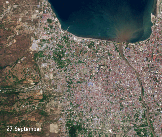
    A 7.5-magnitude earthquake and tsunami hit Indonesia on 28 September, destroying homes and hundreds of lives. As the death toll continues to rise, the effects of this natural disaster are far-reaching, with hundreds of thousands of people seeking access food, water and shelter in the aftermath of this tragedy.

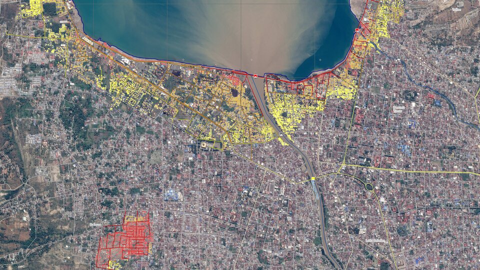
    The European Union activated its Emergency Copernicus satellite mapping service a couple of hours after the earthquake to assist authorities. Copernicus has also produced grading maps showing the impact of the damage covering ten areas of interest. The tailor-made service continues to closely monitor the situation and provide assistance in the aftermath of the disaster.

    Copernicus grading map

    The Copernicus Emergency Management Service is a key tool providing understanding of the situation on the ground, thus assisting the European Union’s Civil Protection Mechanism, activated following a request for assistance from the government of Indonesia. The Emergency Response Coordination Centre is working 24/7 to mobilise offers of assistance to the affected areas. 

    One of the ways in which ESA is contributing to this area is through leading a range of activities in the framework of the Committee on Earth Observation Satellites (CEOS) Working Group on Disasters.

    The Geohazards Office, led by the French Geological Survey (BRGM) liaises with practitioners on the exploitation of Earth observation processing services to support hazard mapping and risk assessment. This is in the spirit of the International Forum on Satellite Earth Observation and Geohazards.

    Displacement map

    BRGM experts have generated displacement maps using Copernicus Sentinel-2 acquisitions from 17 September and 2 October.

    Thematic experts from the Corinth Rift Laboratory in Greece have generated similar results using the Cloud processing platform GEP, which has been designed to rapidly provide automated measurements.

    As shown in the images, the earthquake triggered deformations of several metres and a tsunami. Around 1400 people are reported to have lost their lives, hundreds have been hospitalized and many more thousands are thought to have been displaced. It has been estimated that up to 1.5 million people will be affected by these events.

    Displacement data

    The Vice-President of the country, Jusuf Kalla, has said that the final death toll could reach the thousands. The International Charter Space and Major Disasters was triggered by the Asian Disaster Reduction Centre on 29 September for this event. International collaboration is in place to organise Earth observation-based disaster response activities.

    Scientific products such as the map created by BRGM are helping us to better understand hazards. Beyond this example it is foreseen that Earth observation data will also be useful for supporting recovery, rehabilitation and reconstruction activities in Indonesia.

    Rate this

    Views

    Share

    • Currently 4.5 out of 5 Stars.
    • 1
    • 2
    • 3
    • 4
    • 5
    Rating: 4.7/5 (99 votes cast)

    Thank you for rating!

    You have already rated this page, you can only rate it once!

    Your rating has been changed, thanks for rating!

    12549
    Tweet

    Related articles

    Sentinel-1 maps flash floods in Laos30 July 2018

    Sentinel-1 maps flash floods in Laos30 July 2018 Copernicus Sentinel-1 data are highlighting the collapse of the Xe-Pian Xe-Namnoy dam in the southeastern province of Attapeu in Laos. The collapse has led to flash floods that have claimed several lives and left many more people missing, according to...

    Copernicus Sentinel maps Florence hurricane flood15 September 2018

    Copernicus Sentinel maps Florence hurricane flood15 September 2018 Making landfall in the US state of North Carolina on 14 September, Hurricane Florence is causing widespread damage and flooding. The Copernicus Sentinel-1 radar mission is being used to map affected areas.

    Sentinel-1 sees through hurricanes25 October 2017

    Sentinel-1 sees through hurricanes25 October 2017 This year’s Atlantic hurricane season has been a harsh reminder of the grief and devastation brought by these vast storms. Imaging the top of hurricanes from space is nothing new, but the Sentinel-1 satellites can see right through these towering spin...

    • Sentinel data access
    • International Charter
    • Related Links
    • Disasters charter Indonesia earthquake activation
    • Geohazards
    • Satellite Earth Observation for Geohazard Risk Management
    • App Store
    • Subscribe
    • mobile version
    • ESA Observing the Earth Twitter

    @ESA_EO

    • FAQ

    • Site Map

    • Contacts

    • Terms and conditions