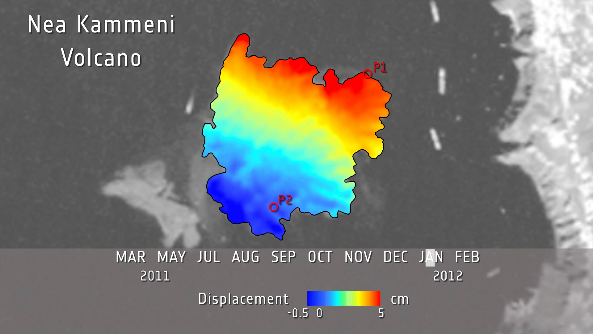
Nea Kameni volcano movement captured by Envisat
Archived data from the Envisat satellite show that the volcanic island of Santorini has recently displayed signs of unrest. Even after the end of its mission, Envisat information continues to be exploited for the long-term monitoring of volcanoes.
Santorini is a picturesque Greek island in the south Aegean Sea and the most active volcanic centre in the South Aegean Volcanic Arc.
The island is the site of one of history’s largest volcanic eruptions, about 3600 years ago. The geological record over the past million years reveals an extensive history of eruptions, with the most recent occurring in 1950.

But despite being dormant for over half a century, satellites have detected slight movements.
These and other findings were presented at the International Forum on Satellite Earth Observation for Geohazard Risk Management, currently under way in Santorini itself.
Organised by ESA in partnership with the Group on Earth Observations (GEO), the forum is focusing on the science and applications of satellite Earth observation to support the management of risks associated with geophysical hazards.
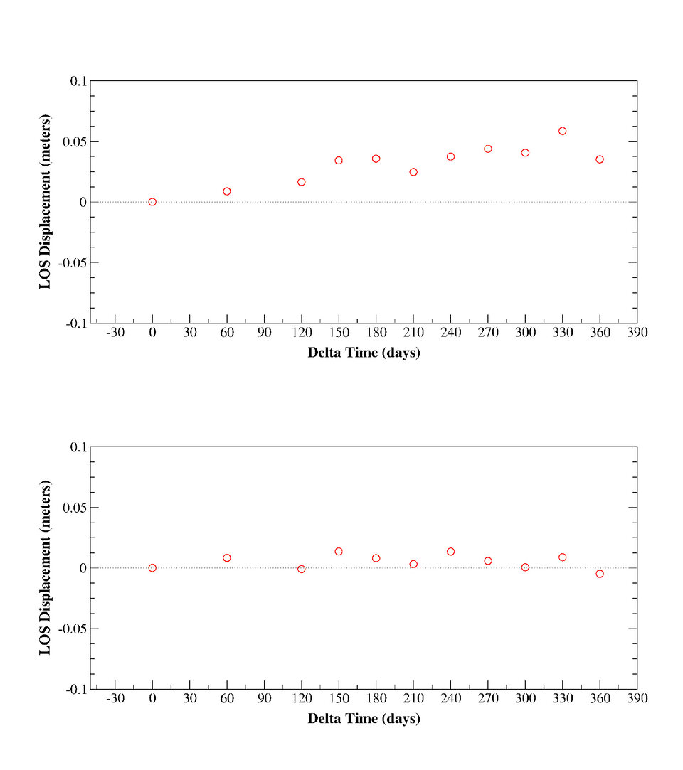
Seismic activity in Santorini, such as the underground movement of magma, from January 2011 to today has caused ground deformation that was detected by Envisat’s radar.
Even from an orbit about 800 km above the ground, deformations of a few centimetres can be detected by satellite radars.
When two or more radar images of the same area are combined, changes in signal reflections between them can be measured. This technique called Differential Interferometric Synthetic Aperture Radar – or DInSAR – has become a useful tool for detecting ground deformation.
Envisat shows that the northeastern part of Santorini’s Nea Kameni volcano experienced an uplift of about 5 cm in 2011, while other areas of the volcano rose some 3–4 cm.
"Monitoring to detect any change of the status of the volcano presents a further step towards the understanding of physical processes related to volcanic eruptions that can lead to natural disasters," said Prof. Issaak Parcharidis from the Department of Geography at the Harokopio University of Athens.
During the first months of this year, Santorini saw a drop in the speed of deformation, accompanied by a reduction in seismic activity.

"After evaluation of local seismic activity, deformation and physicochemical changes, [we] concluded that during the last months the volcano presents a very limited activity, much lower than that of 2011," said Prof. Kosmas Stylianidis, Head of the Special Scientific Committee for the Monitoring of Santorini Volcano.
"The Committee, in its monthly report of April to the government, advises the application of no restrictive measure concerning the mobility of population."
Contact with Envisat was lost on 8 April, but ten years of archived data from the mission will continue to be used by scientists for monitoring volcanoes and many other studies.
The continuation of observation from coming satellite missions, such as the family of Sentinels under Europe’s Global Monitoring for Environment and Security programme, is crucial for ensuring data flow to scientists and operational users dealing with hazard and risk assessment.