• → European Space Agency

      • Space for Europe
      • Space News
      • Space in Images
      • Space in Videos
    • About Us

      • Welcome to ESA
      • DG's News and Views
      • For Member State Delegations
      • Business with ESA
      • ESA Exhibitions
      • ESA Publications
      • Careers at ESA
    • Our Activities

      • Space News
      • Observing the Earth
      • Human Spaceflight
      • Launchers
      • Navigation
      • Space Science
      • Space Engineering
      • Operations
      • Technology
      • Telecommunications & Integrated Applications
    • For Public

    • For Media

    • For Educators

    • For Kids

    • ESA

    • Observing the Earth

    • Understanding Our Planet

    • Securing Our Environment

    • Benefiting Our Economy

    • About Observing the Earth

      • How does Earth Observation work?
      • How to get Earth observation data
      • Integrating Earth Observation in your job
      • Earth Observation users speak
    • EO programmes
    • The Living Planet
    • GMES
    • ESA's Earth Observing missions
    • Envisat overview
    • ERS overview
    • Earth Explorers overview
    • Sentinels overview
    • MSG overview
    • MetOp overview
    • Proba-1 overview
    • Third Party Missions overview
    • Opportunities with us

      • Education & training
      • International cooperation
      • Milestones & announcements
    • Multimedia

      • Image Gallery
      • Video Gallery
      • Online resources
      • RSS feeds
    • Services
    • Subscribe

    ESA > Our Activities > Observing the Earth

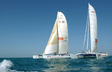
    Satellites ensure safe passage through treacherous waters in Volvo Ocean Race

    Grinding in heavy seas
    Grinding in heavy seas
    6 March 2006

    The Volvo Ocean Race yachts have safely rounded Cape Horn on the fourth leg of their round-the-world adventure thanks to the help of radar satellites steering them away from dangerous icebergs.

    While all the legs of the race have their unique dangers, Volvo Ocean Race Meteorologist Chris Bedford said leg four is arguably the most dangerous. "The boats have to face 50-knot storms, massive seas and possible ice, and if something happens on the leg, help is many hours and, more likely, days away."

    C-CORE, a Canadian company providing Earth observation based geo-information services, supplied ‘pre-leg’ reconnaissance of the areas in the Southern Ocean notorious for harbouring icebergs by using data acquired by the ESA’s Envisat and the Canadian Space Agency’s (CSA) RADARSAT-1 satellites.

    Ice island on radar
    Radar image highlights ice island

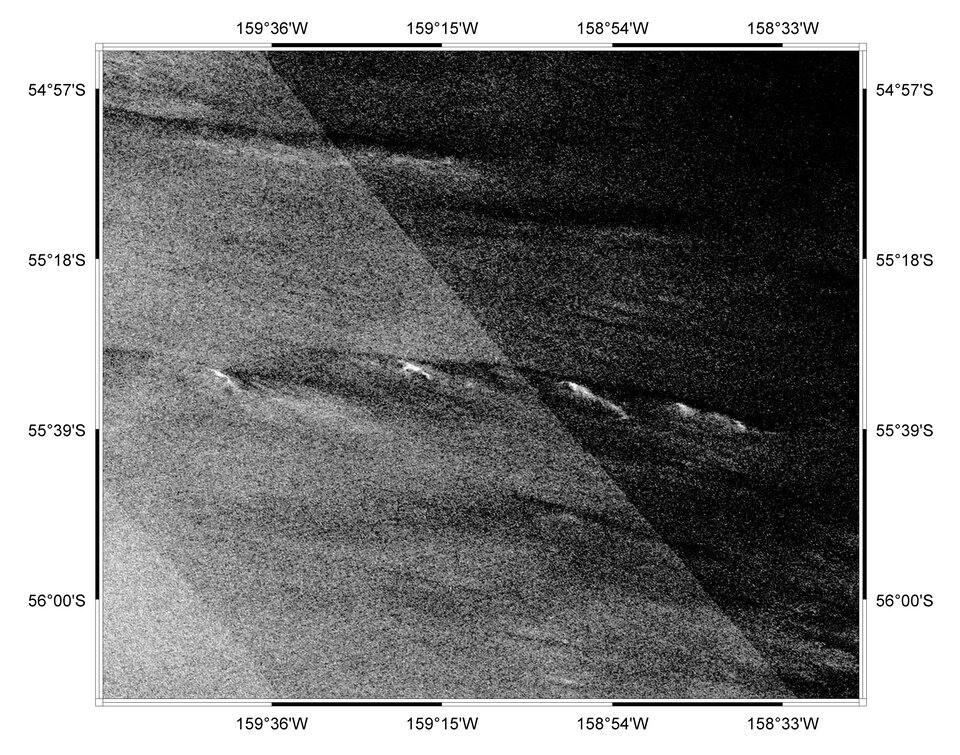
    Within a few hours of the satellites collecting the data with Synthetic Aperture Radar (SAR), C-CORE received and processed it using a specialised Iceberg Detection Software. The results, which included iceberg targets, their size and shape and longitude and latitude information, were then forwarded to Bedford, who provided it to the crews.

    "The C-CORE service has been a huge help in allowing us to set the course in such a manner as to keep the team away from potential ice," Bedford said. "In addition, the crews were able to leave the dock with a reasonable idea of where the ice was most likely to be."

    Knowing where the ice was most likely to be was helpful to sailors who still had to be vigilant and weary of ‘growlers’ – smaller bits of ice that break away from main icebergs and do not show up on radar. Growlers can be the size of a small car and are extremely dangerous and difficult to spot by eye, especially when travelling at full speed during rough seas at night.


    Route map

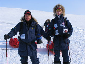
    "I'm relieved that I got through another amazing Southern Ocean trip in one piece, but also somewhat sad. Every time I get to this part of a round-the-world trip I look over my shoulder at Cape Horn and just wonder: will I be coming down here again? If not, thank you Southern Ocean for letting me cross you safely and for those unforgettable experiences," Ericsson skipper Neal McDonald wrote to race headquarters via email.

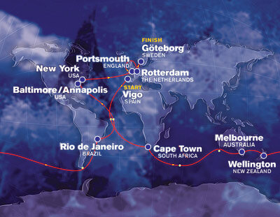
    The Volvo Ocean Race, which takes place every four years, is a 31 250 nautical mile round-the-world race comprised of nine legs. The fourth leg covers 6 700 miles from Wellington, New Zealand, to Rio de Janeiro, Brasil, via Cape Horn.

    C-CORE is funded under The Polar View initiative and is part of Global Monitoring for Environment and Security (GMES), a joint initiative by the ESA and the European Commission to establish an independent global monitoring capacity in support of European policy goals.

    Rate this

    Views

    Share

    • Currently 0 out of 5 Stars.
    • 1
    • 2
    • 3
    • 4
    • 5
    Rating: 0/5 (0 votes cast)

    Thank you for rating!

    You have already rated this page, you can only rate it once!

    Your rating has been changed, thanks for rating!

    46
    Tweet
    • Related news
      • Envisat helps Polar Challenge racers on way to Magnetic North Pole
        • Satellites guide world's top yachts through Southern Ocean 'iceberg alley'
        • Related missions
          • Envisat overview
          • In depth
          • Earth Observation Market Development (EOMD)
          • GMES
          • Related links
          • Polar View
          • Volvo Ocean Race
          • Canadian Space Agency

    Connect with us

    • RSS
    • Youtube
    • Twitter
    • Flickr
    • G+
    • Facebook
    • Livestream
    • Subscribe
    • App Store
    • LATEST ARTICLES
    • · Rare merger reveals secrets of gal…
    • · Watching for hazards: ESA opens as…
    • · ESA astronaut Timothy Peake set fo…
    • · Space drives e-mobility
    • · Proba-V opens its eyes
    • FAQ

    • Jobs at ESA

    • Site Map

    • Contacts

    • Terms and conditions