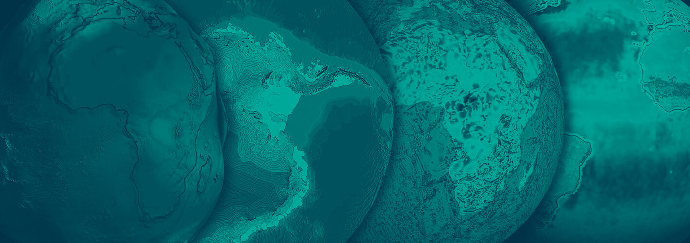
• → European Space Agency

      • Space for Europe
      • Space News
      • Space in Images
      • Space in Videos
    • About Us

      • Welcome to ESA
      • DG's News and Views
      • For Member State Delegations
      • Business with ESA
      • ESA Exhibitions
      • ESA Publications
      • Careers at ESA
    • Our Activities

      • Space News
      • Observing the Earth
      • Human Spaceflight
      • Launchers
      • Navigation
      • Space Science
      • Space Engineering
      • Operations
      • Technology
      • Telecommunications & Integrated Applications
    • For Public

    • For Media

    • For Educators

    • For Kids

    • ESA

    • Observing the Earth

    • Understanding Our Planet

    • Securing Our Environment

    • Benefiting Our Economy

    • About understanding our planet
    • Space and Earth Monitoring

      • Land

        • Overview
        • Rivers & lakes
        • Volcanoes
        • Coastal zones
        • Wetlands & deserts
      • Oceans

        • Overview
        • Wind & waves
        • Ocean colour & algae blooms
        • Sea Surface Temperature
        • El Niño
      • Ice

        • Overview
        • Ice and climate
      • Atmosphere

        • Overview
        • Water vapour & clouds
        • Aerosols
        • Ozone hole
        • Climate change
      • Biosphere

        • Overview
        • Forests
        • Carbon cycle
    • About Observing the Earth

      • How does Earth Observation work?
      • How to get Earth observation data
      • Integrating Earth Observation in your job
      • Earth Observation users speak
    • Opportunities with us

      • Education & training
      • International cooperation
      • Milestones & announcements
    • Multimedia

      • Image Gallery
      • Video Gallery
      • Online resources
      • RSS feeds

    ESA > Our Activities > Observing the Earth > Understanding Our Planet

    Climate change

    Our climate is undergoing change more rapid than at any other point since the end of the last ice age, 10 000 years ago. The extent remains uncertain but its direction is clear: the world is heating up, and it appears to be due to our actions.
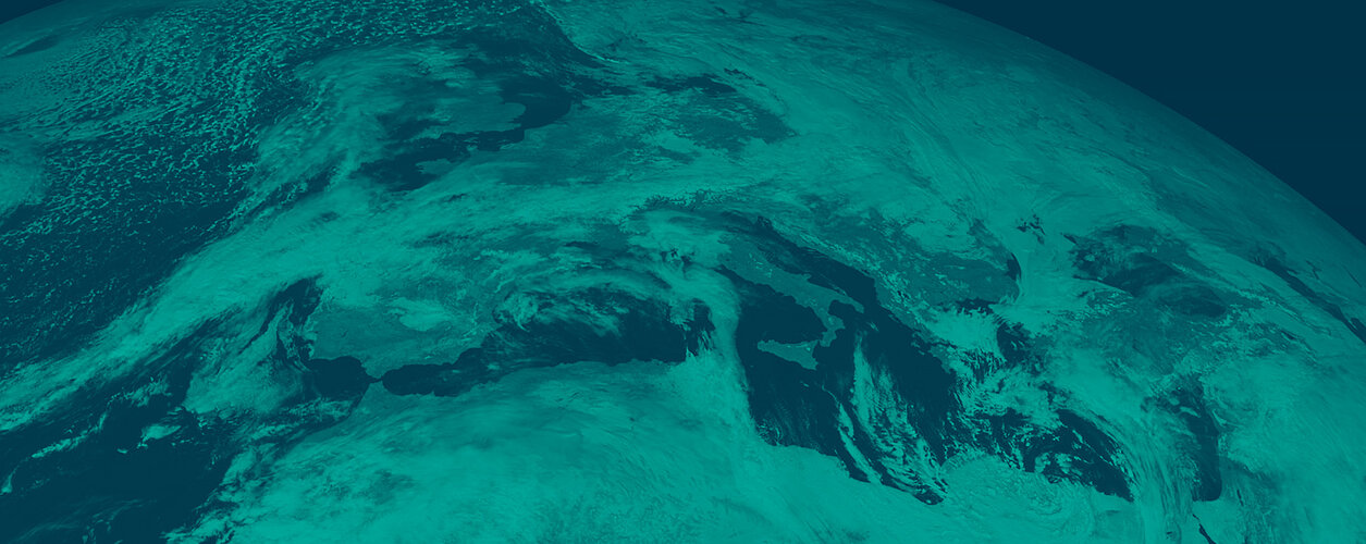
    Global heat blanket

    Human activities are rapidly altering the make-up of our atmosphere and in doing so are warming it up. The atmosphere works like a blanket around the rocky Earth, trapping solar heat that would otherwise be radiated straight back out to space. By doing so, it increases the surface temperature from a chilly -18º C to a balmy +15º C, and makes life on Earth possible.

    But by mass burning of fossil fuels and biomass, humanity is increasing the proportion of carbon dioxide and other heat-trapping greenhouse gases found in the atmosphere. Going by scientists’ current best models, the average global temperature could increase by anything from 1.5 to 5º C plus by the century’s end. The full consequences of this temperature shift for the dynamic system that is our climate can currently only be guessed at.
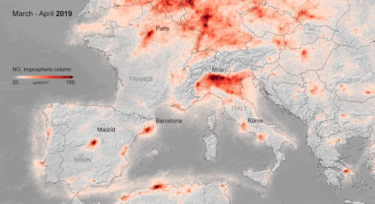
    Fishing town Muynak is now 150 km from water

    Atmospheric mapping

    Earth Observation has the potential to improve our predictive vision. Space-based spectrometers split the light passing through the atmosphere into visible and invisible individual wavelengths to look for distinctive absorption or emission 'footprints' left by global warming chemicals.

    Possessing a sensitivity of a few molecules per billion parts of air, atmospheric instruments can collectively create three-dimensional maps showing the concentration of greenhouse gases throughout the atmosphere, including methane and carbon monoxide as well as carbon dioxide.


    Climate indicators

    Accurately estimating the extent of global warming that such gases may cause requires high-accuracy measurement of key climate indicators over time.

    For instance, Envisat's Advanced Along Track Scanning Radiometer (AATSR) - like its predecessors flown on previous satellites - keeps a precise record of global sea surface temperature, adding to an archive that already extends across more than a decade.

    Earth Observation can also map carbon 'sinks' such as tropical rainforests and peat bogs. The 1997 Kyoto Protocol intended to stabilise the global release greenhouse gas sets the presence of such carbon sinks within a nation's territory against the amount of carbon dioxide they are permitted to emit.

    Rate this

    Views

    Share

    • Currently 0 out of 5 Stars.
    • 1
    • 2
    • 3
    • 4
    • 5
    Rating: 0/5 (0 votes cast)

    Thank you for rating!

    You have already rated this page, you can only rate it once!

    Your rating has been changed, thanks for rating!

    78
    facebook
    twitter
    reddit
    google plus
    digg
    tumbler
    digg
    blogger
    myspace
    • Related news
      • read 2
        • Climate talks underway in South Africa
          • Caring about climate: ESA experts at international conference
            • Polar scientists herald importance of satellite observations
            • Special features
            • Animals on climate
            • Space for our climate
            • Related missions
            • ERS overview
            • Envisat overview
            • Earth Explorers overview
            • Sentinels overview
            • MetOp overview
            • MSG overview
            • In depth
            • EO Principal Investigator Portal
            • Related links
            • UN Framework Convention on Climate Change (UNFCCC)
            • Eumetsat
            • WMO

    Connect with us

    • RSS
    • Youtube
    • Twitter
    • Flickr
    • Google Buzz
    • Subscribe
    • App Store
    • LATEST ARTICLES
    • · CryoSat hits land
    • · Ariane 5 completes seven launches …
    • · Measuring skull pressure without t…
    • · Malargüe station inauguration
    • · The solar wind is swirly
    • FAQ

    • Jobs at ESA

    • Site Map

    • Contacts

    • Terms and conditions