• → European Space Agency

      • Space for Europe
      • Space News
      • Space in Images
      • Space in Videos
    • About Us

      • Welcome to ESA
      • DG's News and Views
      • For Member State Delegations
      • Business with ESA
      • ESA Exhibitions
      • ESA Publications
      • Careers at ESA
    • Our Activities

      • Space News
      • Observing the Earth
      • Human Spaceflight
      • Launchers
      • Navigation
      • Space Science
      • Space Engineering
      • Operations
      • Technology
      • Telecommunications & Integrated Applications
    • For Public

    • For Media

    • For Educators

    • For Kids

    • ESA

    • Operations

    • Ground Systems Engineering

    • Space Debris

    • SSA

    • Background
    • About Operations
    • The Right Stuff
    • Multimedia

      • Images
      • Videos
    • SSA programme
    • Space Situational Awareness
    • Teams on ground
    • Ground Systems Engineering
    • EGOS - Ground operation system
    • Missions in space
    • Solar and planetary
    • Astronomy & fundamental physics
    • Earth observation
    • Human spaceflight
    • Technology demonstration
    • Past missions
    • ESA mission history
    • - Find a mission: A...Z
    • Mission control centres
    • ATV Control Centre (ATV-CC)
    • Columbus Control Centre (Col-CC)
    • Ground stations
    • ESTRACK tracking stations
    • ESTRACK Control Centre
    • - Find a station: A...Z
    • OPS Community
    • Advanced Mission Concepts & Technologies Office
    • HSO Exchange
    • Knowledge Management at ESA's Operations team

    ESA > Our Activities > Operations

    ESA extends Envisat satellite mission

    ESA Member States unanimously voted to extend the Envisat mission through to 2013
    5 June 2009

    ESA Member States have unanimously voted to extend the Envisat mission through to 2013. Envisat – the world’s largest and most sophisticated satellite ever built – has been providing scientists and operational users with invaluable data for global monitoring and forecasting since its launch in 2002.

    "The decision to extend the Envisat mission operations, taken during the last ESA Earth Observation Programme Board meeting, is a recognition of the success of the mission, in terms of the wide number of scientific and operational users served and the good technical status of the satellite after seven years of operations," Envisat Mission Manager Henri Laur said.

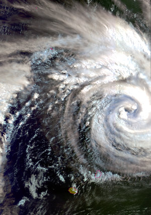
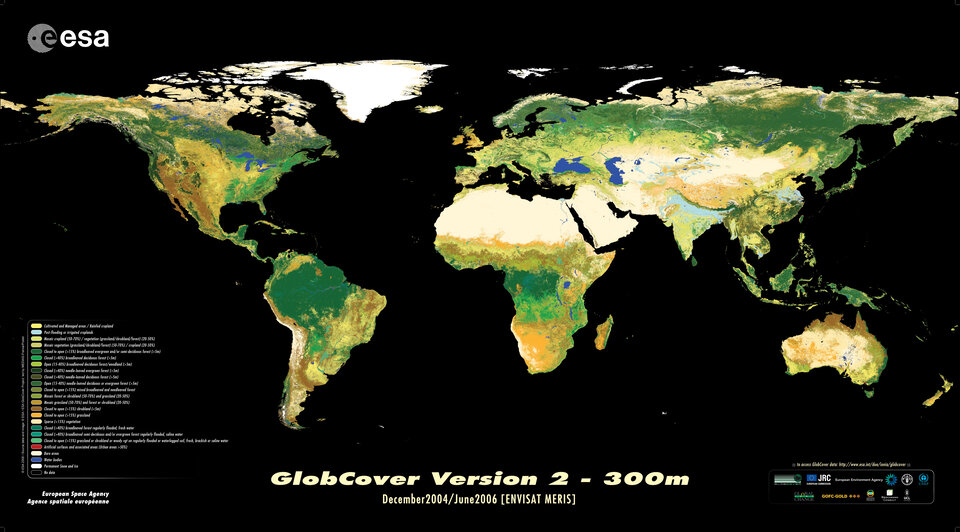
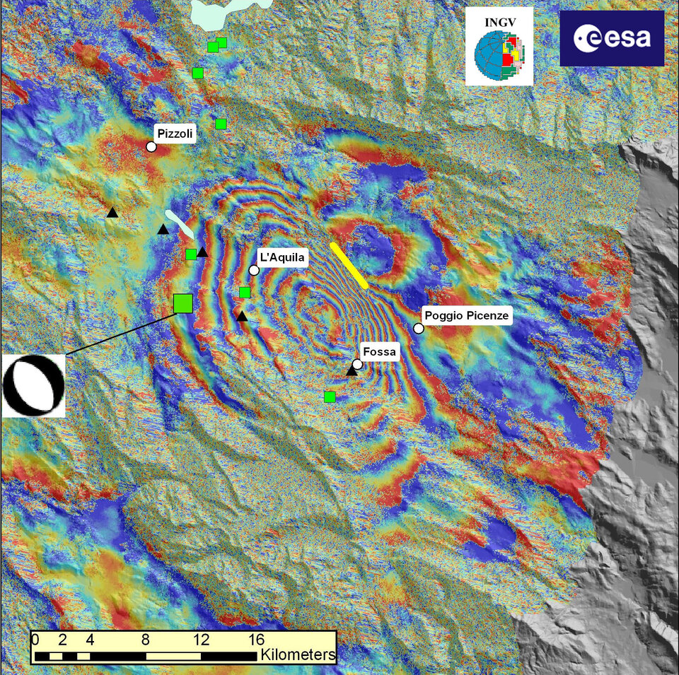
    Envisat, short for environmental satellite, has a unique combination of 10 different instruments which collect data about Earth’s atmosphere, land, sea and ice – providing scientists with the most detailed picture yet of the state of the planet.

    ESA’s global land cover map
    Envisat global land cover map

    Envisat data have never been in more demand than today, and many of these established services rely upon being able to access near-real time (NRT) data. The data are being increasingly used for routine applications, such as monitoring sea ice, oil slicks and illegal fisheries, which require the fastest possible access to the data so that quick decisions can be made.

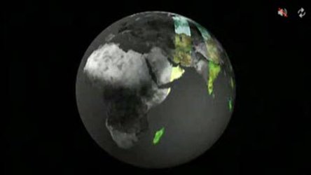
    Envisat NRT data make it possible to provide daily sea surface temperatures, worldwide fire maps, UV radiation levels and ozone forecasts, accessible through Today’s Earth check-up on ESA’s Earth observation website.

    Another reason the mission was extended is the need for scientists to be able to access data over long periods of time in order to identify and analyse long-term climatic trends and changes (such as greenhouse gas concentrations, sea surface temperature, sea levels, sea-ice extent).


    Interpreted Envisat interferogram
    L'Aquila earthquake: Envisat interferogram

    Envisat affords this by providing continuity of data initiated in the early 1990s with previous ESA satellites, ERS-1 and ERS-2. With the extension, Envisat will bridge the gap in data supply until the launch of the Sentinel satellites that will be launched as part of the Global Monitoring for Environment and Security (GMES) initiative.

    Sentinel-1 will ensure the continuity of radar imaging. Sentinel-3 will ensure continuity with Envisat’s radar altimeter and optical sensors. Sentinel-5’s precursor mission will ensure continuity with Envisat’s atmospheric sensors.

    The Envisat mission generates a large amount of daily data through its European-wide network of acquisition stations and processing centres. Access to Envisat data has continuously been upgraded since its launch, with an increasing amount of data available online free of charge.

    Rate this

    Views

    Share

    • Currently 0 out of 5 Stars.
    • 1
    • 2
    • 3
    • 4
    • 5
    Rating: 0/5 (0 votes cast)

    Thank you for rating!

    You have already rated this page, you can only rate it once!

    Your rating has been changed, thanks for rating!

    25
    facebook
    twitter
    reddit
    google plus
    digg
    tumbler
    digg
    blogger
    myspace
    • Related news
      • Envisat still going strong after five successful years
        • Four years on, Envisat hailed for its contribution to Earth science
        • Related missions
          • Envisat overview
            • ERS overview
            • In depth
            • GMES
            • ESA EO Principal Investigator Portal
            • Wilkins Ice Shelf
              Wilkins Ice Shelf
              'Webcam' from Space:
               Wilkins Ice Shelf
            • MIRAVI: Earth live

    Connect with us

    • RSS
    • Youtube
    • Twitter
    • Flickr
    • Google Buzz
    • Subscribe
    • App Store
    • ESA Operations Twitter

    Follow ESA operations

    • LATEST ARTICLES
    • · CryoSat hits land
    • · Ariane 5 completes seven launches …
    • · Measuring skull pressure without t…
    • · Malargüe station inauguration
    • · The solar wind is swirly
    • FAQ

    • Jobs at ESA

    • Site Map

    • Contacts

    • Terms and conditions