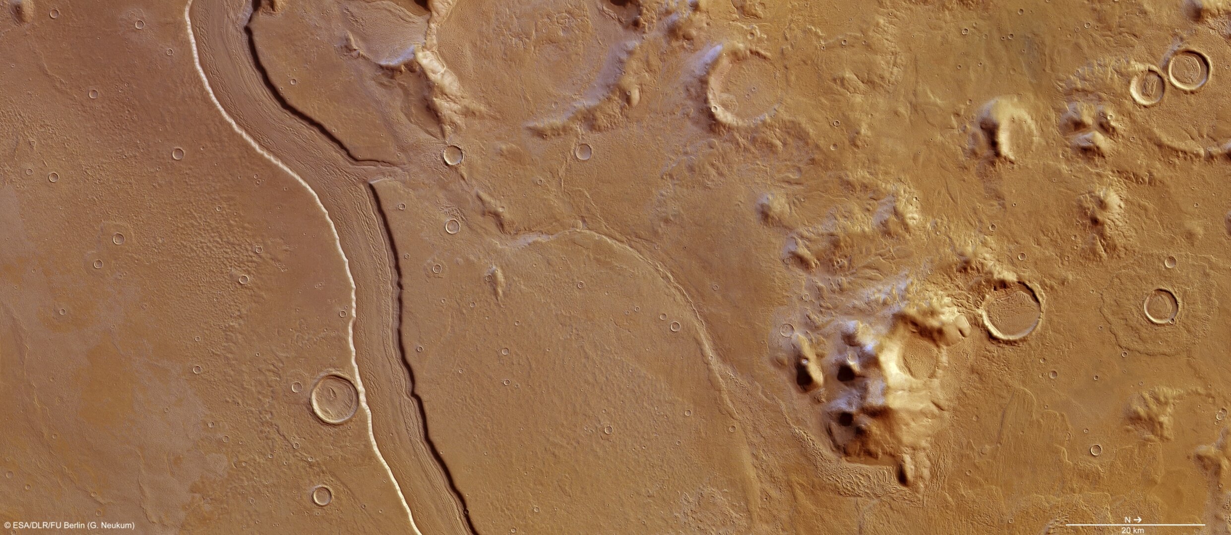
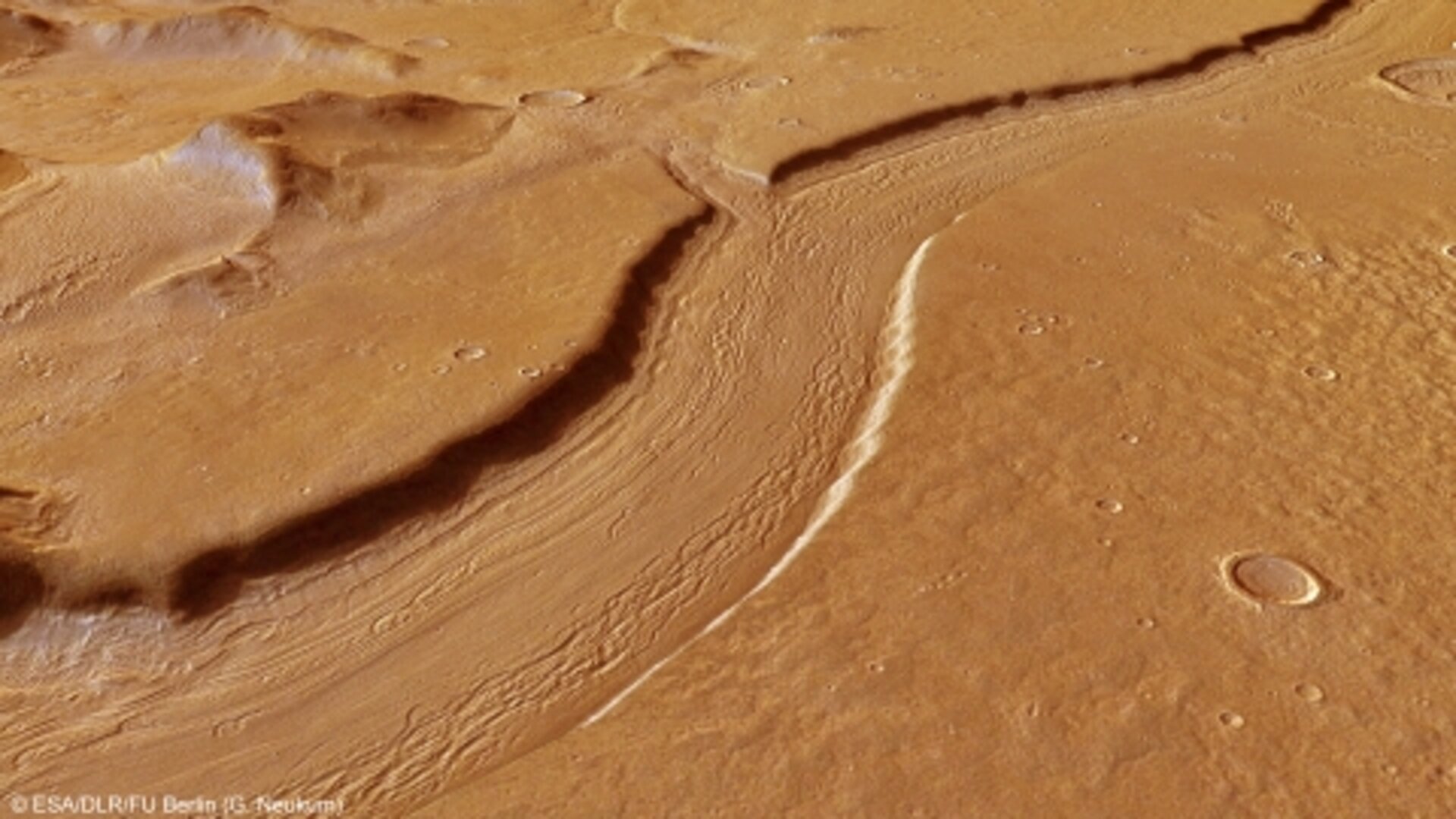
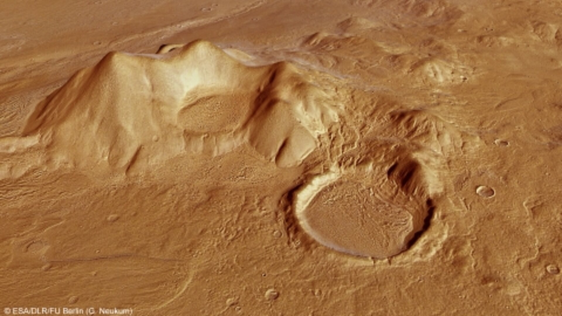
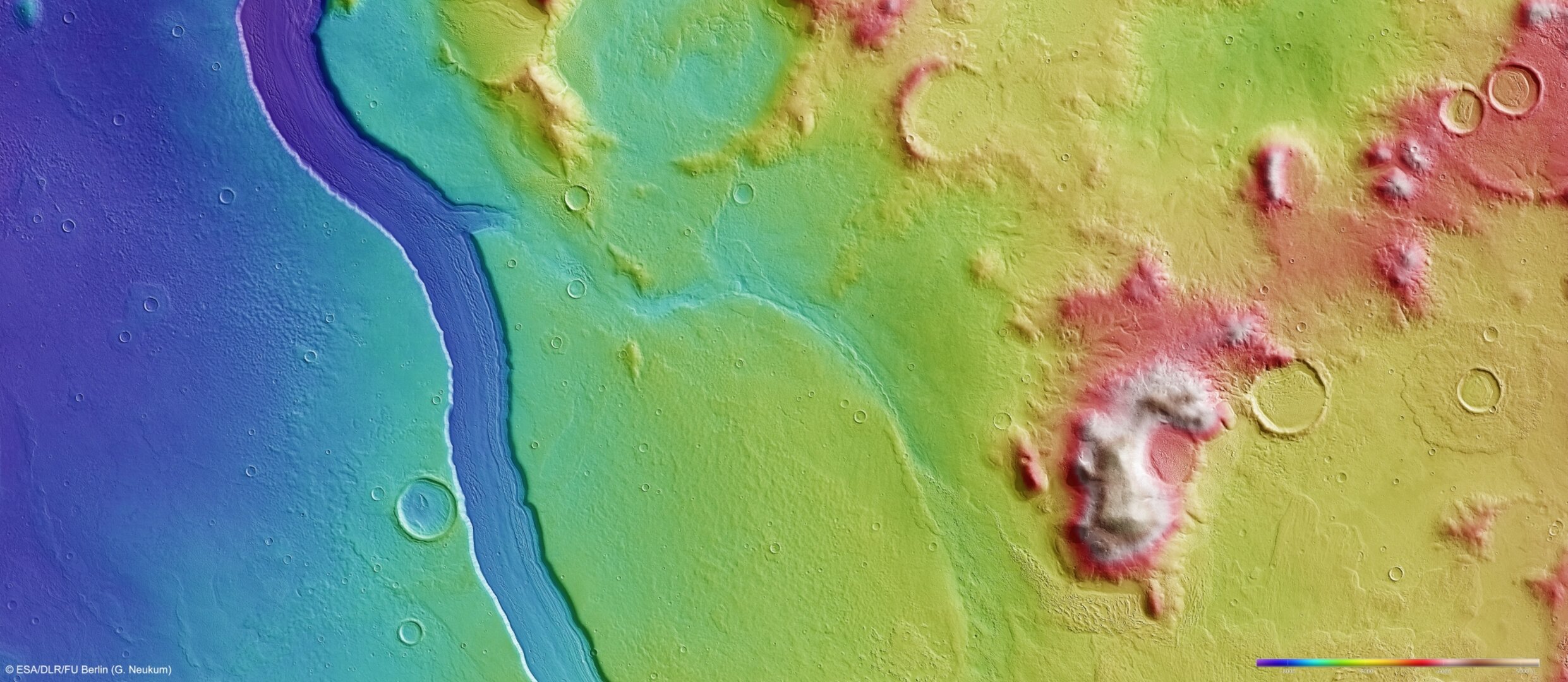
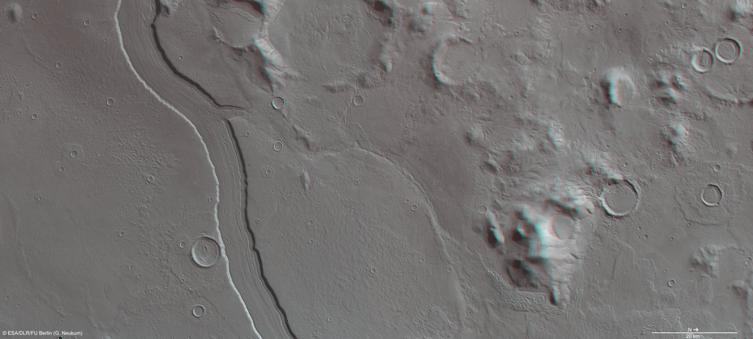
High-Resolution Stereo Camera (HRSC) nadir and colour channel data taken during revolution 10657 on 14 May 2012 by ESA’s Mars Express have been combined to form a natural-colour view of Reull Vallis. Centred at around 41°S and 107°E, the image has a ground resolution of about 16 m per pixel. The river-like channel is believed to have been formed by flowing water, which at some distant epoch cut through highland terrain and successively formed smooth plains. With a width of close to 7 km and a depth of around 300 m, the valley floor shows clear linear features believed to be ice-rich, and formed by debris and ice in a manner not dissimilar to the formation of glacial valleys on Earth.
This computer-generated perspective view of Reull Vallis was created using data obtained from the High-Resolution Stereo Camera (HRSC) on ESA’s Mars Express. Centred at around 41°S and 107°E, the image has a ground resolution of about 16 m per pixel. This perspective view shows a small tributary channel which, in the wider context view, is seen to later merge back into the main channel. Strong linear features are clearly seen on the valley floor in this view, evidence of ice and loose debris scraping away the floor in a glacial-like manner.
This computer-generated perspective view of part of the Promethei Terra highlands adjacent to Reull Vallis was created using data obtained from the High-Resolution Stereo Camera (HRSC) on ESA’s Mars Express. Centred at around 41°S and 107°E, the image has a ground resolution of about 16 m per pixel. The image shows a rounded and smooth-topped mountain with a large impact crater in the foreground. The crater is largely filled in with sediments and shows step-like structures towards the right side, possibly indicative of sublimation or evaporation of water ice at different times and at different depths within the crater.
This colour-coded overhead view is based on an ESA Mars Express HRSC digital terrain model of the Reull Vallis region, from which the topography of the landscape can be derived. The colour coding shows the depth of the main channel, coloured in blue, which contrasts clearly against the Promethei Terra Highlands and their smooth, soft and rounded mountain tops. Centred at around 41°S and 107°E, the image has a ground resolution of about 16 m per pixel. The image was taken during revolution 10657 on 14 May 2012.
![[1/5] Reull Vallis](/var/esa/storage/images/esa_multimedia/images/2013/01/reull_vallis/12483104-1-eng-GB/Reull_Vallis_latestnews.jpg)
![[2/5] Perspective view of Reull Vallis](/var/esa/storage/images/esa_multimedia/images/2013/01/perspective_view_of_reull_vallis2/12483134-5-eng-GB/Perspective_view_of_Reull_Vallis_latestnews.jpg)
![[3/5] Perspective view of Reull Vallis](/var/esa/storage/images/esa_multimedia/images/2013/01/perspective_view_of_reull_vallis/12483492-5-eng-GB/Perspective_view_of_Reull_Vallis_latestnews.jpg)
![[4/5] Topographic view of Reull Vallis](/var/esa/storage/images/esa_multimedia/images/2013/01/topographic_view_of_reull_vallis/12483164-3-eng-GB/Topographic_view_of_Reull_Vallis_latestnews.jpg)
![[5/5] 3D view of Reull Vallis](/var/esa/storage/images/esa_multimedia/images/2013/01/3d_view_of_reull_vallis/12483522-6-eng-GB/3D_view_of_Reull_Vallis_latestnews.jpg)
Rate this
Views
Share
- Currently 4.5 out of 5 Stars.
- 1
- 2
- 3
- 4
- 5
Rating: 4.58/5 (17 votes cast)Thank you for rating!
You have already rated this page, you can only rate it once!
Your rating has been changed, thanks for rating!