Views from space help oil prospectors see deep underground
It takes seismic force to make the ground give up its secrets. Through the years, those searching for oil and gas have used varied methods to send sound energy into the ground and to record the waves reflected by the geological features beneath the surface.
Modern methods include large vibrator trucks and many thousands of surface sensors called geophones, all precisely located to obtain the most useful information with which to explore for hydrocarbons. Today, seismic surveys planned with satellites are yielding clearer, deeper subterranean views at reduced cost.
Often carried out in the remotest parts of the planet, these surveys are almost military in scale and expense; a seismic crew exploring a 500-square-kilometre area can require 400 people with up to 50 small and 15 large vehicles working with up to 600,000 geophones, and carrying out 600 seismic 'shots' daily.
Seismic surveyor WesternGeco, has been working with ESA for the last three years to integrate satellite data into its working practices. What Earth Observation can provide is a detailed preview of a region's topography and geology, valuable for assessing areas that will produce the best and worst seismic quality – meaning the sending and receiving of vibration signals – far in advance of commencing the survey.

"Working on the surface, we deliver imaging and structural characterisation of the subsurface, down to 6000 metres or deeper," says Andreas Laake of WesternGeco. "Technology has moved on since the days of heavy explosives, but the principle remains the same."
Elastic waves are excited at the surface and propagate through the subsurface, partly transmitting, partly reflecting, and partly scattering. The reflected waves are then detected on the surface by a pre-planned array of geophones. Sophisticated processing of these sensor data creates a three-dimensional picture of the underlying geology of the survey area.
"The modern vibroseis technique has spatial resolution sufficient not just to identify oil and gas reservoirs, but also to show internal details such as their fracture geometry," Laake adds. "This is vital, because our customers do not make money for the amount of hydrocarbons theoretically in the ground, but what they actually recover.”

"The vibroseis method uses trucks with heavy masses and baseplates that vibrate the ground to provide a far more controlled source," Laake explains. "Depending on the target, the trucks can be tuned to work across a pre-defined frequency spectrum, providing 'multicoloured' views in terms of elastic waves."
To achieve high-fidelity reservoir characterisation, the surveyors aim to exclude as many variables as possible. Around 80% of acoustic signal distortion comes from propagating through the top 100 metres of ground, with the most problems encountered nearest the surface.
"For satisfactory results, we must achieve very good coupling of both the vibration source and the receivers with the ground," Laake recounts. "The mechanical energy generated by a vibrator truck is only useful if it gets converted into elastic energy in the ground. And elastic energy coming back out of the ground must be converted into electrical signal in order to be measured, so here we must have good coupling of the geophones with the ground as well.

"Very hard rock has poor coupling with the baseplate, and the returning signal is low-quality because receivers cannot be placed satisfactorily. Coupling cannot take place on uneven ground. And with soft ground, the baseplate may just sink, or the soft ground may just absorb high frequencies at the receiver end to reduce the potential image resolution.
"But, until we started using satellite imagery, we could only guess at the coupling and data quality in advance of an actual survey. Space-derived topographic information is also important because rises or falls in the landscape delay signal arrival time, and if they are not compensated for, they cause blurring of imagery.
"These two variables set the scene for a broad range of information we require. For example, we must know if there is anywhere we can't go due to steepness and roughness of terrain. Also, we need to know if there are any rivers to cross or infrastructure to avoid such as oil wells or pipelines whose activities may interfere with our signal."

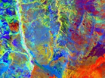
No single space-borne instrument can supply all the data required. Instead, data from a variety of different satellites are collected and combined within a geographic information system to yield information on accessibility, data quality, and source and receiver coupling.
The process begins with a digital elevation model, available from many sources including space shuttle mapping and ESA's ERS-tandem mission. This provides topographic and gradient information for logistics and safety planning. Next comes radar imagery – from spacecraft such as Envisat and ERS – to measure surface roughness, forming the basis of a map of coupling potential.
Visible light images provide infrastructure and land use information that help determine accessibility for vehicles and people. Also, surface vegetation detected in this imagery may indicate sediment-buried water channels that weaken signal propagation.
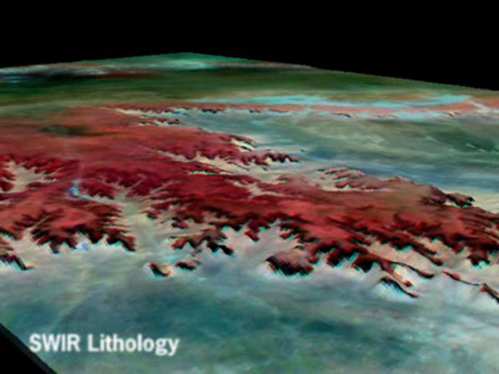
The ground reflects short-wave infrared (SWIR) light immediately, revealing the spectral characteristics of minerals at the surface. SWIR imagery, obtained from hyperspectral satellite sensors, is particularly sensitive to carbonates such as limestone and basalt and occurrences of softer materials such as gypsum or quartzite gravel.
Advancing further into the infrared spectra permits surveyors to peer deeper beneath the surface. Thermal infrared (TIR), or heat radiation from the surface, is a delayed response to incoming solar radiation, coming from the top half-metre of subsurface.
"It is important to characterise this area, as this is where most of that 80% of data distortion comes from," says Laake. "In particular, TIR is useful for identifying underlying layers of basalt, which radiate strongly in thermal energy, so much so that we can interpret its presence indirectly from well below a half a metre.
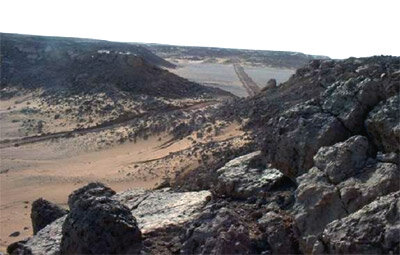
"Basalt is a massive reflector, functioning like a shield between the surface and the hydrocarbon reservoirs. We can't work on surface basalt – the baseplate simply jumps back – but there are optimal design geometries we can use for buried basalt layers using selected angles of incidence for the seismic waves to ensure that not all the signal is reflected and that some goes through."
WesternGeco has so far used remote sensing data for sites in Algeria and Argentina. "We have started with desert areas because they are a relatively simple case with unchanging landscapes," Laake concludes. "But, the technology we are developing here can fully apply to other locations.
"What Earth Observation represents for us is a means of carrying out seismic survey feasibility studies prior to defining survey programmes for our clients, and ensuring enhanced data quality for even the most challenging environments."
UK-based Infoterra and WesternGeco have jointly developed a seismic-quality mapping service as part of an ESA Earth Observation Market Development (EOMD) project. EOMD is a programme aimed at strengthening the European and Canadian capacity to provide geoinformation services based mainly on Earth Observation data, with a particular emphasis on addressing the needs of small value-adding companies.