2007 ozone hole ‘smaller than usual’
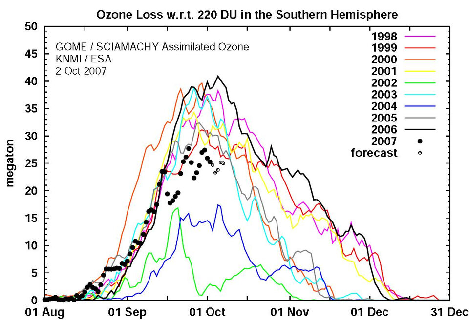
The ozone hole over Antarctica has shrunk 30 percent as compared to last year's record size. According to measurements made by ESA’s Envisat satellite, this year’s ozone loss peaked at 27.7 million tonnes, compared to the 2006 record ozone loss of 40 million tonnes.
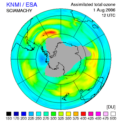
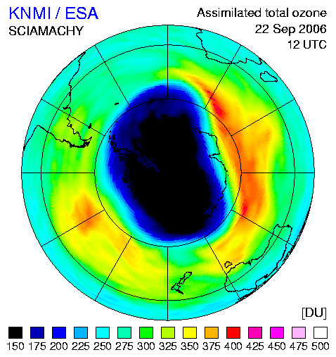
Ozone loss is derived by measuring the area and the depth of the ozone hole. The area of this year’s ozone hole – where the ozone measures less than 220 Dobson Units – is 24.7 million sq km, roughly the size of North America, and the minimum value of the ozone layer is around 120 Dobson Units.
A Dobson Unit is a unit of measurement that describes the thickness of the ozone layer in a column directly above the location being measured. For instance, if an ozone column of 300 Dobson Units is compressed to 0º C and 1 atmosphere (the pressure at the Earth’s surface) and spread out evenly over the area, it would form a slab of ozone approximately 3mm thick.

Scientists say this year’s smaller hole – a thinning in the ozone layer over the South Pole – is due to natural variations in temperature and atmospheric dynamics (illustrated in the time series to the right) and is not indicative of a long-term trend.
"Although the hole is somewhat smaller than usual, we cannot conclude from this that the ozone layer is recovering already,” Ronald van der A, a senior project scientist at Royal Dutch Meteorological Institute (KNMI), said.
"This year's ozone hole was less centred on the South Pole as in other years, which allowed it to mix with warmer air, reducing the growth of the hole because ozone is depleted at temperatures less than -78 degrees Celsius."
During the southern hemisphere winter, the atmospheric mass above the Antarctic continent is kept cut off from exchanges with mid-latitude air by prevailing winds known as the polar vortex. This leads to very low temperatures, and in the cold and continuous darkness of this season, polar stratospheric clouds are formed that contain chlorine.
As the polar spring arrives, the combination of returning sunlight and the presence of polar stratospheric clouds leads to splitting of chlorine compounds into highly ozone-reactive radicals that break ozone down into individual oxygen molecules. A single molecule of chlorine has the potential to break down thousands of molecules of ozone.
The ozone hole, first recognised in 1985, typically persists until November or December, when the winds surrounding the South Pole (polar vortex) weaken, and ozone-poor air inside the vortex is mixed with ozone-rich air outside it.
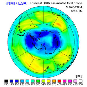
KNMI uses data from Envisat's Scanning Imaging Absorption Spectrometer for Atmospheric Chartography (SCIAMACHY) instrument to generate daily global ozone analyses and nine-day ozone forecasts.
Ozone is a protective layer found about 25 km above us mostly in the stratospheric stratum of the atmosphere that acts as a sunlight filter shielding life on Earth from harmful ultraviolet rays. Over the last decade the ozone layer has thinned by about 0.3% per year on a global scale, increasing the risk of skin cancer, cataracts and harm to marine life.
The thinning of the ozone is caused by the presence of ozone destructing gases in the atmosphere such as chlorine and bromine, originating from man-made products like chlorofluorocarbons (CFCs), which have still not vanished from the air but are on the decline as they are banned under the Montreal Protocol, which was signed on 16 September 1987.
Envisat can localise ozone depletion and track its changes, enabling the rapid estimation of UV radiation as well as providing forecasting. The three atmospheric instruments aboard Envisat are SCIAMACHY, the global ozone monitoring by occultation of stars (GOMOS) sensor and the Michelson interferometer for passive atmospheric sounding (MIPAS).

ESA data form the basis of an operational near-real time ozone monitoring and forecasting service forming part of the PROMOTE (PROtocol MOniToring for the GMES (Global Monitoring for Environment and Security) Service Element) consortium, made up of more than 30 partners from 11 countries, including KNMI.
As part of the PROMOTE and TEMIS service, the satellite results are combined with meteorological data and wind field models so that robust ozone and UV index forecasts can be made.
GMES responds to Europe’s needs for geo-spatial information services by bringing together the capacity of Europe to collect and manage data and information on the environment and civil security, for the benefit of European citizens.
The GMES Service Element (GSE) has been preparing user organisations in Europe and worldwide for GMES by enabling them to receive and evaluate information services derived from existing Earth Observation satellites since 2002.