ESA POLinSAR 2007: Imaging forests in 3-D
More than 140 scientists and researchers from 22 countries have attended the weeklong POLinSAR 2007 workshop, “Science and Applications of SAR Polarimetry and Polarimetric Interferometry,” hosted at ESRIN, ESA’s Earth Observation centre in Frascati, Italy, to hear the first space borne results and to attend interactive training sessions.
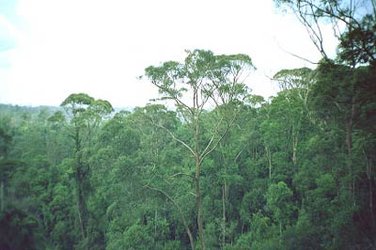
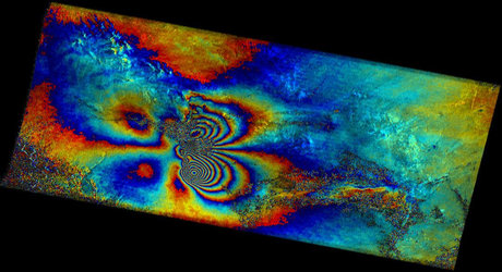
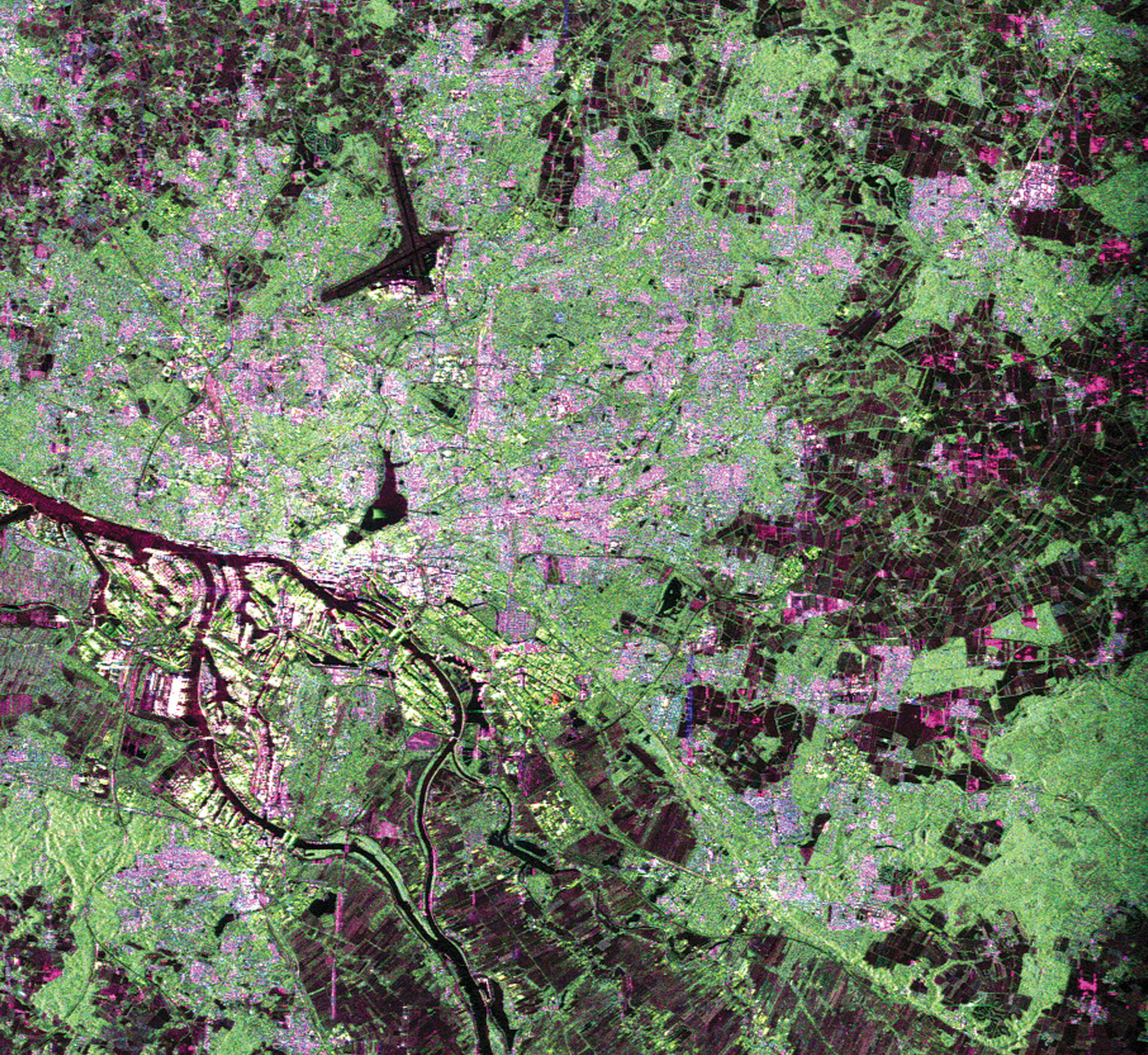
Polarimetric interferometry is performed using two polarimetric SAR images acquired from slightly different directions. The study of these data sets permits us to retrieve information related to the 3-D structure of forest or other natural volume scatterers, such as underlying topography, forest height and to estimate forest biomass – a quantitative estimate of the entire amount of organic material in a particular forest habitat.
Workshop participants saw the first POLinSAR in-orbit results from the Japan Aerospace Exploration Agency’s (JAXA) Advanced Land Observing Satellite (ALOS). Launched on 24 January 2006, ALOS is supported as an ESA Third Party Mission.

"POLinSAR allows us to estimate key environmental parameters that are needed today. For instance, it allows us to make estimations of forest biomass on a global scale," said Konstantinos Papathanassiou, a researcher with the Radar and Microwaves Institute at German Aerospace Centre (DLR). "The conclusions from these global estimates may also be important for climate change modellers and decision makers."
The capability of radar to penetrate ground cover and 'see' the underlying terrain, coupled with POLinSAR techniques to detect forest canopies, make it possible to classify trees and estimate their height using SAR imagery. This may sound of interest only to a narrow band of scientists, until one realizes that determining the types and heights of trees in a forest are critical ingredients in determining its biomass.
In turn, forest’s biomass, together with how it changes over time, are key elements in determining an area’s capacity to act as a carbon sink, soaking up carbon-based gases and cleansing the atmosphere of major types of pollution blamed for the greenhouse effect and global warming. Producing accurate forest biomass estimates, and how they are changing over time, are a critical challenge to environmental scientists to whom national governments are turning for help in meeting their international obligations to stabilise greenhouse-gas emissions under the Kyoto Protocol.
Also at the workshop, ESA provided additional interactive training opportunities for the POLSARPRO tool developed by the University of Rennes 1, France, which includes a wide-ranging tutorial in Polarimetry and Polarimetric Interferometry. To date, some 700 registered users from 62 countries worldwide are using the tool.

Over the last 2 years, ESA has trained some 250 scientists to exploit Polarimetric airborne/spaceborne SAR data for science and applications development using in particular the POLSARPRO software and educational tool.
"POLinSAR is the starting point of future applications because we are at the point where new satellites will be launched, such as Germany’s TerraSAR-X and Canada’s Radarsat-2, that can provide polarimetry and interferometry," said Prof. Eric Pottier, head of the Radar Polarimetry Group at the University of Rennes. "Processing this kind of data will open many new application doors, so it is very important to train young students now to be able to handle this kind of data."