Don Quixote's home shows way to future Earth Observation missions
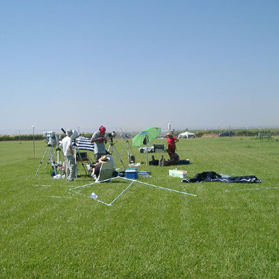
After an interval of six weeks 60 scientists from ten countries returned to the parched heart of Spain to complete testing a new type of sensor intended to yield new insights into global vegetation growth, as well as gather data for the design of a next-generation ESA Earth Observation mission and support efforts to use satellite data for irrigation management.
In Cervantes' comic tale the central Spanish region of La Mancha was where Don Quixote undertook a series of knightly quests. Exactly four hundred years later researchers have been participating in a different type of quest: the direct in-situ detection of photosynthesis, the process by which plants convert sunlight into energy.
When the chlorophyll in plants absorbs energy then some is re-emitted at longer wavelengths as fluorescence. This fluorescence is routinely measured in laboratories to study photosynthetic activity but the signal is very weak compared to direct sunlight. This campaign is the first time that large-scale outdoor measurements have been successfully carried out.
Vegetation fluorescence represents a direct measurement of vegetation's ability to absorb atmospheric carbon dioxide that - if it could be mapped on a global scale by a space-based sensor – would transform our understanding of the carbon cycle and climate change.
Researchers also gathered a host of multispectral data on the local vegetation from a pair of airborne sensors plus satellite acquisitions by Landsat, MODIS and ASTER as well as Envisat's Medium Resolution Imaging Spectrometer (MERIS) and Advanced Along Track Scanning Radiometer (AATSR) sensors. The Compact High Resolution Imaging Spectrometer (CHRIS) aboard ESA's microsatellite Proba made several acquisitions, and complete field measurements were also made in-situ.
This data has being gathered to help identify requirements for ESA's planned Sentinel-2 mission that will carry a multispectral imager, capable of monitoring plant pigments and so derive photochemical indicators of vegetation status.
Sentinel-2 is one of a series of operational Earth Observation satellites planned as the space segment of the Global Monitoring for Environment and Security (GMES) joint initiative between ESA and the European Commission. With this dataset all the potential spectral configurations of the Sentinel-2 mission can now be evaluated. The twin purposes of the campaign is reflected in its name: SEN2FLEX or SENtinel-2 Fluorescence EXperiment.
Also being closely measured during the SEN2FLEX campaign was energy and water fluxes from vegetation, along with a detailed characterisation of soil moisture and water motion in the soil.
Such data is useful for properly modelling the water balance in relation to water management issues, and in particular is intended to validate results from a European Union-funded project called DEMETER (DEMonstration of Earth observation Techologies in Routine advisory irrigation services) that is investigating the utility of satellite data as an aid to irrigation management of water-stressed regions.

Professor Jose Moreno of the University of Valencia, coordinator of the SEN2FLEX campaign, stated: "We have collected a tremendous amount of data, ranging from classical operational satellites up to the most recent and innovative airborne sensors, plus a notable collection of soil, vegetation and atmosphere data, and all necessary ancillary data and supporting validation measurements.
"It will take a few years to fully analyse the whole dataset, but we will learn many things in support of the definition of several future ESA missions."
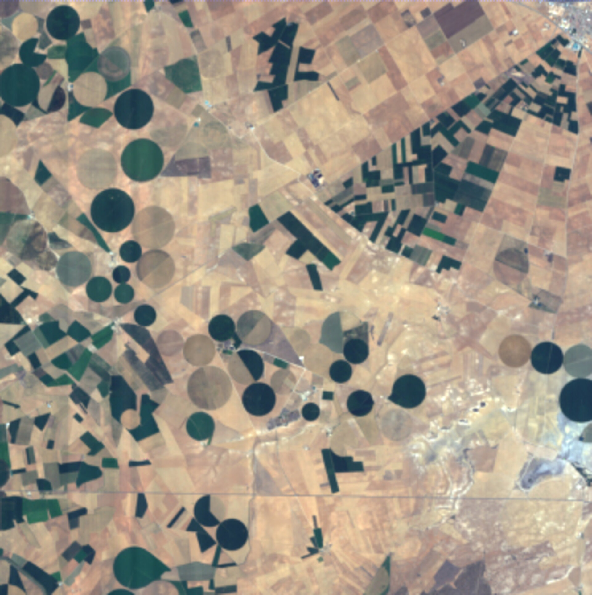
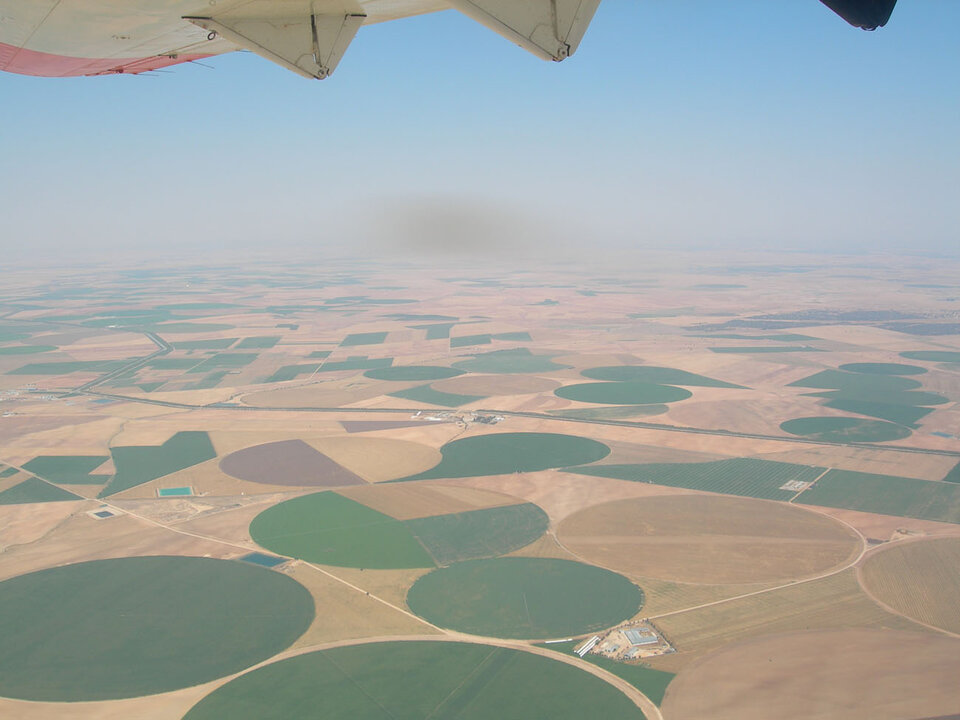
The campaign took place in the Barrax agricultural site in La Mancha, one of the best-documented stretches of ground on planet Earth. In the last 15 years Barrax has been used for many different campaigns and field experiments, being a validation site for a large number of ESA, European Union and national projects.
The new data gathered between 11 and 15 July serve to complement the initial measurements carried out in Barrax last month between 30 May and 4 June, demonstrating the capability of test sensors to detect variability among vegetation species and developmental states, but also to monitor changes in the same fields as crops grew from the six weeks between the previous measurements in June.
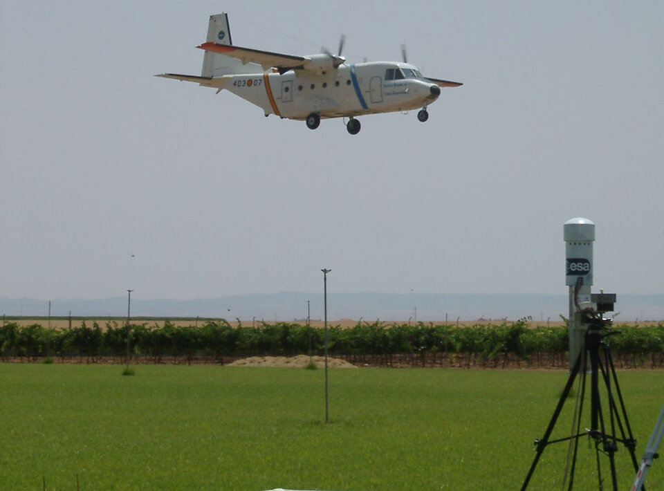
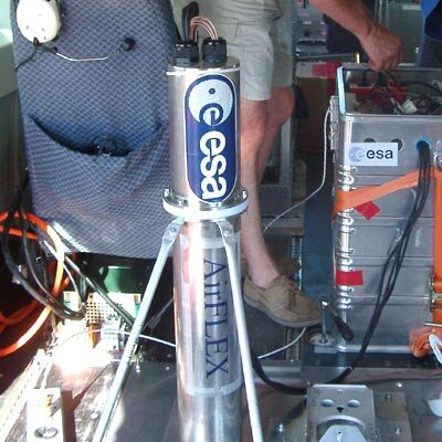
The first objective of the SEN2FLEX campaign was to validate data from the recently built AirFLEX airborne instrument. Developed under an ESA contract by the Laboratoire pour l’Utilisation du Rayonnement Electromagnétique (LURE) Photosynthesis and Remote Sensing team in Paris, AirFLEX has been designed to detect vegetation fluorescence.
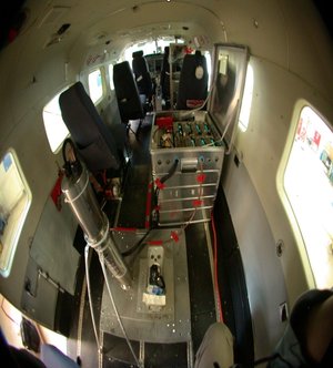
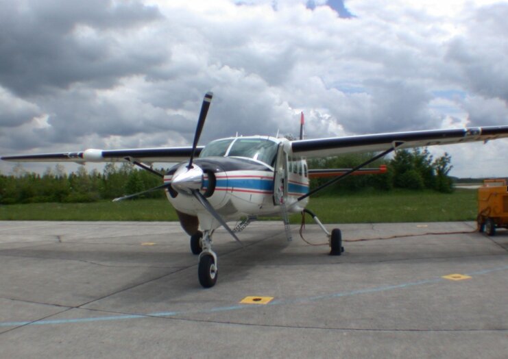
Flown together with AirFLEX on an aircraft supplied by the German Space Agency(DLR) was a hyperspectral sensor called Compact Airborne Spectral Imager-3 (CASI-3) that works in the visible to near-infrared, built by Canadian firm ITRES. To provide complementary measurements into the shortwave infrared and thermal infrared a new sensor called the Airborne Hyperspectral Scanner (AHS) was flown on aircraft operated by Spain's National Institute for Aerospace Technology (INTA) following the same flightpath as the other two sensors.
A team of 16 scientists led by Professor Jose Sobrino of the University of Valencia made thermal measurements of the area to help define the need for such data on future missions.
Meanwhile Professor Bob Su from the International Institute for Geo-Information Science and Earth Observation (ITC) in the Netherlands and Professor Guido d'Urso from Italy's University of Naples were in charge of teams from several countries making water-related measurements using a series of sensors fitted to flux towers and placed within the soil.
Professor Alfonso Calera, from the University of Castilla-La Mancha, oversaw the work related to DEMETER, of which he is project coordinator. The research is regarded as way to define operational requirements for future GMES activities in the context of the EU Water Framework Directive.
The field campaign was made possible thanks to the support of the Institute for Agronomical Technologies of the Albacete Province (ITAP) that operates the Barrax site. The Institute for Regional Development (IDR) local support and logistics, while the University of Castilla-La Mancha provided access to laboratories and support in field measurements.
"It was nice to see that we have combined in a single activity some quite innovative techniques, such as mapping actual photosynthesis from vegetation fluorescence measurements, along with more basic operational aspects in practical applications, such as those related to water management," Professor Moreno concluded.
"Such complete datasets as the one collected in the SEN2FLEX activity are essential to develop quite new science while keeping an eye on potential applications, particularly in the context of definition and exploitation of future ESA missions."