Satellites predict city hot spots
Satellites are helping to forecast the location of urban areas most affected during heat waves, helping planners to design cooler, more comfortable cities.
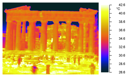
The temperature in densely urbanised areas can be several degrees higher than in nearby rural areas – a phenomenon known as the ‘urban heat island’ effect.
These ‘heat islands’ are particularly noticeable at night. During the day, cities accumulate solar radiation and release the energy after the Sun sets.
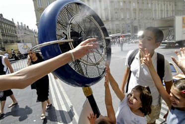
The negative effects of this increase in urban temperatures are multiple: health problems, higher energy demand, air pollution and water shortages.
At their final review held at ESA’s ESRIN site Frascati, Italy, the Urban Heat Islands and Urban Thermography team presented its findings on how remote sensing allows the continuous monitoring of thermal radiation emitted by urban surfaces.
Monitoring thermal radiation can help city planners to design more ‘liveable’ cities, assist civil protection authorities in taking adequate measures during heat waves and create maps of energy efficiency.
The project analysed trends in heat distribution over 10 European cities – Athens, Bari, Brussels, Budapest, Lisbon, London, Madrid, Paris, Seville and Thessaloniki – over the last 10 years, using multiple sensors.
Satellite sensors played a large role in collecting data, providing thermal-infrared measurements that scientists then used to improve urban climate and weather prediction models that can forecast heat waves. Two airborne campaigns and multiple ground sensors also contributed.
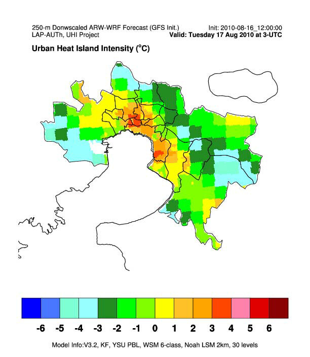
In mid-August 2010, two strong heat islands were correctly forecast in Thessaloniki, Greece a day in advance. These heat islands lead to elevated temperatures and reduce thermal comfort.
At night, the most vulnerable areas of city retained high temperatures, above 31°C.
According to the forecast, there was a small area within the urban centre where both temperature and risk were expected to be low – corresponding to an open space with abundant vegetation cover.
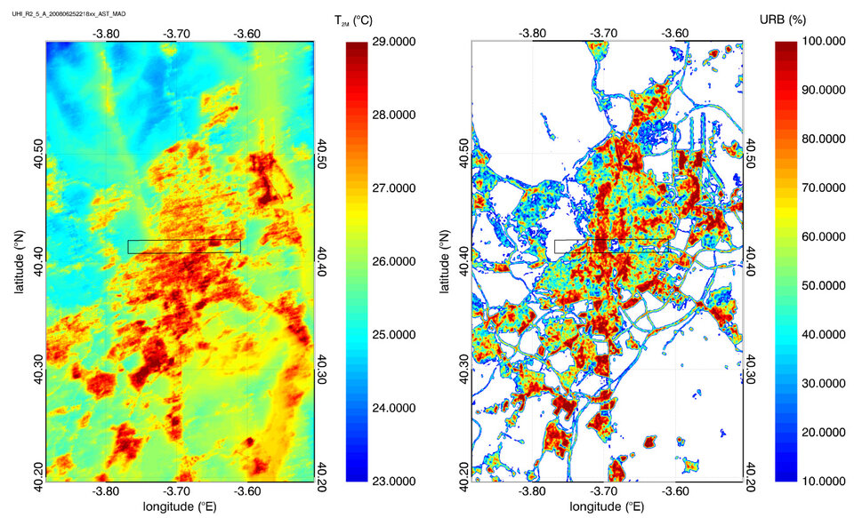
Thermal radiation maps of Madrid compared to soil surface maps showed that the night air temperature in parks or areas of vegetation is significantly cooler than other areas. This demonstrates the important role that green areas play in the overall thermal radiation and circulation of urban areas.
The new urban climate models show a muggy outlook for the future. During the summer of 2003, large portions of Europe were struck by a major heat wave. Paris was affected severely as the urban heat island effect prevented the city from cooling during the night, leading to thousands of heat-related deaths.
Modelling results suggest that, in the future, heat waves of this intensity and duration might occur every 3–4 years.