
Earth from Space: South Island
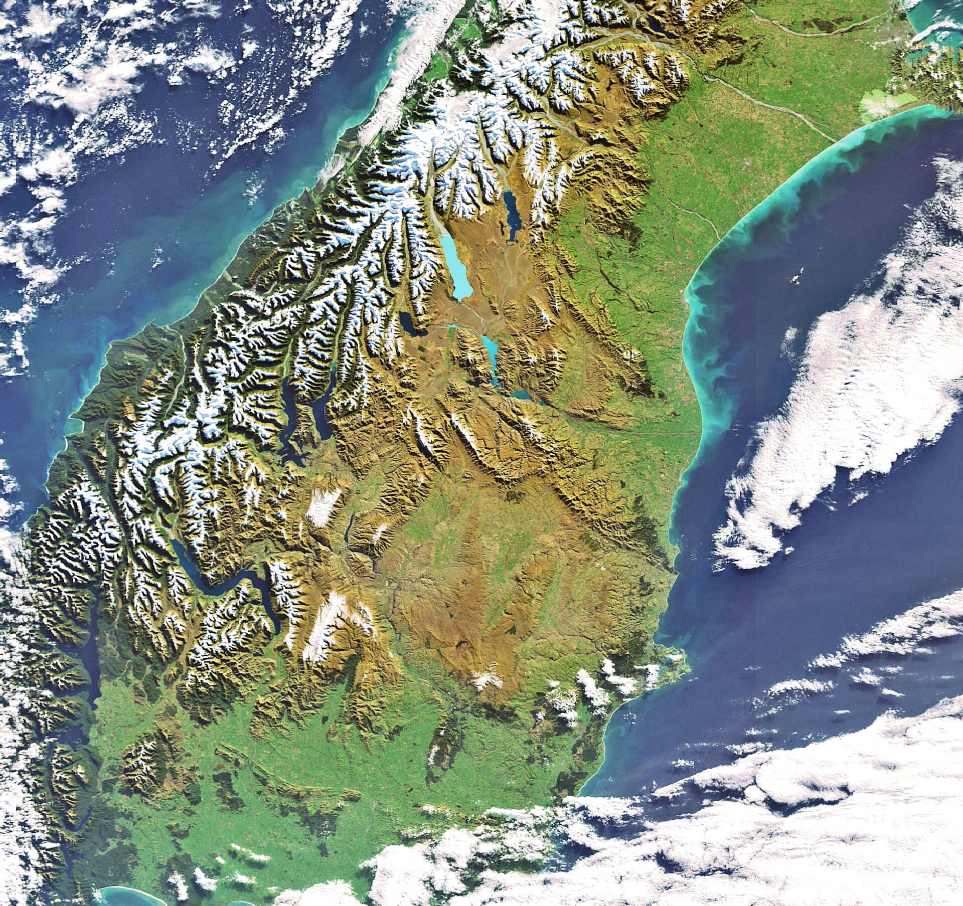
New Zealand’s South Island is highlighted in this Envisat image. Located in the South Pacific Ocean, New Zealand is comprised of two major islands – North and South – and a number of smaller islands.
The mountain range visible in the image stretching the entire length of South Island down the western side is the Southern Alps. Some two-thirds of the South Island is comprised of mountains, many of which are caused by the collision of the Australian and Pacific Plates.
New Zealand is located at the south-western end of the Pacific ‘Ring of Fire’, a continuous line (40 000 km long) of volcanoes and fault lines circling the edges of the Pacific Ocean, and straddles the boundary of both the Pacific and Australian tectonic plates.
To the east of the Southern Alps are the regions of Canterbury, Otago and Southland. The latter two, visible in the image, are made up of rolling farmland and numerous lakes.
Lake Te Anau, seen in the south-western corner, is located in Southland and covers an area of 344 square kilometres making it the largest lake in the South Island and the second largest in New Zealand, after Lake Taupo.
Lake Wakatipu, above Lake Te Anau but in the Otago region, is New Zealand’s longest (80 km) and third largest lake (291 square km). The Remarkables mountain range is on the lake’s southeastern edge.
Also located in the Otago region (above Wakatipu) is Lake Wanaka, which is New Zealand’s fourth largest lake (192 square km). Lake Hawea is seen beside Wanaka. The milky-blue alpine lake above them is Lake Pukaki, which was created by receding glaciers.
This image was acquired on 12 May 2007 by Envisat’s Medium Resolution Imaging Spectrometer (MERIS) while working in Full Resolution Mode to provide a spatial resolution of 300 metres.

