Giant iceberg B-15A edges past floating ice pier
Envisat radar imagery confirms that the B-15A iceberg – the world's largest floating object – is adrift once more after two months aground on a shallow seamount. This latest development poses a renewed threat to the nearby pier of land-attached ice known as the Drygalski ice tongue.
The sheer scale of B-15A is best appreciated from space. The bottle-shaped Antarctic iceberg is around 120 kilometres long, with an area exceeding 2500 square kilometres, making it about as large as the entire country of Luxembourg.
Back in Janauary the iceberg appeared to be drifting towards the 70-kilometre-long Drygalski ice tongue in McMurdo Sound on the Ross Sea, and an unprecedented ice collision looked imminent.
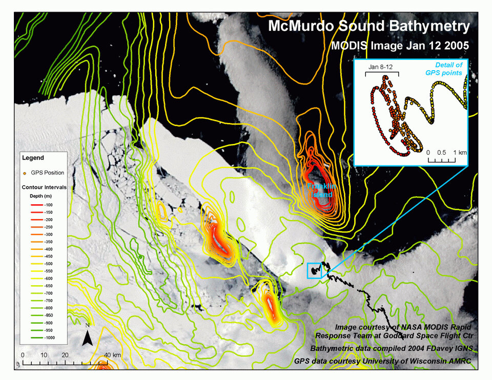
However B-15A eventually slowed down and stopped. Local bathymetry charts suggested the iceberg had become anchored at a point near the middle of its coastward (or western) side to a shallow section of seabed.
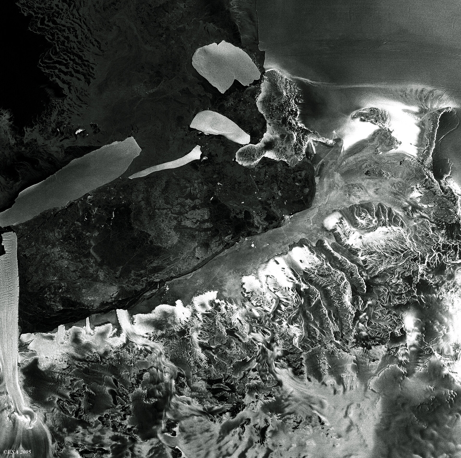
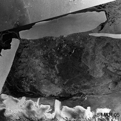
In early March local tides and currents lifted B-15A free from its temporary resting place, an event coinciding with numerous fragments of ice seen breaking off from the centre of its coastward side as the iceberg was worked loose.
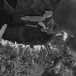
Now prevailing currents are transporting it into deeper and out of McMurdo Sound, right past the far end of the Drygalski ice tongue. The latest Envisat satellite image shows the two ice masses only a few kilometres apart.
Mark Drinkwater of ESA's Ice/Oceans Unit is among researchers keeping close watch on the situation: "The widest part of the iceberg would now appear to have successfully negotiated the narrow channel between the shallow seamount to its west – where it was formerly grounded – and Franklin Island to the east.
"It was now achieved a critical overlap with the end of the Drygalski ice pier, so far without touching. It would now appear that any contact – if at all – between the drifting iceberg and the land-fast floating ice tongue is likely to be a consequence of being 'brushed' or 'bumped' by the broader trailing end of the iceberg, much like the wide turns made by a long trailer behind a truck or the stern of a ship."
Drinkwater adds that the tidal current oscillations in the cross-shelf – or approximately east-west – direction may not be large enough to force a significant impact. Currently the northward end or narrower 'nose' of B-15A has been steered on a course consistent with currents following the bottom topography of a deepwater channel joining the Nordenskjøld and Drygalski Basins.
"As long as the rear end of the iceberg remains pinned to its west by the shallow bottom topography, a collision may remain less likely," Drinkwater states. "A lot now depends on the ability of the tides and local currents to free the southernmost end of the iceberg, and to close the gap between the iceberg and the ice tongue."
Ice in motion
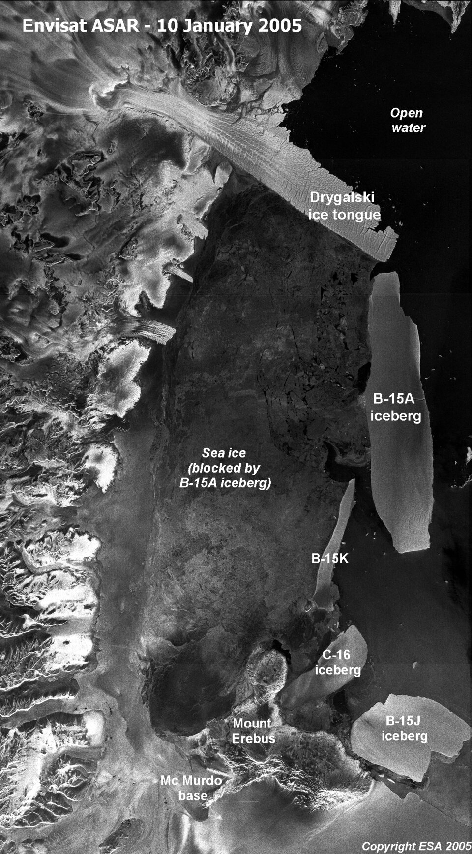
B-15A is the largest remaining section of the even larger B-15 iceberg that calved from the Ross Ice Shelf in March 2000. Equivalent in size to Jamaica, B-15 had an initial area of
Since then, B-15A has found its way to McMurdo Sound, where its presence has blocked ocean currents and led to a build-up of sea ice. With the Antarctic summer now at an end and in-situ observations therefore limited, the ASAR instrument aboard Envisat becomes even more useful for monitoring changes in polar ice and tracking icebergs.
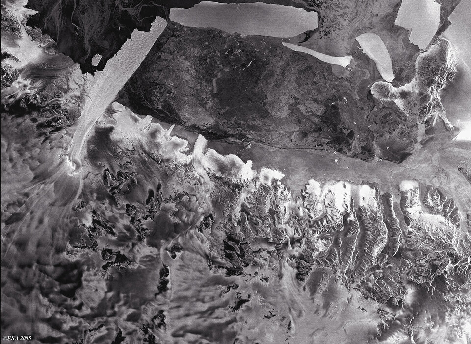
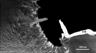
Its radar signals pass freely through the thickest polar storm clouds or local darkness. And because ASAR measures surface texture, the sensor is extremely sensitive to different types of ice – for example clearly delineating the older rougher surface of the Drygalski ice tongue from the surrounding sea ice.
The Drygalski ice tongue is located at the opposite end of McMurdo Sound from the US and New Zealand bases.
Large and (considered) permanent enough to be depicted on standard atlas maps of the Antarctic continent, the long narrow tongue stretches out to sea as an extension of the land-based David Glacier, which flows through coastal mountains of Victoria Land.
Twin-mode ASAR Antarctic observations

Envisat's ASAR instrument monitors Antarctica in two different modes: Global Monitoring Mode (GMM) provides 400-kilometre swath one-kilometre resolution images, enabling rapid mosaicking of the whole of Antarctica to monitor changes in sea ice extent, ice shelves and iceberg movement.
Wide Swath Mode (WSM) possesses the same swath but with 150-metre resolution for a detailed view of areas of particular interest.
ASAR GMM images are routinely provided to a variety of users including the US National Oceanic and Atmospheric Administration (NOAA) National Ice Centre, responsible for tracking icebergs worldwide.

ASAR imagery is also being used operationally to track icebergs in the Arctic by the Northern View and ICEMON consortia, which provide ice monitoring services as part of the Global Monitoring for Environment and Security (GMES) initiative, jointly backed by ESA and the European Union.
The Northern View recently extended this service to the Southern Ocean for the first time, to ensure that participants in the Oryx Quest 2005 yacht race stayed safely away from icebergs and ice fields.

This year also sees the launch of CryoSat, a dedicated ice-watching mission designed to precisely map changes in the thickness of polar ice sheets and floating sea ice.
CryoSat, in connection with regular Envisat ASAR GMM mosaics and SAR interferometry – a technique used to combine radar images to measure tiny millimetre-scale shifts between acquisitions - should answer the question of whether the kind of ice-shelf calving that gave rise to B-15 and its descendants are a consequence of ice sheet dynamics or other factors.
Together they will provide insight into whether such iceberg calving occurrences are becoming more common, as well as improving our understanding of the relationship between the Earth's ice cover and the global climate.