Envisat keeping an eye on the Eyjafjallajoekull volcano
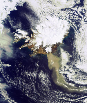
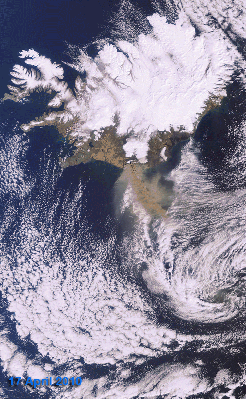
The development of the ash plume from Iceland’s Eyjafjallajoekull volcano between 17-20 April is tracked in this series of Envisat images.
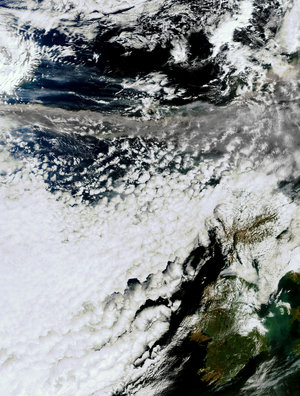
On 17 and 19 April, the brown-coloured ash plume is visible travelling in a roughly southeasterly direction over the Atlantic Ocean by the prevailing western air current. By 20 April, much less ash is visible spewing from the volcano.
In the latest Envisat image (below) acquired today at 13:36 CEST, even less ash is visible. Envisat has been monitoring the volcano since its recent eruptions began on 20 March. To see the latest Envisat satellite images over the area, simply visit our MIRAVI website. MIRAVI, which is free and requires no registration, generates images from the raw data collected by Envisat’s Medium Resolution Imaging Spectrometer (MERIS) instrument and provides them online quickly after acquisition.

MERIS images provide visual clues of what is happening over the volcano and, furthermore, can provide information on the height of the ash plume in the atmosphere.
Scientists from the Free University of Berlin have developed an experimental algorithm for the retrieval of cloud-top height from measurements taken by MERIS between 17 – 19 April from 14:00 and 15:00 CEST.
The algorithm, which is operationally applied within the MERIS ground segment, is normally used to determine the height of clouds to support weather and precipitation forecasts. A similar algorithm, based on the exploitation of the height dependent oxygen absorption (~ 0.76 microns), is now being experimentally applied to determine the height of the ash cloud spewing from the volcanic eruption.
"We normally apply this method to clouds to determine their heights over ground. We have now applied the same technique to the ash plume from Iceland’s volcano. The results show that the method works, and we can now provide the 'starting height' of the ash cloud and hope to be able to better predict the ash distribution in the future," said Prof. Juergen Fischer from the Free University of Berlin, who provided the height maps.
On 17 April, the ash plume reached a top height of more than 5 km close to its origin over the southern coast of Iceland with its top height dropping below 2 km as it travelled. On 19 April, the massive, wide-spread ash plume resided in the lower atmosphere close to the volcano with top heights below 2 km.
According to Prof. Fischer, these preliminary results agree with the volcanic plume heights established by research flights and forecasts by volcanic plume models. A more detailed algorithm dedicated to the height of volcanic ash clouds is currently under development.
Other satellite datasets as well as ground measurements are being used to measure the evolution of the ash cloud. To learn more about these, visit the links on the right.