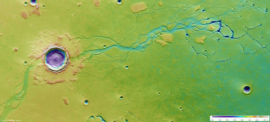
Mars: how low can you go?
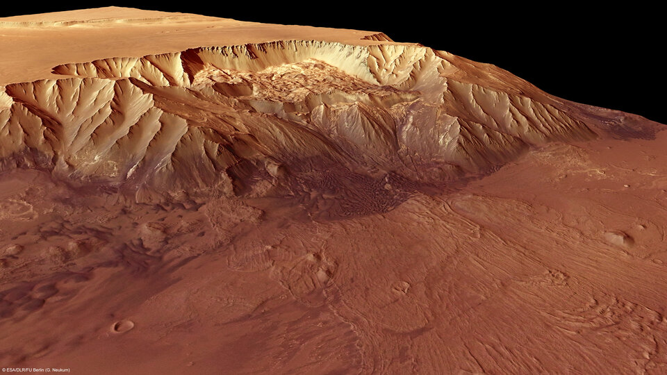
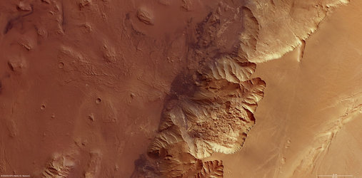
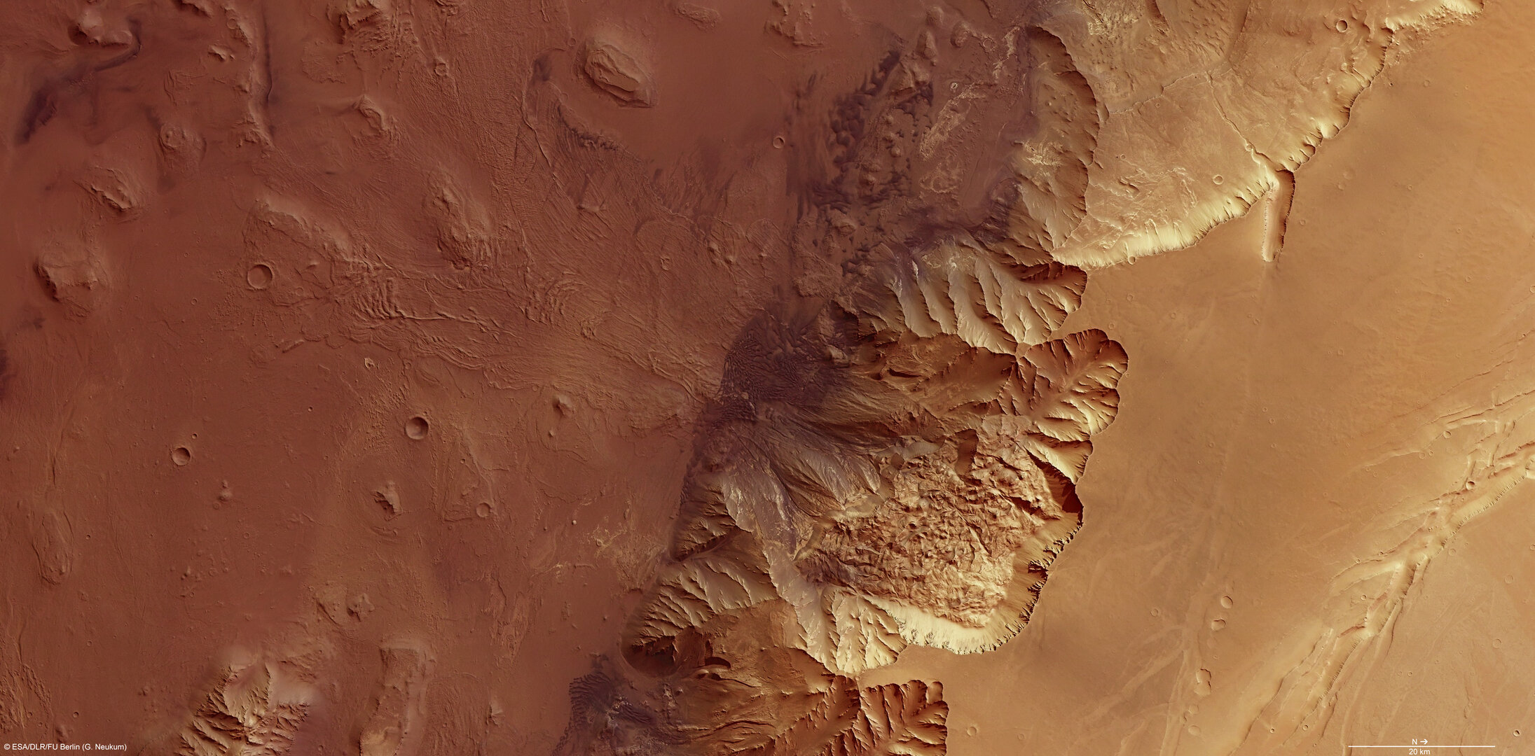
There are few places on Mars lower than this. On the left of this image, the floor of Melas Chasma sinks nine kilometres below the surrounding plains. New images from ESA’s Mars Express highlight the complex history of this enormous martian canyon.
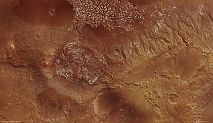
Melas Chasma is part of the huge Valles Marineris rift valley, which stretches for more than 4000 km across the surface of Mars. This image covers 200 x 100 km and covers an area of roughly 20 000 sq km, which is about the size of Slovenia. Around Melas Chasma, there is abundant evidence for water having flowed across Mars in the past. As well as ancient water-cut channels, there are lighter-coloured deposits of sulphate components that were probably deposited in a former lake.

The image was obtained on 1 July 2006 using the High-Resolution Stereo Camera (HRSC) on ESA’s Mars Express spacecraft.
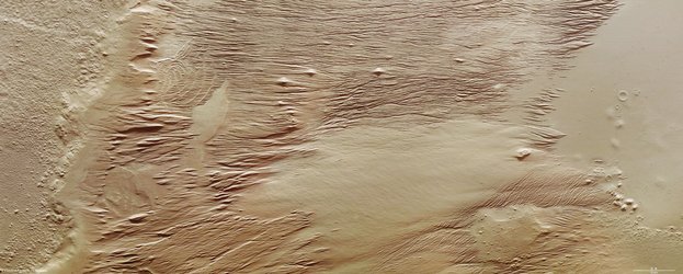
The valley sides show evidence of multiple large landslides that have created vast fan shapes of material. This debris appears rough and jumbled, contrasting with the underlying smoother surface visible further into the basin. The rocks display flow textures indicating that they were once deposited by liquid water, water ice or mud. Levees of sediment can also been seen here.

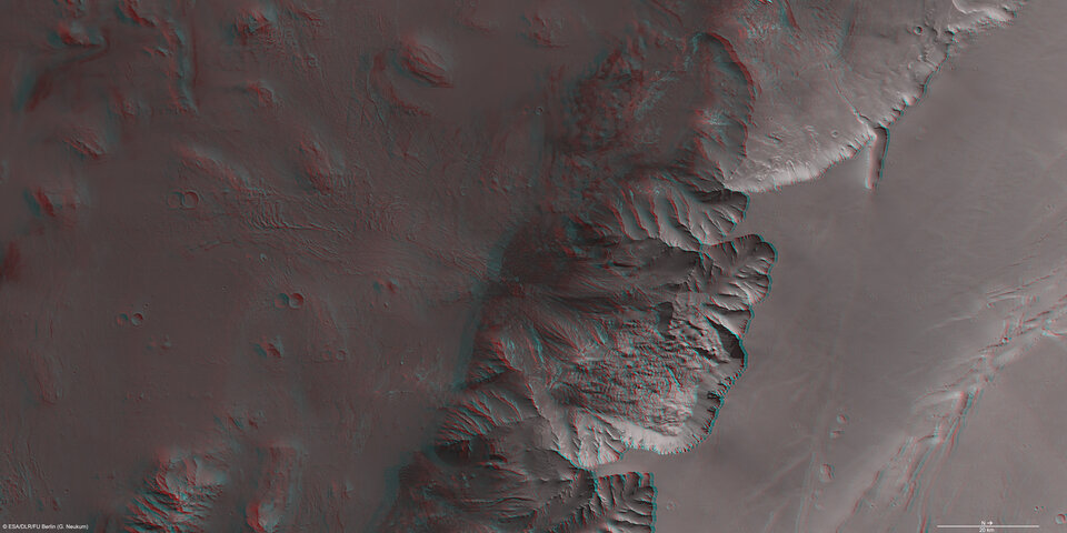
The colour-coded elevation map shows the large variations in altitude within this region. The difference from the floor, on the left of the image, to the plateau on the right is more than 9 km. But what do you measure elevations against on Mars? On Earth, we use sea level. For Mars, planetary scientists have derived an average shape and size for the planet based on spacecraft observations. They call this the ‘areoid’ and use its surface as the equivalent of sea level.
In the case of Melas Chasma, the deepest portions of the canyon are 5 km below the areoid, whilst the surrounding plateau rises to elevations of 4 km above.

On the high plateau at the top of the cliff, a few ancient valleys have been preserved. The orientation of the largest one is parallel to the edge of the cliff, which may indicate that the valley originally followed an old fault line. Remaining faults are probably the main reason for the instability of the flanks, which have frequently collapsed forming huge landslides.