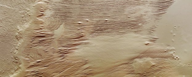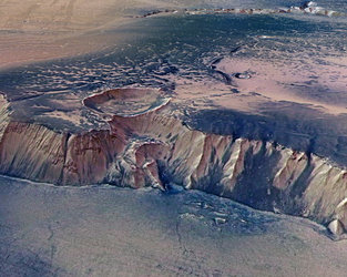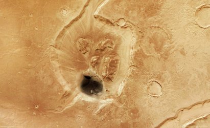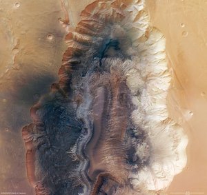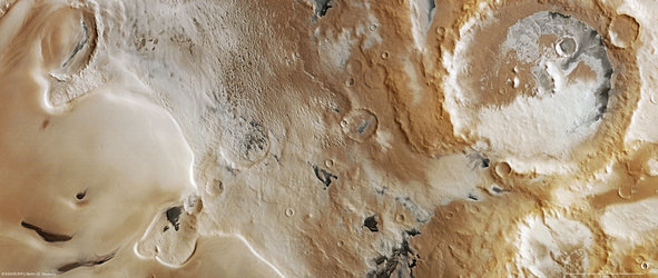
Chaotic terrain in Ariadnes Colles
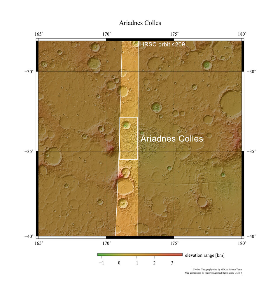
These images, taken by the Mars Express High Resolution Stereo Camera, show the region of Ariadnes Colles on the Red Planet.
The image data were acquired on 16 April 2007 and are centred at 34° south and 172° east. The ground resolution is about 13 m/pixel.
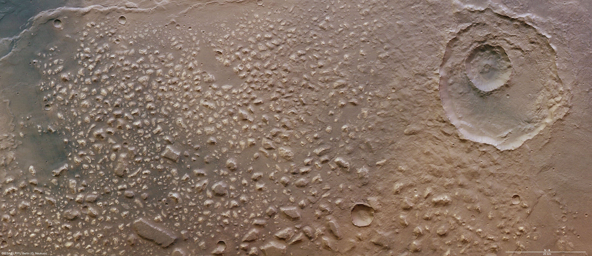
Mars exhibits numerous 'chaotic terrains'. These are areas with an apparently inordinate accumulation of rocks of varying sizes and flat-topped features.
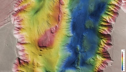
Ariadnes Colles is one such chaotic terrain located in the planet's southern highlands. It covers an area of 180 x 160 sq km, roughly half the size of Estonia. These images show the northwestern part of the region.
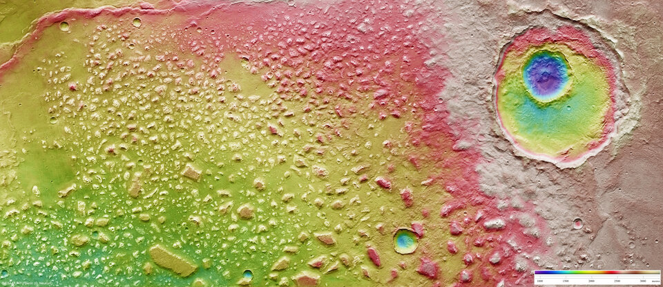
Most of the area pictured is dominated by erratically shaped rocks that are 1-10 km in size. These are lighter in colour compared to their surroundings. Some larger blocks appear similar to mesa, a flat-topped natural feature found on Earth, and can reach a height of 300 m.

A striking lineation on the surface of the blocks (visible upon zooming in) is oriented in the northwest-southeast direction. The northwestern flanks have been eroded more strongly than the opposing southeastern ones.
Wrinkle ridges, which form due to tectonic compression, are visible in the southwestern part. These ridges mark the western boundary of Ariadnes Colles.

In contrast to other chaotic terrains such as Iani Chaos, Adrianes Colles is not a water-source region. It is still debated, therefore, whether Ariadnes Colles was formed by the action of water or wind.
The darker material in the southern areas is most likely sand or volcanic ash; some slopes of the flat-topped features have been covered by this dark material that was blown up on the slopes.

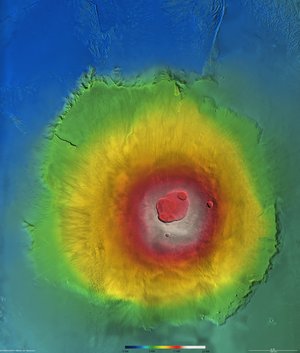
A large impact crater, 1200 m deep, is visible on the right. It shows a smaller crater superimposed on it. The larger crater is about 30 km in diameter and covers an area roughly the size of Hamburg. The smaller younger crater lies almost at the centre of the older one, and has a diameter of just 10 km.

The colour scenes have been derived from the three HRSC-colour channels and the nadir channel. The perspective views have been calculated from the digital terrain model derived from the stereo channels. The anaglyph image was calculated from the nadir and one stereo channel. The black and white high-resolution images were derived from the nadir channel which provides the highest detail of all channels.
For more information on Mars Express HRSC images, please read our updated FAQ (frequently asked questions).