• → European Space Agency

      • Space for Europe
      • Space News
      • Space in Images
      • Space in Videos
    • About Us

      • Welcome to ESA
      • DG's news and views
      • For Member State Delegations
      • Business with ESA
      • Law at ESA
      • ESA Exhibitions
      • ESA Publications
      • Careers at ESA
      • ESAshop
    • Our Activities

      • Space News
      • Observing the Earth
      • Human Spaceflight
      • Space Transportation
      • Navigation
      • Space Science
      • Space Engineering & Technology
      • Operations
      • Telecommunications & Integrated Applications
      • Preparing for the Future
    • Careers at ESA

    • For Media

      • Media
      • ESA TV
      • Videos for professionals
      • Photos
    • For Educators

    • For Kids

    • ESA

    • Space in Images

    ESA > Space in Images > 2016 > 03 > Sentinel-3: better than good

    Free Search (22057 images)

    Sentinel-3: better than good

    (3.12 MB)

    (24.01 MB)

    Details

    Open/Close
    • Title Sentinel-3: better than good
    • Released 01/04/2016 10:05 am
    • Copyright Contains modified Copernicus Sentinel data [2016], processed by ESA, CC BY-SA 3.0 IGO
    • Description

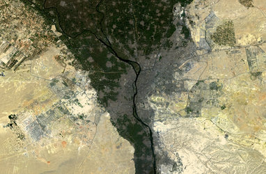
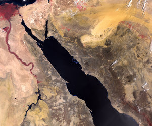
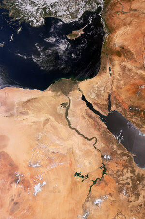
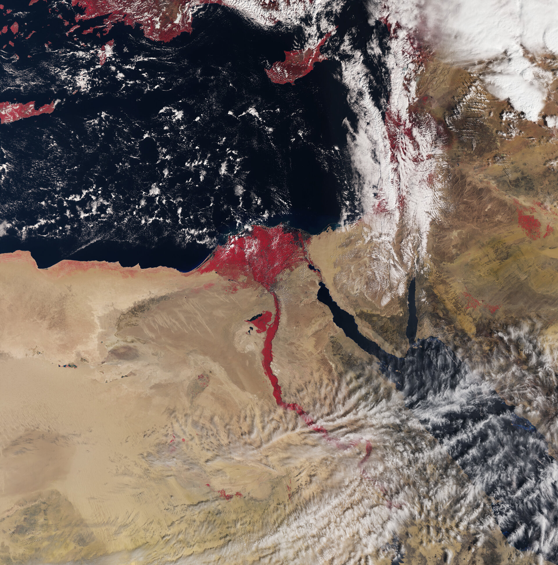
      The new Sentinel-3A satellite recently began providing data from orbit. This very early image recorded on 3 March 2016, takes us over the River Nile and Delta and the surrounding desert areas of northeast Africa and parts of the Middle East.

      Very distinct is Egypt, a country connecting northeast Africa with the Middle East, home to millennia-old monuments still sitting along the lush Nile valley.

      In the centre of the image, capital city Cairo with the Nile snaking northwards is clearly visible, along with the Red Sea just further east. Also evident are the islands of Cyprus further north in the Mediterranean Sea and parts of Crete on the very left.

      One of the suite of sophisticated instruments that will measure Earth’s oceans, land, ice and atmosphere, Sentinel-3’s Sea and Land Surface Temperature Radiometer (SLSTR) measures the energy radiating from Earth’s surface in nine spectral bands, including visible and infrared.

      The instrument improves on the capabilities of the Advanced Along-Track Scanning Radiometer carried by the Envisat satellite of 2002–12, including a wider swath of 1400 km, new channels and a partly higher spatial resolution.

      Combining radiometer and colour data helps us to understand the state of vegetation better.

      Launched last 16 February, Sentinel-3 will systematically measure Earth’s oceans, land, ice and atmosphere to monitor and understand large-scale global dynamics. It will provide essential information in near-real time for ocean and weather forecasting, among other major applications.

      Over land, this innovative mission will provide a bigger picture by monitoring wildfires, mapping the way land is used, providing indices of vegetation state and measuring the height of rivers and lakes, complementing the high-resolution measurements of its sister mission, Sentinel-2.

      This image is also featured on the Earth from Space video programme.

    • Id 357922

    TAGS

    Open/Close
    • Click on the tags to find the matching images.
    • Activity Observing the Earth
    • Mission Envisat, Sentinel-3
    • System Copernicus
    • Location Egypt, Middle East, Nile
    • Keywords River, River delta , Rivers, Deserts, Vegetation monitoring, Radiometer, Satellite image, Sea surface
    • Set Earth observation image of the week

    TAGS

    Open/Close

    Details

    Open/Close

    Rate this

    Views

    Comments

    Share

    • Currently 5 out of 5 Stars.
    • 1
    • 2
    • 3
    • 4
    • 5

    Rating: 4.8/5 (145 votes cast)

    Thank you for rating!

    You have already rated this page, you can only rate it once!

    Your rating has been changed, thanks for rating!

    24653 0
    Tweet

    COMMENTS

    Open/Close

    COMMENTS

    Open/Close

    RELATED IMAGES

    • 06 November 2015 Cairo, Egypt 6835 Votes: 61
    • Cairo, Egypt 26 November 2004 Cairo and the Nile Delta, Egypt 1468 Votes: 9

    Related links

    • Image of the week archive

    • Earth observation

    USING OUR IMAGES

    Terms and conditions

    Contact us

    Commenting guidelines

    • Connect with us
    • Subscribe
    • mobile version
    • LATEST ARTICLES
    • · Seventh Sentinel satellite launched for Copernicus
    • · Gaia creates richest star map of our Galaxy – and beyond
    • · ESA teams ready for space
    • · Space smash: simulating when satellites collide
    • · Sentinel-3B on launch pad
    • FAQ

    • Site Map

    • Contacts

    • Terms and conditions