Agency
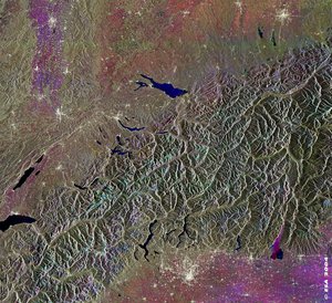
Land use map for Switzerland
Kyoto-Inventory land use map for the whole of Switzerland based on satellite data. Yellow signifies cropland, dark green is forest, light green grassland, red settlements, white unproductive and blue water and wetlands.