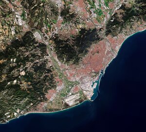
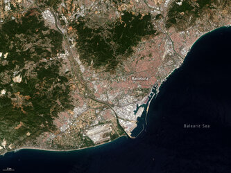
United space in Europe
Barcelona, Spain
Applications

Barcelona, Spain

21/06/2013 12220 views 66 likes 293358 ID
  • HI-RES JPG [3.88 MB]
  • HI-RES TIF

Thank you for liking

You have already liked this page, you can only like it once!

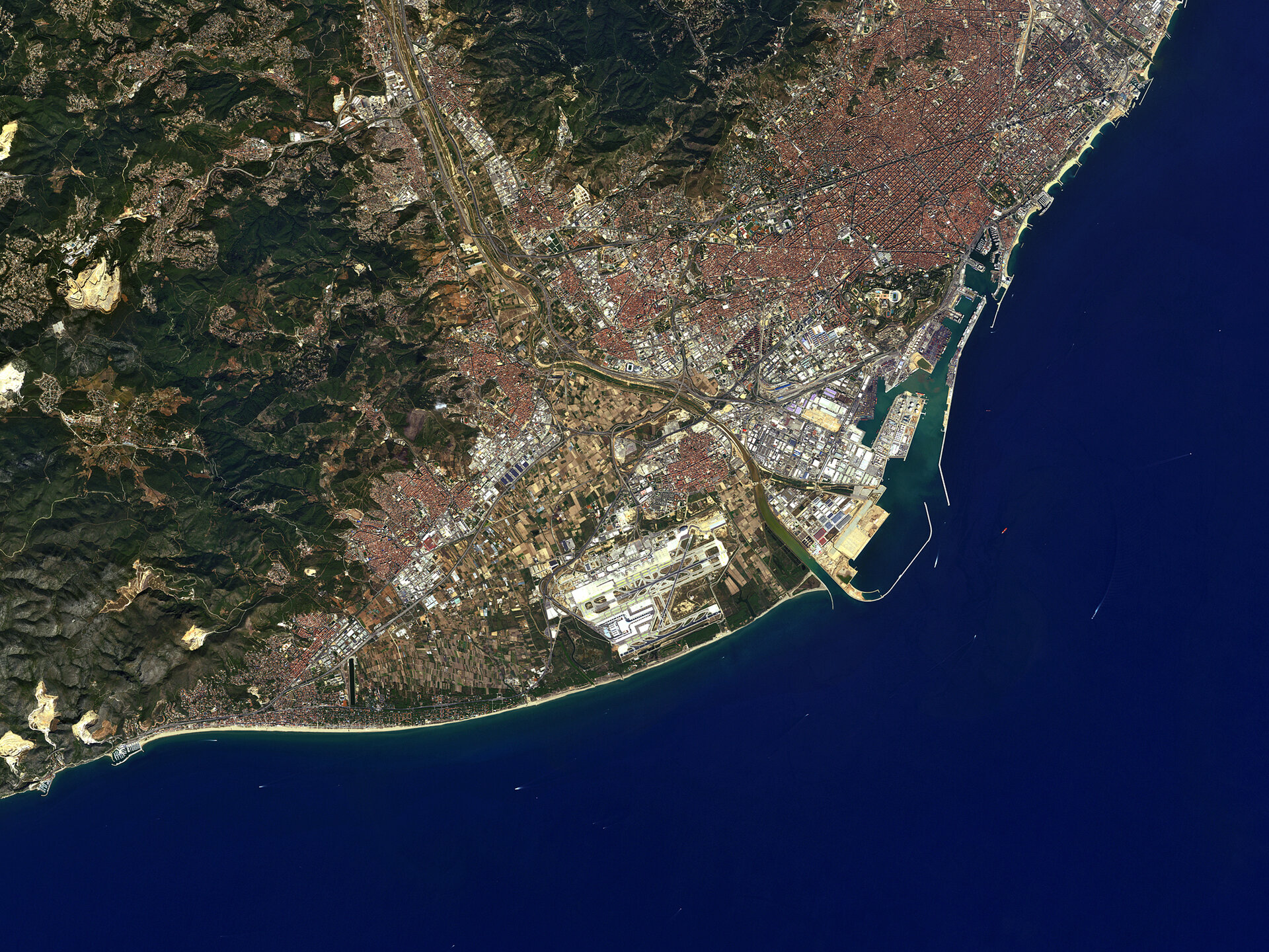
The Spanish city of Barcelona is pictured in this image captured on 13 September 2010 by Japan’s ALOS satellite. Near the top right corner, the circular Plaça de les Glòries Catalanes was meant to be the city centre in the original urban plan. Dominating the left side of the image are the Garraf Massif mountains, their cliffs reaching the Mediterranean coast. Rock quarries and rubbish dumps are degrading the land here, and some of these degraded areas can be seen in the lower left corner as large yellow patches. Along the coast, we can see the Barcelona’s port – one of Europe’s top ten largest container ports. Barcelona-El Prat airport is about 10 km southwest of the city centre, across the Llobregat River. On either side of the airport we can see the darker areas of the Llobregat delta. 

This image is featured on the Earth from Space video programme.

  • JAXA, ESA
  • Observing the Earth
  • ALOS Third-Party missions
  • Spain
  • City Satellite image Ports
  • Earth observation image of the week
Catalan coast, Spain
Applications

Catalan coast, Spain

Image 9042 views 65 likes
Zaragoza, Spain
Applications

Zaragoza, Spain

Image 3526 views 51 likes
Barcelona from Sentinel-2A
Applications

Barcelona from Sentinel-2A

Image 4129 views 31 likes
Barcelona, Spain - ASAR - 19 February 2004
Applications

Barcelona, Spain - ASAR - 19 February 2004

Image 1120 views 9 likes
Japan’s ALOS satellite captured this image of the Spanish city.
Applications

Earth from Space: Ports of Barcelona

Video 00:00:00 1203 views 18 likes