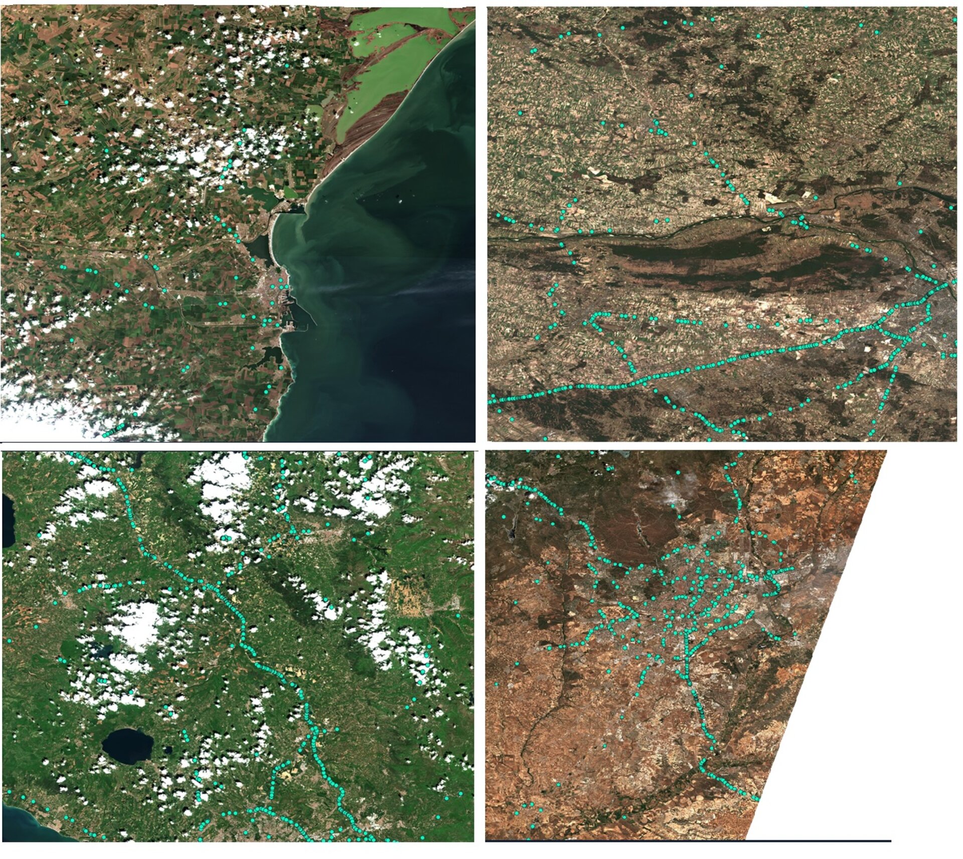
Post-COVID-19 truck traffic in four European countries
In April, ESA sought proposals on how space assets can help understand and characterise the paralysing effects of the COVID-19 pandemic. The joint first prize in this contest has been awarded to a proposal on how Copernicus Sentinel-2 images can reveal coronavirus-related effects on traffic activity – an idea that will be included in the recently created ESA-European Commission 'Rapid Action on Coronavirus and Earth Observation' dashboard. This image shows the mapping of reflectance patterns of long moving vehicles (such as trucks), as proposed by joint contest winner Henrik Fisser (Julius-Maximilians-University Würzburg, Germany). The traffic maps show Romania (upper left, data from 2 April 2020), Poland (upper right, data from 7 April 2020), Italy (Rome, bottom left, data from 3 April 2020), and Spain (Madrid, bottom right, data from 10 June 2020).
Read more: Monitoring trucks and trade from space

Space and the COVID-19 crisis: The value of Earth ob…

Aircraft and Aeolus data before and during COVID-19

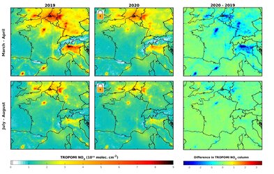
Nitrogen dioxide concentrations over densely populat…

Nitrogen dioxide concentrations observed over major…