Applications
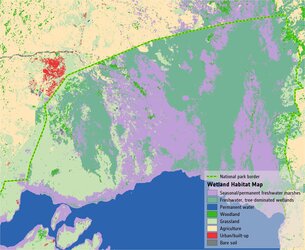
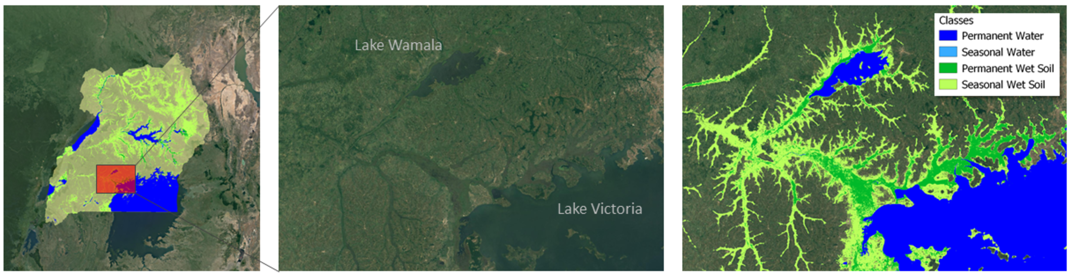
Wetland inventory for Lake Victoria and Lake Wamala
Wetland inventory map for Uganda. The map is based on four years (2017-2020) of Copernicus Sentinel-1 and Sentinel-2 data to extract the water and wetlands dynamics. The classification shows permanent and seasonal water bodies as well as permanent and seasonally wet soils. The methods and products have been derived within the ESA project ‘GlobWetland Africa Extension on Wetland Inventory’.
Read full story: Earth observation vital in monitoring wetland waters