Hot and cold beneath Tonga volcano
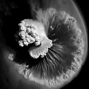
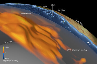
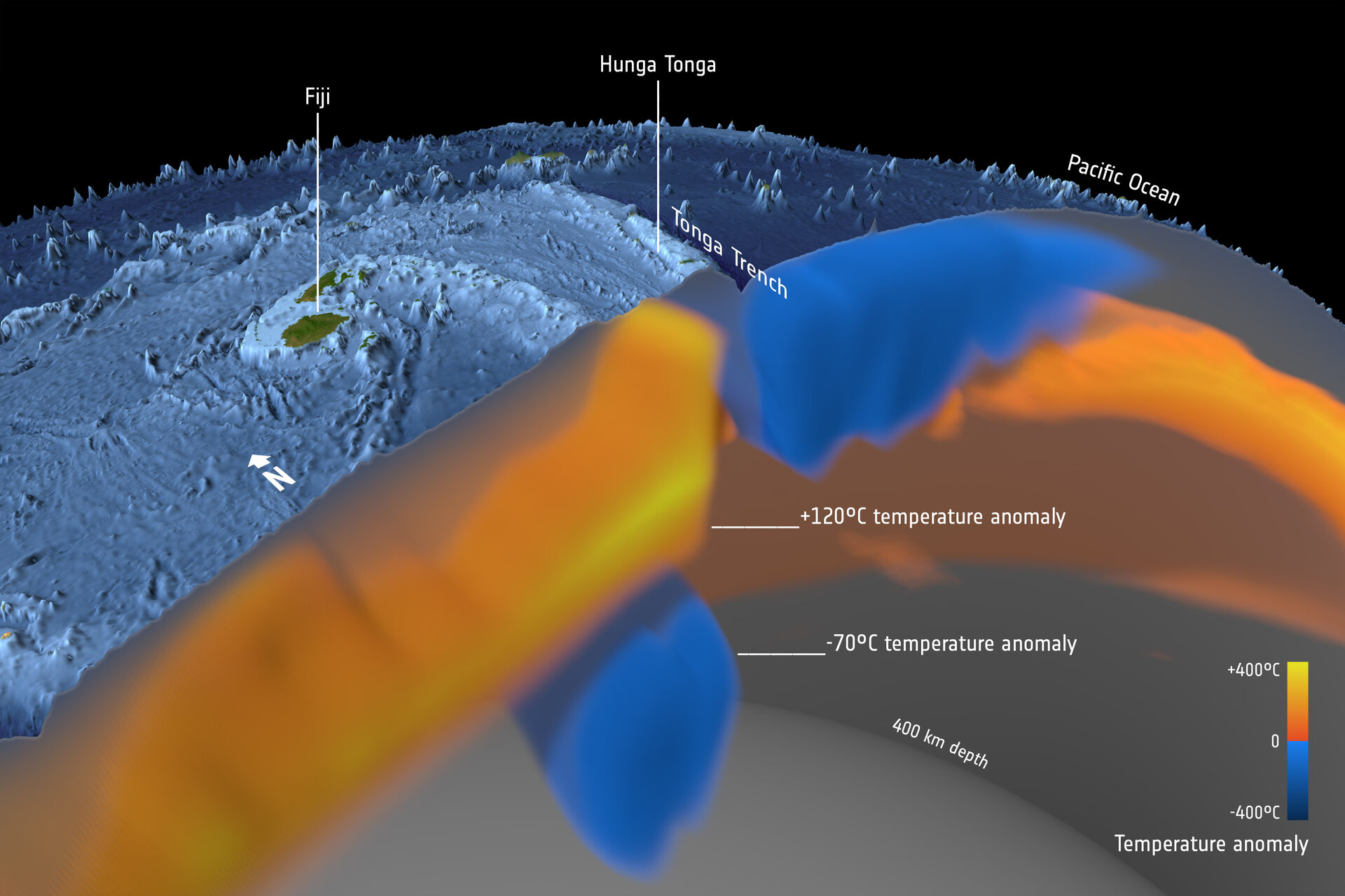
The astonishing force of the Tonga volcanic eruption in January 2022 shocked the world, but the fact that this underwater volcano actually erupted came as less of a surprise to geoscientists using satellite data to study changes in the temperature deep below Earth’s surface. As part of the effort to understand the complexities of Earth’s interior, scientists working within ESA’s Science for Society 3D Earth project, have developed a state-of-the art model of the lithosphere, which is a term to describe Earth’s brittle crust and the top part of the upper mantle, and the sub-lithospheric upper mantle down to 400 km depth. The model combines different satellite data, such as gravity data from ESA’s GOCE mission, with in-situ observations, primarily seismic tomography. The model that show differences in temperature, or thermal structures, indicated that the Tonga volcano was due to erupt at some point.
The Hunga Tonga-Hunga Ha‘apai volcano is located in a back arc basin, created by the subduction of the Tonga slab. Back arc volcanoes are associated with the cold slab being melted by the mantle as the slab slides down into the mantle. It is a part of the Tonga–Kermadec arc, where the edge of the Pacific tectonic plate dives beneath the Australian Plate. Here, seismic tomography shows the layer of hydrated, partially molten rock above the plunging Pacific Plate, which feeds the volcanoes of the arc.
Read full story: Deep down temperature shifts give rise to eruptions