Prevent
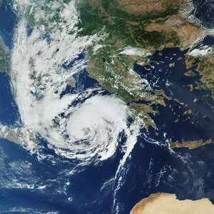
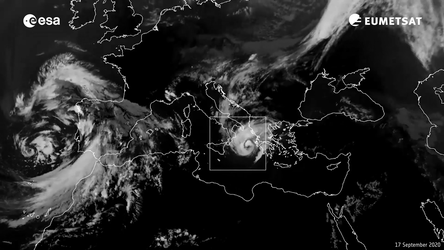
Copernicus Sentinel-3 captures Mediterranean hurricane – or ‘Medicane’ – Ianos in 2020
Planet Earth is ever changing, and these changes occur at a bewildering variety of scales and speeds. In this image Copernicus Sentinel-3 captured Mediterranean hurricane – or ‘Medicane’ – Ianos, as it crossed the Ionian Sea to approach Greece in September 2020. Ianos did more than €100 million of property damage and claimed several lives, but Copernicus satellite data helped guide weather forecasters in the triggering of evacuation alerts, to prevent an even worse outcome.
Copernicus provides services for a range of different applications such as early warnings of severe weather, air-quality forecasting, flood warnings, early detection of drought and desertification, oil-spill detection and drift prediction, sea-water quality, crop analysis, forest monitoring, land-use change, agriculture, food security and humanitarian aid – to name but a few.
Satellite images show the world through a wide-enough frame so that complete large-scale phenomena can be observed to an accuracy and entirety it would take an army of ground-level observers to match. A single picture has the potential to show the spread of air pollution across a continent, the precise damage done in a region struck by an earthquake, or – as seen here – the entire span of an event like Ianos, from the calmness of its 50-km-diameter eye to its outermost storm fronts.