
Gabon topography
ESA revealed the first stunning images from its groundbreaking Biomass satellite mission – marking a major leap forward in our ability to understand how Earth’s forests are changing and exactly how they contribute to the global carbon cycle.
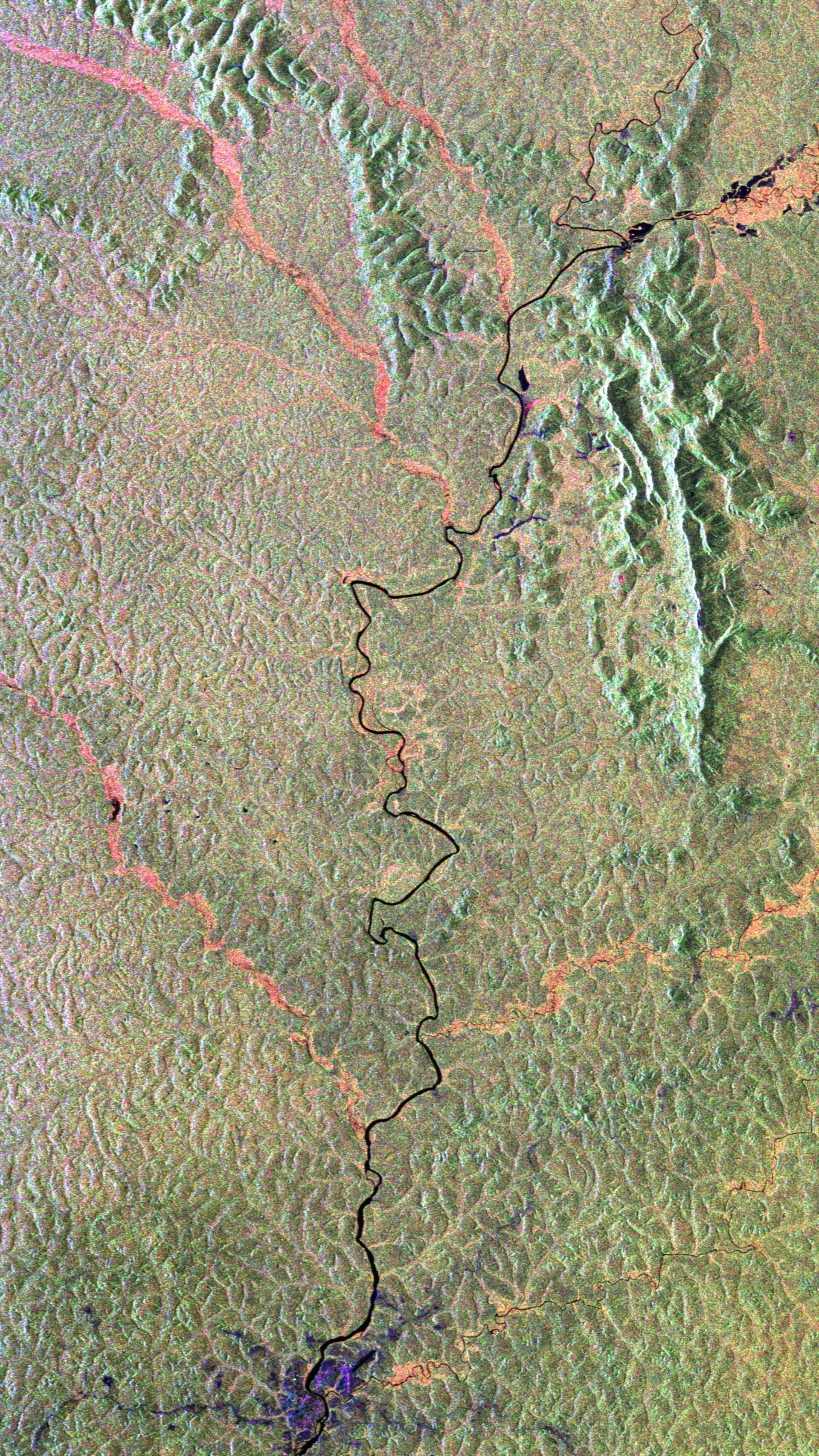
Biomass captured this image over Gabon in Africa. The Ivindo River, which is vital to the health of the rainforest, is clear to see in this striking image. Other than the river and tributaries, the image is predominantly green, representing dense forest. The visibility of topographical features in this image further underscores the radar’s capability to image through forest canopies to the terrain underneath.
The image spans approximately 100 km along the Biomass satellite's flight path (length) and 60 km across in width, with north oriented to the top.
The Biomass synthetic aperture operates continuously in fully polarimetric imaging mode, capturing all four linear polarisation combination: HH, HV, VH, and VV. The resulting images are displayed using a Pauli decomposition in RGB format, where different scattering mechanisms are represented by specific colours: blue corresponds to single-bounce surface scattering, red to double-bounce scattering, and green to multiple-bounce interactions, which are indicative of volume scattering within the forest canopy.
Read full story: Biomass satellite returns striking first images of forests and more


