Agency
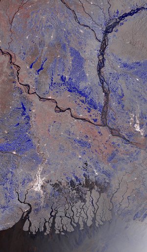
Summary of long-term flooding events in Bangladesh
This high-resolution image – showing a summary of the total extent of long-term flooding events in Bangladesh – was created with flash flood modelling using data gathered over the period 2003–2020 from the Global Flood Database (a collection of maps showing flood locations and their impacts around the world). The image was created by a project supported by ESA’s Global Development Assistance Programme.
Read full story: Satellite data streamlines global development finance