
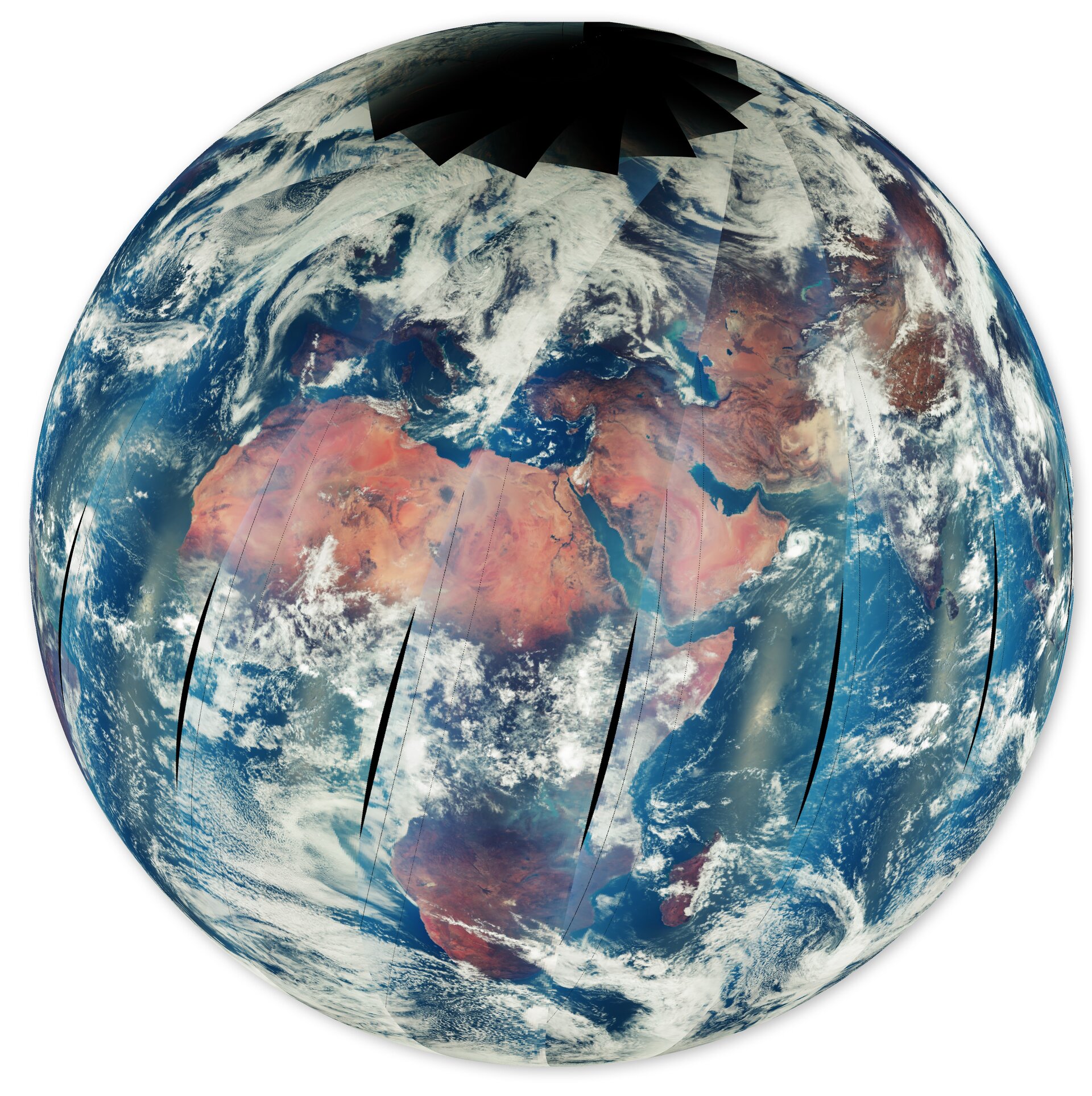
Earth radiance measured by Sentinel-5A
Launched a little over three months ago, Copernicus Sentinel-5A has returned its first images – including a global map of ozone, maps of nitrogen dioxide over the Middle East and South Africa, formaldehyde over parts of Africa, and emissions of sulphur dioxide from an active volcano in Russia – showcasing the mission’s powerful capability to monitor atmospheric gases worldwide.
This image shows Earth radiance data measured by Sentinel-5 from 5 to 6 October 2025. The data acquired during an entire day cover the entire globe. Specific spectral ranges of the measurement data have been assigned to the colours red, green and blue to generate this false colour map. The map shows land, ocean and clouds and has been used mainly for verifying the in-flight health of the satellite instrument.
Read full story: Sentinel-5 debuts images of atmospheric gases

Europe and North Africa from Sentinel-4
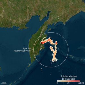
Sulphur dioxide over Klyuchevskaya Volcano measured…

Nitrogen dioxide over South Africa measured by Sentinel-5A

Nitrogen dioxide over the Middle East measured by Se…
