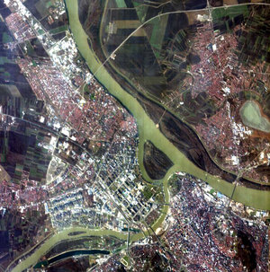
Wildfire damage east of Belgrade, Serbia
These images show two contrasting views of the countryside around the Serbian capital, Belgrade, captured on 8 August 2026.
The image on the left was captured by Copernicus Sentinel-3, using false-colour data on the near infrared channel of the Ocean and Land Colour Instrument (OLCI). The instrument’s red band was used, with red representing the thick vegetation around Belgrade. Sentinel-3’s OLCI is able to image in strips 1270 km wide, enabling it to take a broad view across large regions.
The image on the right was captured by Copernicus Sentinel-2. In contrast to Sentinel-3’s OLCI instrument, the high-resolution multispectral instrument on board Sentinel-2 is able to provide more detail. It images a strip of just 290 km in width, so we can see the burnt area of the Deliblato Sands wildfire just north of the Danube river.
There have been more than 600 wildfires in Serbia in recent days, according to the government’s Head of the Emergency Situations Sector Luka Čaušić.
The Copernicus Emergency Management Service (CEMS) was activated on 2 August (activation number EMSR914) to provide mapping of wildfires reported in Serbia, including the fire at Deliblato Sands. The CEMS Rapid Mapping was requested to delineate the burnt areas and provide data to assess damage.
Read full story: Sentinel-3 provides faster data for Europe fires