Where winds blow and lava flows
The European Space Agency’s Mars Express has explored the many landscapes of Mars for over two decades. The mission’s High Resolution Stereo Camera now captures the fascinating feature of Amazonis Mensa, a flat-topped mountain that towers up to three kilometres above the surrounding plains – around three times as tall as South Africa’s famous Table Mountain here on Earth.
This image is interactive. You can zoom and pan across the image, or click on the circle markers to explore its most interesting features.
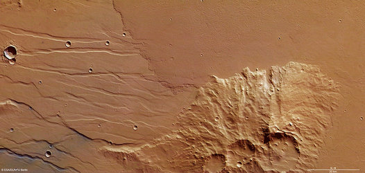
Visible as the large, irregular mound of rock just to the right of centre, Amazonis Mensa sits in an ancient part of Mars that has been sculpted for billions of years by a combination of lava, wind, and incoming space rocks.
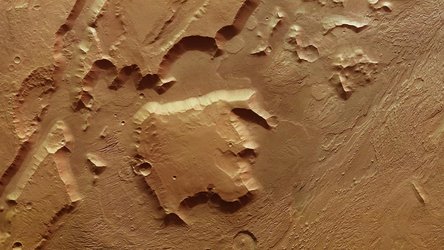
The mound is one of three, together with Gordii Dorsum to the east and Eumenides Dorsum to the west. All three have curved, elongated shapes, like fingers stretching out across the planet, and slowly grow shallower as they approach the lowlands. Click here for a wider view of the area.
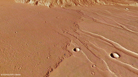
We see signs that material once flowed in this region, likely ancient lava some three billion years ago. This lava resurfaced parts of the terrain, leaving it noticeably smooth. Some impact craters have been filled with this smooth material since they formed, including one that is almost completely buried, leaving only the rim visible. A 50-km-long valley can be seen next to one of these half-buried craters, also partly filled with smooth material, while a narrower 20-km-long channel lies next to another.
Alongside flowing lava was flowing wind. This entire area shows signs of wind erosion, most notably in the crinkled, compressed patterns encircling Amazonis Mensa. These ridges are called yardangs, and form as loose sand particles are whipped up by wind and deployed a little like a cosmic sandblaster. We see two different groups of yardangs here, each aligned differently according to the direction of the winds that formed them – winds that are influenced by Amazonis Mensa itself.
Processing notes:
Mars Express has mapped the surface of Mars at unprecedented resolution, in colour, and in three dimensions since it launched in 2003. Read more about Mars Express and its findings here.
The HRSC was developed and is operated by the German Aerospace Center (Deutsches Zentrum für Luft- und Raumfahrt; DLR). The systematic processing of the camera data took place at the DLR Institute of Space Research in Berlin-Adlershof. The working group of Planetary Science and Remote Sensing at Freie Universität Berlin used the data to create the image shown here, which was acquired by the HRSC on 14 June 2026 during orbit 28328. The ground resolution of the original image is approximately 24 m/pixel, and the image is centred at about 3°S/215°E.
You can see more HRSC images of Amazonis Mensa, including 3D and topographical views, in the accompanying FU Berlin release.
[Image description: A rectangular image of the orange surface of Mars. The centre-right is dominated by a large mound called Amazonis Mensa. Diagonal lines created by wind erosion are visible on either side of it. The left half of the image is a smooth surface with some impact craters, a wide valley, and a small snaking water-carved channel. These have been partially filled in by smooth material: ancient lava flows.]