Earthquakes IntroductionIzmit earthquakeFloods Thessaloniki (Greece)Hurricanes Storm surgesHurricane KatrinaVolcanoes IntroductionAndean Volcanic BeltEtnaNyiragongo and Nyamuragira
|  |  |  |  | | Article Images |  | Exercise 1: Exploring the volcano - continued
| | |  | The 4-5-3 combination with two IR bands highlights details not seen with previous combinations. Vegetation types can be distinguished and are displayed in shades of orange/brown/green, urban areas in shades of light purple, water is dark and can be delineated from land very well, and the volcanic plume disappears.
Credits: USGS |  |  |  |  |
| | |  | The 7-4-2 FCC band provides a natural appearance: healthy vegetation is bright green, grassland is green, soils have multiple colours, bare soil is pink and sparse vegetation is orange. Fires would appear red.
Credits: USGS |  |  |  |  |
| |
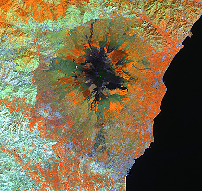
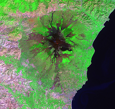
|  | Etna IntroductionChange Detection and Hazard Assessment Worksheet introductionExercise 1: Exploring the volcanoExercise 2 : Visual interpretation using terrestrial photographsExercise 3: Lava detection: crisis images and mapsExercise 4: Hazard assessment: GIS can help!Eduspace - Download Etna_Landsat_GIS.zipEduspace - Software LEOWorks 3LEOWorks 3 Tutorial
|