ESA
Education
Hjem
Vejr og klima
Globale forandringer
Naturkatastrofer
Forandring af kystlinien
Donau-deltaet
Olieforurening fra borerig
Skovrydning
Bardia National Park
Congobækkenet
Kameng-Sonitpur Elephant Reserve
Kilimanjaro
Rondonia
Shillong og Guwahati
Is
Antarktis 2003
Klimaforandringer og gletsjere
Gletscheres tilbagesmeltning i Alperne
Gletsjerisens bevægelse
Gletsjeranalyse ved hjælp af radarbilleder
Monitorering af gletschere i Himalaya
Telemåling af is og sne
Urbanisering
Cairo
Cordoba
Kathmandu
Himalaya
Kathmandudalen
Lagos
Vegetation
Annapurna Conservation Area
Forsvundet i Andesbjergene
Ngorongoro Conservation Area
Niger-indlandsdeltaet
Sydamerika
Søg
Article Images
Analysere satellitbilledserierne - Part 3
Tilbage til artiklen
Download:
HI-RES JPEG
(Size:
11 kb
)
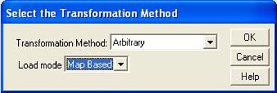
Kameng-Sonitpur Elephant Reserve – Selection of transformation method for opening of the GIS theme showing the forest boundaries in 1994.
Tilbage til artiklen
Download:
HI-RES BMP
(Size:
253 kb
)
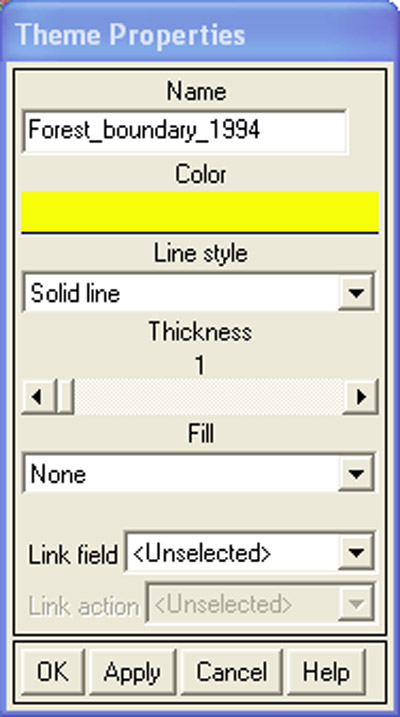
Kameng-Sonitpur Elephant Reserve – Select a colour for the forest boundaries in the Theme Properties window.
Tilbage til artiklen
Download:
HI-RES BMP
(Size:
619 kb
)
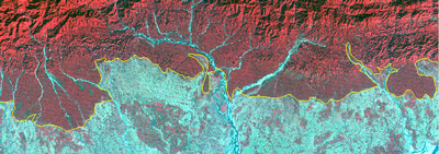
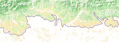
Kameng-Sonitpur Elephant Reserve – False colour combination of 1994 image with forest boundaries.
Tilbage til artiklen
Download:
HI-RES BMP
(Size:
622 kb
)
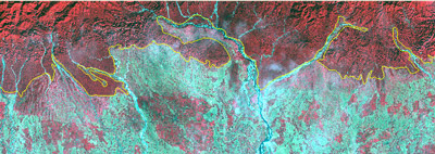
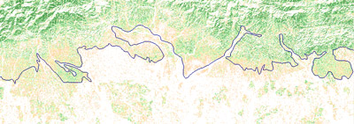
Kameng-Sonitpur Elephant Reserve – False colour combination of 2003 image with forest boundaries.
Tilbage til artiklen
Download:
HI-RES BMP
(Size:
619 kb
)
Kameng-Sonitpur Elephant Reserve – NDVI image of 1994 with forest boundaries.
Tilbage til artiklen
Download:
HI-RES BMP
(Size:
805 kb
)
Kameng-Sonitpur Elephant Reserve – NDVI image of 2003 with forest boundaries.
Kameng-Sonitpur Elephant Reserve
Inledning
Elephant Reserve
Den asiatiske elefant
Menneske vs elefant
Øvelser
Inledning
Udarbejdelsen af papirkort og studiet af Kameng-Sonitpur
Analysere satellitbilledserierne
Eduspace - Software
LEOWorks 3
ArcExplorer
Eduspace - Download
ks_papermap.zip
ks_satelliteimg.zip
Resourcer
Nyttige links
Copyright 2000 - 2014 © European Space Agency. All rights reserved.