ESA
Education
Home
Weather and Climate
Global Change
Natural Disasters
Weather
Foehn wind
Interactive Meteosat
Meteosat images
Climate
African climate
El Niño
Gulf Stream
Himalayan climate
Explore the world and its climate with JP Explorer
Lake Chad
Search
Article Images
Exercises - Continued
Draw fronts
Back to article
Download:
HI-RES GIF
(Size:
68 kb
)
Weather map of 18 March 2000.
Credits: ESA
My forecast
Back to article
Download:
HI-RES JPG
(Size:
79 kb
)
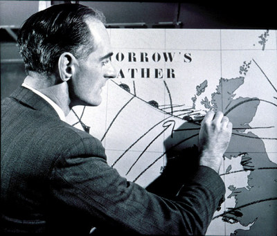
1954: The first live BBC Television forecast, lasting five minutes, was made by Met Office forecaster George Cowling.
Credits: Met Office, UK
Background for a weather forecast
Back to article
Download:
HI-RES JPG
(Size:
81 kb
)
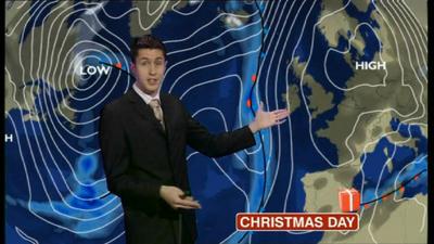
Today’s weather forecasters can report the weather with increased accuracy.
Credits: BBC
Interactive Meteosat
Introduction
Weather in Europe
Meteosat images
Weather observations
Wind
Cloudiness
Temperature
Upload observations
Exercises
Introduction and exercises
Links
Eumetsat
Sarepta
Dundee Satellite Receiving Station
WetterZentrale
US National Hurricane Center
NOAA
Met Office (UK)
Weather map
with fronts
(choose
'Bodenanalyse')
Historical Data
Cloud atlas
Current weather
Map of the frontal zone
Map showing prognosis frontal zone
Eduspace - Download
Images and observations archive
Download latest Meteosat animation
Copyright 2000 - 2014 © European Space Agency. All rights reserved.