Semi-supervised learning for scene classification
Recent years have seen a drastic increase in the launch of remote sensing satellites and with increased affordability and novel industrial applications the field is poised to become even more relevant. Notably, processing the data from remote sensing satellites offer specific challenges. While large amounts of data are becoming available, processing of the collected data is often still difficult or laborious.
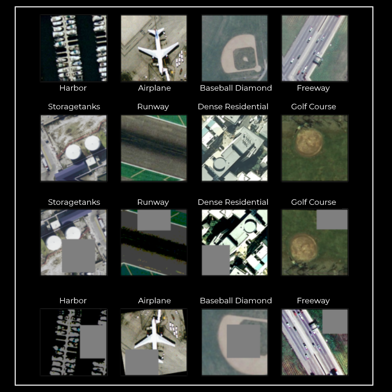
Deep learning methods provide one way to remedy this, but a lack of labelled training data is the bottleneck in many cases, especially in cases where the interest is not of a commercial nature. Semi-supervised learning techniques are one way to alleviate the lack of labelled training data. In recent works, novel methods have been introduced that bear great promise to allow a comparable performance of deep learning methods as if they were trained on considerably larger labelled datasets. The research we are pursuing here will aim to adopt these methods to the application of processing remote sensing data, in particular to scene classification, to allow dealing with the vast amounts of data that are becoming available. Thus, new areas of application will become feasible and, by performing this research openly accessible, the research will contribute to the democratization of remote sensing tools.
Project overview
With the advent of deep learning methods the need for a large number of labelled training sample has become a notable burden in many cases. Building on research and datasets that the remote sensing community has published over the last decade [1-3] we are trying to improve the utilized methods to a point where a low number of images per class can suffice for training a high accuracy classification model. This will enable utilization especially in cases where a lack of commercial interest limits the availability of data annotated by experts.
To achieve this goal, we build on recent advances in semi-supervised learning methods by Berthelot et al. [4] and novel architectures [5] that bear the promise to significantly lower the computational complexity. These methods have provided state-of-the-art results on classical ML benchmarks. As part of this project we are adapting them for remote sensing data, such as aerial imagery and likely hyperspectral imagery.
Further the project is actively exploring application domains related to other research projects at ESA that may immediately profit from this.
Currently, this project is in progress and preliminary results are being collected.
References:
Yi Yang and Shawn Newsam, "Bag-Of-Visual-Words and Spatial Extensions for Land-Use Classification," ACM SIGSPATIAL International Conference on Advances in Geographic Information Systems (ACM GIS), 2010.
G. Xia et al., "AID: A Benchmark Data Set for Performance Evaluation of Aerial Scene Classification," in IEEE Transactions on Geoscience and Remote Sensing, vol. 55, no. 7, pp. 3965-3981, July 2017, doi: 10.1109/TGRS.2017.2685945.
P. Helber, B. Bischke, A. Dengel and D. Borth, "Introducing Eurosat: A Novel Dataset and Deep Learning Benchmark for Land Use and Land Cover Classification," IGARSS 2018 - 2018 IEEE International Geoscience and Remote Sensing Symposium, Valencia, 2018, pp. 204-207, doi: 10.1109/IGARSS.2018.8519248.
Sohn, Kihyuk, et al. "FixMatch: Simplifying semi-supervised learning with consistency and confidence." arXiv preprint arXiv:2001.07685 (2020).
Tan, Mingxing, and Quoc V. Le. "EfficientNet: Rethinking model scaling for convolutional neural networks." arXiv preprint arXiv:1905.11946 (2019).