Doubling radar vision of Earth
Following a contract signed with Arianespace today, the second Sentinel-1 satellite is now set to join its identical twin sister in orbit in early 2016, optimising the mission’s global coverage to manage the environment and improve everyday lives.
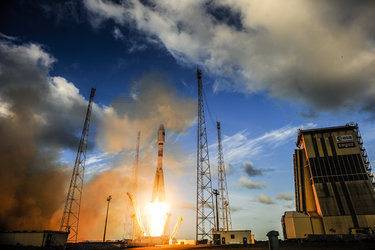
Launched in April this year, Sentinel-1A is the first satellite designed specifically for Europe’s Copernicus programme.
This joint ESA–EU programme is the largest environmental monitoring effort in the world.
Although it is still being calibrated and not yet quite in its operational orbit, the state-of-the-art radar satellite has already been used to help respond to a number of disastrous floods.
The mission was designed as a constellation of two satellites, launched separately. Orbiting Earth 180° apart, the constellation optimises data delivery and revisits everywhere on Earth every six days.
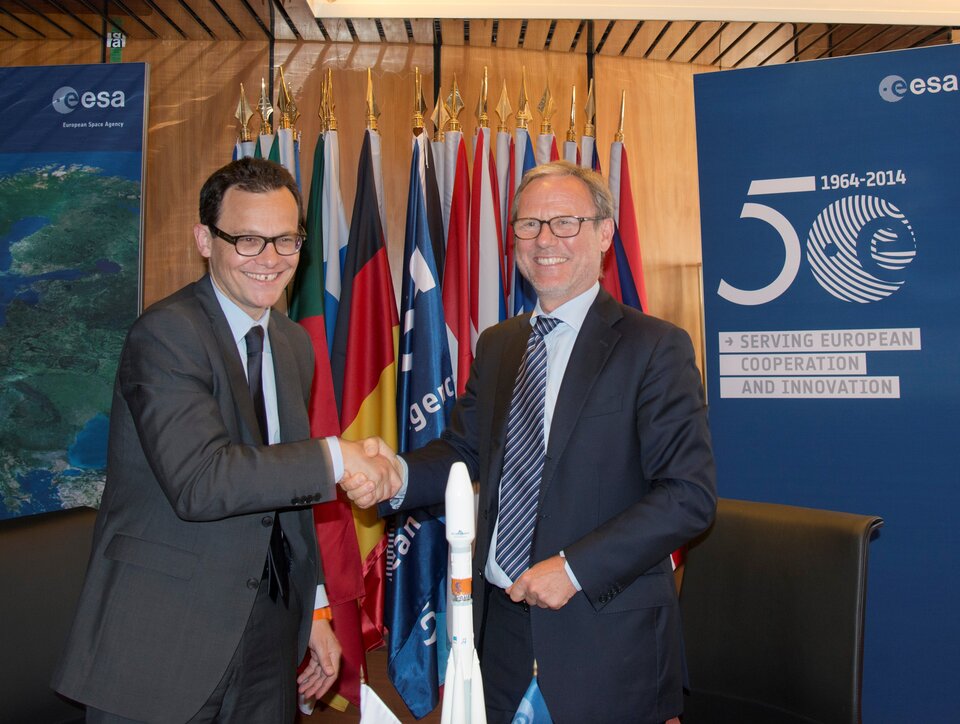
According to the contract, which was signed at ESA headquarters in Paris, France, by ESA’s Director of Earth Observation Programmes, Volker Liebig, and CEO of Arianespace, Stéphane Israël, Sentinel-1B will be launched on a Russian Soyuz rocket from Europe’s Spaceport near Kourou in French Guiana, as was Sentinel-1A.
Mr Israël said, “We are very proud to have been chosen once again to support the Copernicus programme designed to protect our planet.”
Prof Liebig noted, “When Sentinel-1B is in orbit, the time it takes for the mission to cover Earth will be halved and we will be delivering 1.5 TB of data every day for the Copernicus services.
“Sentinel-1A has been performing exceptionally well and in a few short months we have already seen what it is capable of and we have had very positive feedback from the user community.
“With the launch contract now in place, we can now look forward to having both satellites in orbit to complete the mission configuration.”
As an advanced radar mission, Sentinel-1 can image the surface of Earth through cloud and rain, regardless of whether it is day or night. This makes it an ideal mission for monitoring, for example, the polar regions, which are in darkness in the winter months and for monitoring tropical forests, which are typically shrouded in cloud.
The mission is also designed for fast response to aid in emergencies and disasters such as flooding and earthquakes.
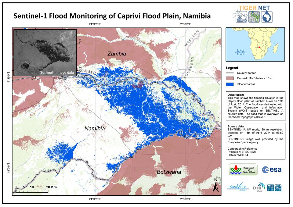
Demonstrating its value in this respect, just 10 days after being launched, Sentinel-1A captured an image of flooding from the Zambezi River in Namibia. The image was crucial in helping Namibian authorities decide how to respond to this serious flood.
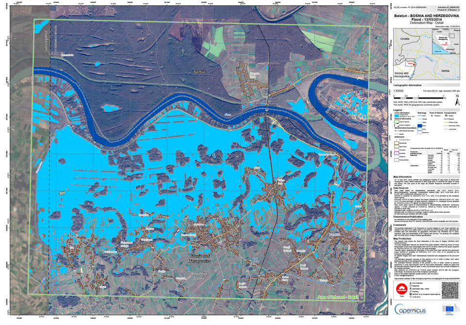
A few weeks later, it provided data for mapping floods in Bosnia and Herzegovina and was also used to map the extent of flooding from the Paraná river following activation of the International Charter Space and Major Disasters.
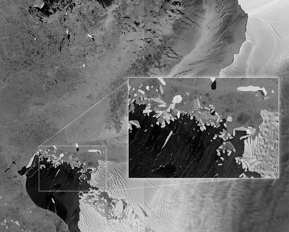
Images from Sentinel-1A have also demonstrated its suitability for mapping sea-ice conditions for maritime safety and monitoring glacial movement.
It will also be used to map changes in land cover. Its ‘radar interferometry’ technique, which combines two or more radar scans over the same area, will be used to detect ground movement down to a few millimetres between them – valuable information for monitoring shifts from earthquakes, landslides and volcanic uplift.
The commissioning phase is expected to be finished by the end of September when Sentinel-1 will become fully operational for Copernicus.
With the contract to launch its sister now secured, users and decision-makers can also look forward to a fully-fledged Sentinel-1 mission by the middle of 2016.