• → European Space Agency

      • Space for Europe
      • Space News
      • Space in Images
      • Space in Videos
    • About Us

      • Welcome to ESA
      • DG's news and views
      • For Member State Delegations
      • Business with ESA
      • Law at ESA
      • ESA Exhibitions
      • ESA Publications
      • Careers at ESA
    • Our Activities

      • Space News
      • Observing the Earth
      • Human Spaceflight
      • Space Transportation
      • Navigation
      • Space Science
      • Space Engineering & Technology
      • Operations
      • Telecommunications & Integrated Applications
      • Preparing for the Future
    • Careers at ESA

    • For Media

      • Media
      • ESA TV
      • Videos for professionals
      • Photos
    • For Educators

    • For Kids

    • ESA

    • Observing the Earth

    • Copernicus

    • Sentinel-1

    • Radar vision
    • Introducing Sentinel-1
    • Applications
    • Oceans and ice
    • Changing lands
    • Emergency response
    • About the mission
    • Facts and figures
    • Satellite constellation
    • Instrument
    • About the launch
    • Operations and data
    • Data flow
    • Data products
    • Multimedia
    • Image gallery
    • Video gallery
    • Downloads
    • Documents & publications
    • Services
    • Subscribe

    ESA > Our Activities > Observing the Earth > Copernicus > Sentinel-1

    First Copernicus satellite now operational

    Handing over Sentinel-1A
    6 October 2014

    With the commissioning of Sentinel-1A completed and the satellite’s transfer to the team in charge of its exploitation, its data are available as of today to all users.

    This marks the beginning of the satellite’s operational life, delivering radar coverage for an array of applications in the areas of oceans, ice, changing land and emergency response.

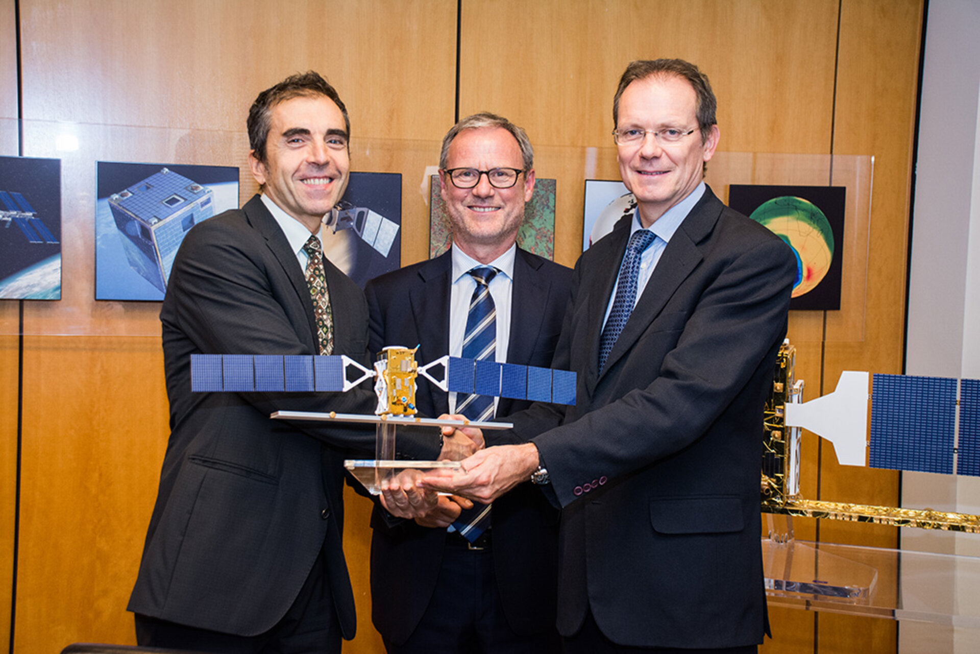
    Project Manager Ramón Torres, who led the development team, formally handed over the satellite to the Mission Manager, Pierre Potin.

    “The time has arrived for the satellite to exploit its extraordinary capabilities and start helping users,” said Ramón.

    “A leap forward from ESA’s earlier Envisat, the unprecedented quality of Sentinel-1A will ensure that all users’ needs are fully met.

    “Of course, saying farewell is always difficult, but I am confident that it is in capable and safe hands for the next stage of its journey.”

    Loading...
    Sentinel-1
    Access the video

    Launched on 3 April, Sentinel-1A completed commissioning on 23 September – an important process that ensures the satellite, instruments, data acquisition and data processing procedures are working well.

    Not only did Sentinel-1A pass these tests and reach its target orbit on 7 August, eight anticollision manoeuvres to avoid space debris were performed during this phase.

    The satellite will now begin delivering radar scans for an array of operational services and scientific research.

    “My main objective is to ensure that Sentinel-1 fulfils the high expectations from the various operational services and scientific users,” notes Pierre.

    “Looking at the satellite and ground segment performance – as demonstrated during the commissioning – as well as the preliminary results achieved so far, I’m confident that the mission will be a great success.”

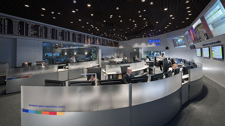
    The satellite will continue to be monitored, operated and controlled from ESA’s Space Operations Centre in Darmstadt, Germany.

    The Sentinels are a new fleet of ESA satellite poised to deliver the wealth of data and imagery that are central to Europe’s Copernicus programme. 

    By offering a set of key information services for a broad range of applications, this global monitoring programme is a step change in the way we manage our environment, understand and tackle the effects of climate change, and safeguard everyday lives.

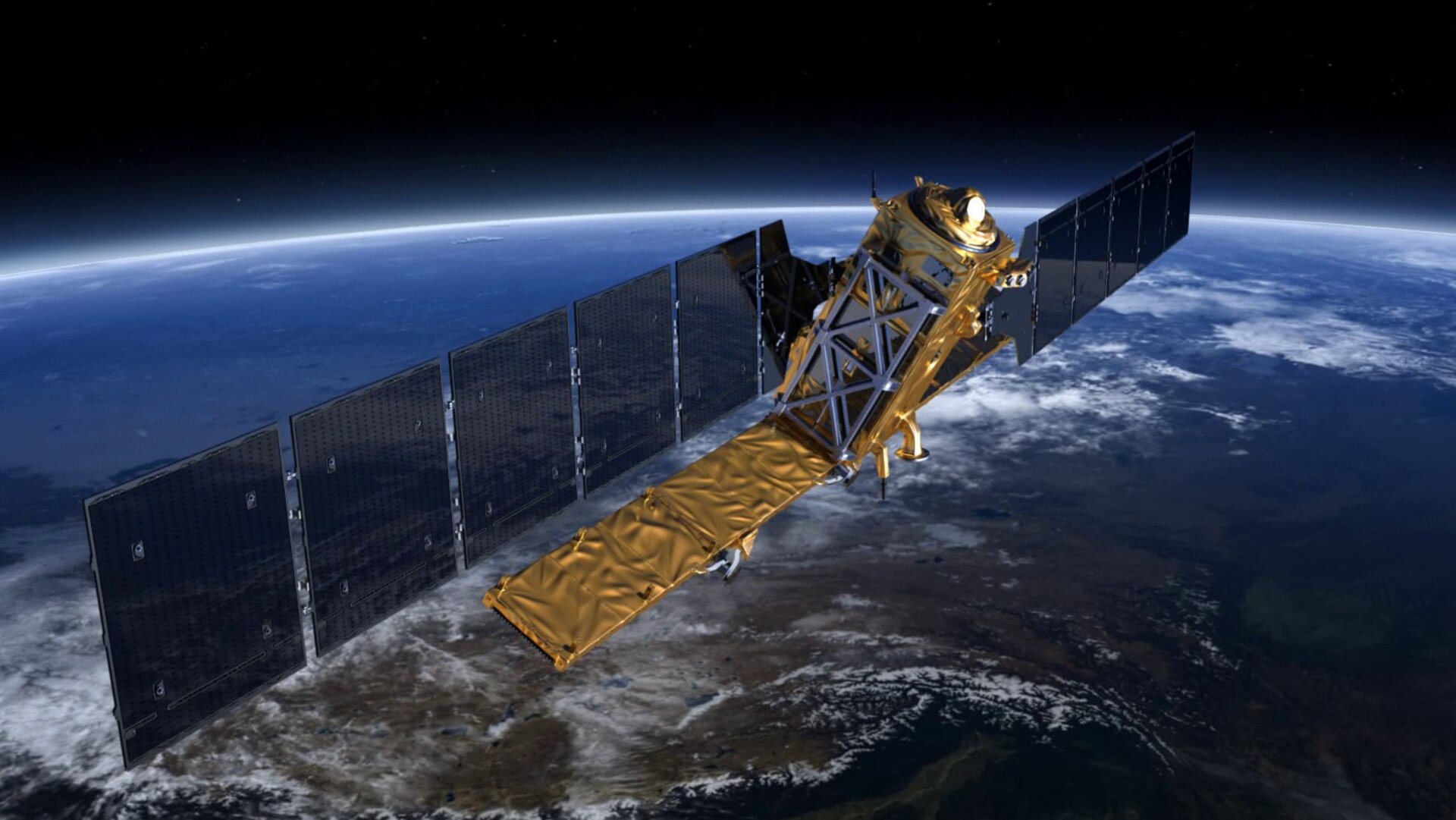
    Sentinel-1 – a two-satellite constellation – is the first in the series and carries an advanced radar to provide an all-weather, day-and-night supply of imagery of Earth’s surface.

    Napa Valley quake

    Even during commissioning, Sentinel-1A demonstrated its potential in the various applications domains.

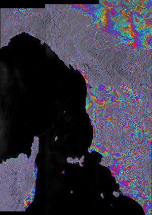
    Just days after launch, its results were included in maps of the floods that hit Namibia, as well as those in the Balkans the following month. This information was then used by authorities involved in flood response.

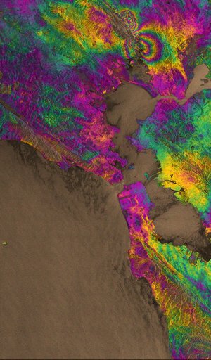
    Radar images were also used to map the rupture caused by the 24 August earthquake that shook northern California – the biggest the area has seen in 25 years.

    The towing of the Costa Concordia cruise ship off the west coast of Italy was captured by the radar, demonstrating Sentinel-1’s ability to survey the marine environment.

    This and many other services will now start benefiting from Sentinel-1A’s operational status. These include services related to monitoring Arctic sea-ice extent, routine sea-ice mapping, surveillance of the marine environment, monitoring land-surface for motion risks, mapping for forest, water and soil management and mapping to support humanitarian aid and crisis situations.

    The mission’s contributions will further improve once the satellite’s identical twin, Sentinel-1B, is launched in 2016.

    Rate this

    Views

    Share

    • Currently 5 out of 5 Stars.
    • 1
    • 2
    • 3
    • 4
    • 5
    Rating: 4.8/5 (83 votes cast)

    Thank you for rating!

    You have already rated this page, you can only rate it once!

    Your rating has been changed, thanks for rating!

    7483
    Tweet

    Related articles

    New toolboxes make using Sentinel data easy30 September 2014

    New toolboxes make using Sentinel data easy30 September 2014 The Sentinel satellites are built primarily to deliver information for environmental services through Europe’s Copernicus programme, but they will also be used to advance our scientific understanding of Earth. Paving the way for easy scientific exploi...

    Radar vision maps Napa Valley earthquake02 September 2014

    Radar vision maps Napa Valley earthquake02 September 2014 Sentinel-1A has added yet another string to its bow. Radar images from this fledgling satellite have been used to map the rupture caused by the biggest earthquake that has shaken northern California in 25 years.

    Sentinel-1 poised to monitor motion26 August 2014

    Sentinel-1 poised to monitor motion26 August 2014 Although it was only launched a few months ago and is still being commissioned, the new Sentinel-1A radar satellite has already shown that it can be used to generate 3D models of Earth’s surface and will be able to closely monitor land and ice surface...

    • Sentinel-1
    • Copernicus
    • Sentinel data access & technical information
    • Spacecraft Operations
      Spacecraft Operations
      Operations
    • Related links
    • European Commission Copernicus site
    • Interview with Ramón Torres
    • Interview with Pierre Potin
    • App Store
    • Subscribe
    • mobile version
    • ESA Observing the Earth Twitter

    @ESA_EO

    • LATEST ARTICLES
    • · Counting calories in space
    • · How to rescue a Moonwalker in need
    • · See our seasons change from space
    • · Preparing for Mercury: BepiColombo…
    • · Giant iceberg in the making
    • FAQ

    • Site Map

    • Contacts

    • Terms and conditions