UN development work guided from space
United Nations-led development efforts in some of the poorest and most remote parts of the globe are being guided by images from space.
The ESA-backed UNOSAT consortium is providing an average of five new satellite-derived maps or data products to UN agencies and non-governmental organisations every week.
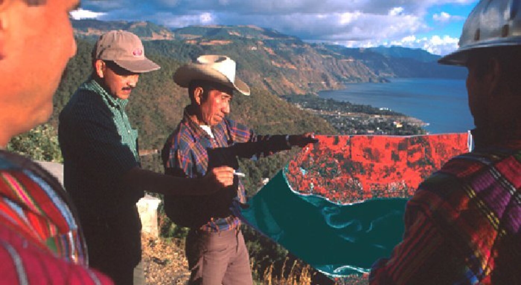
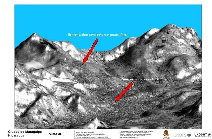
The poor Nicaraguan highlands municipality of Matagalpa is just one site among many where UNOSAT-supplied geographical information system (GIS) tools are being used in development projects. Here the International Strategy for Disaster Reduction (part of the UN Office for the Coordination of Humanitarian Affairs) is using space-derived relief data that identifies areas most at risk of landslides to plan safe urban expansion.
And by using GIS tools to combine a satellite image of newly built-up areas with local data on the limits of the local water supply, zones most at risk of disease are highlighted for attention.
Such Earth Observation (EO) services are being made available worldwide to United Nations agencies and non-governmental organisations (NGOs) concerned with short-term emergency relief and longer-term development assistance. The provider is UNOSAT, a consortium funded by ESA's Earth Observation Market Development Programme, together with the Centre National pour les Etudes Spatiales of France (CNES) and the Ministry of Foreign Affairs of France.
"UNOSAT is operated by the United Nations Office for Project Services (UNOPS), which provides technical support and advice for other UN agencies involved in reconstruction projects," said Alain Retiere of UNOSAT. "It's often true that maps of remote areas are outdated and unreliable so that led us to take an interest in the potential of EO data."
Service born out of a hurricane

The catastrophic experience of Hurricane Mitch - which killed 10,000 people and destroyed 150 bridges as it crossed Central America in November 1998 – was actually helpful in demonstrating how an operational EO service might work.
The scale of the damage done was such that ESA's ERS and France's SPOT satellite systems were specifically tasked to acquire images in order to elaborate and supply cartographic and damage mapping products across the complete region – a unique experience that involved combining radar and optical images together in a rush production for delivery into a fully operational environment, with people in the field awaiting the final products.
"UNOPS already had a presence in Central America so we provided ground validation for the damage mapping carried out by satellite," explained Retiere. "We then helped ensure the results got into the right hands to do some good. That experience showed us how a more open-ended EO service for the development sector might work in practice."
To form the UNOSAT consortium UNOPS struck deals with data providers such as Spot Image and Space Imaging Eurasia, along with value-adding companies (VACs) such as Gamma Remote Sensing and Digitech who work to turn raw satellite data into usable products and maps. This non-profit initiative is eventually intended to cover its costs through the services it provides for clients.

"In the past, use of EO data in the development arena has been limited, partly because of cost but also because EO is a very specialist field," said Retiere. "We have brought the price down by increasing the overall number of users. In addition we know both our users' precise requirements and the capabilities of the VACs very well and so we can bring both sides together."
Clients access the UNOSAT service through a 'one-stop' website http://www.unosat.org. Here they can search through and download images, maps and other geographical information products already produced, and also order the creation of new ones. For optimal connectivity the website is hosted at CERN, the place where the World-Wide Web was created. UNOSAT is also considering partnerships with VSAT operators in the space telecommunications sector, so access to the website can be assured even in regions where terrestrial phone lines run out.
"Once on the ground, UNOSAT maps do a great deal of good," Retiere said. "Long detailed reports don't have the same influence as a good map, especially in places where many people who live there still cannot read. There's a big difference between just telling local people about a problem like deforestation and actually showing them it on a map."
Besides being used by NGOs in the pursuit of sustainable development, UNOSAT has also helped make EO data available directly to local authorities. In Matagalpa, UNOSAT – with the financial backing of the Swiss canton of Geneva – has helped set up a local centre to broker EO data to users within the Rio Grande water basin and elsewhere in Nicaragua. Another such EO brokering centre is being created in East Africa.
"The idea is to set up networks that provide local people with experience and skill in making use of EO data," said Retiere. "We're conscious that our real final end user is the people in the localities we're working to benefit."