| | Background
Weather
Weather is the combination of different phenomena (e.g. wind, clouds, precipitation) in the lower atmosphere, the so-called Troposphere, at a certain location and time. The weather is caused by the sun's energy heating the earth's surface and the overlying atmosphere. The weather depends on latitude, orography (altitude and relief), land-ocean-distribution, natural cover and anthropo-geographical factors. The weather's physical characteristics are temperature, air pressure and air humidity.
|  | The Earth's movement around the Sun | |
Seasons
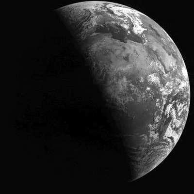
The earth moves around the sun in an elliptical orbit. One entire circuit takes one year. The sun is located at one focus of the ellipse and the orbit of the earth around the sun lies in an imaginary plane, the Ecliptic.
The earth's rotation axis is inclined at an angle of 23.5° relative to the Ecliptic. During the movement of the earth around the sun, the rotation axis of the earth does not move. Consequently, the northern hemisphere points towards the sun during the summer months and points away from the sun in winter.
These conditions derive from the different angles at which the radiation from the sun reaches the surface of the earth during a year. In the summer in the northern hemisphere the incidence angle is high. During the winter months the angle diminishes and the sun is positioned lower above the horizon. Consequently sunrise is late and sunset early during the winter months in the northern hemisphere. The days are short, and, because of the low insolation, cold. This is the situation in the northern hemisphere. While it is winter in the northern hemisphere, in the southern hemisphere the sun stands high and the days are long and warm. During the northern summer months it is winter in the southern hemisphere. The seasons in the northern and the southern hemispheres are opposites.
The point where the sunlight strikes the Earth's surface at a right angle moves between 23.5° N and 23.5° S during a year. The seasonal climatic differences are caused by the earth´s inclination of 23.5°. The distance from the earth to the sun is of little importance. The northern and southern turning points of the sun are called the northern and the southern tropics, the tropic of cancer and the tropic of Capricorn respectively.

Summer Northern hemisphere

Summer Southern hemisphere
 Summer Northern hemisphere
 Summer Southern hemisphere
| | Climate map of Himalayan region | |
Climate Zones
The formation of climate zones is also a consequence of the different sun wave angles. But there are many more influences, such as land-ocean distribution, orography, atmospheric and ocean streams, and so on. The strong degree of coaction is highly visible in the intertropical convergence zone (ITC).
| | | SEMHQMEH1TF |
ITC (Inter Tropical Convergence)
The intertropical convergence zone is situated near the equator. The air mass is heated and therefore rises. Under the warm air mass a thermal low pressure is formed. The humid north-east trade winds from the northern hemisphere and the south-east trade winds from the southern hemisphere converge.
During the flow of the passats the air mass becomes heated and rises. Because of the very high humidity of the air and the very high temperature, the rising air mass forms high cumulonimbus clouds. These clouds are much larger and more vertical than fair weather cumulus. The top of a cumulonimbus cloud can reach up to 12 000 meters. Many rain and thunder storms derive from cumulonimbus cloud formations.
The location of the ITC depends on the seasons. Basically the ITC moves with the zenith of the sun from 20° N to 20° S. Deviations can be found, caused partly by high passat circulation. The actual position of the ITC defines the meteorological equator.
| | Trade wind circulation | |
Trade Winds
Winds with an average speed of 20 km/h flow regularly to the west along the equatorial flanks of the subtropical high-pressure zone. Over land and at the beginning of their oceanic travel, they are mostly dry winds like the Harmattan in West Africa. During their ocean transit, however, the winds take up large quantities of water vapour, and in mountainous barrier zones develop extensive clouds and precipitation.
Along the Equator the north-eastern and south-eastern Passat winds converge in a trough of low pressure. Under the influence of the sun at its zenith and the consequent pronounced warming of the ground surface, the converging air masses rise and form moist cumulonimbus clouds. The rise of the air masses at the Equator is balanced by a fall in the areas of the tropics, which completes the circle. (see diagram Intertropical Convergence)
NDVI
The Normalized Difference Vegetation Index (NDVI), which is related to the proportion of photosynthetically absorbed radiation, is calculated from the visible red channel and the near infrared channel. The healthy vegetation shows a steep increase in reflection at 0.7 µm (near infrared), whereas soil, depending on its nature, shows a linear increase. The more active the chlorophyll, the steeper the increase of reflection in the near infrared at 0.7 - 1 µm. This allows for a classification of the vitality of vegetation. See also: Remote Sensing Principles, Remote Sensing and Vegetation Mapping
The standardisation (by quotientiation) reduces topographical and atmospherical influences and allows wide areas to be observed.
The calculation for Landsat NDVI is: (channel4 - channel3) / (channel4 + channel3).
In other words,
| NDVI = |
near infrared - red
|
near infrared + red |
| | | Meteosat Second Generation artistic view |
Weather Satellites
The weather satellites used for meteorological observations operate on polar or equatorial orbits. These satellites measure the reflection and radiation from the Earth's surface. The reflection and the radiation (infrared) can be interpreted to obtain information on the distribution of clouds, temperature and the the amount of water vapour in the atmosphere. Special attention is given to the early detection of hurricanes and thunderstorms. Because of the radiation it is possible to measure the temperatures of air films and of the earth´s surface. It is therefore also possible to determine the altitude of clouds. Even at night cloud distribution can be observed by measuring infrared radiation.
Meteosat
- Meteosat First Generation:
- Ground resolution:
- visible light (VIS) 2.5 km
- infrared (IR) 5 km
- Spectral channels
- 1: 0.50 - 0.90 µm visible light
- 2: 5.70 - 7.10 µm water vapour
- 3: 10.50 - 12.50 µm thermal infrared
- Operating altitude 36 000 km
- Repeat rate 30 minutes
- Data since 1978
Visible light: The VIS-channel operates in the visible spectrum. It measures the solar radiation reflected by the atmosphere and the earth's surface. Water and ice clouds stand out because of their conspicuously higher reflection. Admittedly, snow and ice can show a similar strong reflection. The reflection of water surfaces depends very much on the direction of recording and the surface conditions.
Water vapour: The WV-channel operates in the zone of vapour absorptivity (5.7 - 7.1 µm, middle infrared). Due to the strength of absorption in this wavelength range, it is mainly values of the middle and upper troposphere that are recorded. The atmospheric absorption of the middle infrared radiation is in fact so strong that almost no radiation can reach the surface of the Earth. Consequently, on the Earth´s surface there is nothing left to reflect and it appears to be 'invisible'.
Even in areas where no clouds have formed, water vapour flow fields existing in the upper atmosphere may eventually cause clouds and precipitation. The images typically have a lower resolution than IR images but are available both day and night, which is an advantage over visible imagery. Water vapour is visible day and night, because the middle infrared exists both day and night and is not dependent on the existence of direct solar radiation. The usefulness of the images is diminished by the fact that 'low-level' water vapour content is often very important for the formation of clouds and precipitation. The 'upper level' nature of the images can miss significant variations of water vapour at lower levels.
Thermal Infrared: The IR-channel operates in a spectral range with a low absorption of trace gas. This makes it possible to measure long wave radiation from the earth´s surface and cloud surfaces. There is a very good differentiation of clouds because of their lower temperatures in comparison to the Earth's surface temperatures. Difficulties occur with low lying clouds and snow and ice fields, which can show low temperatures similar to those of the ice cloud surfaces.
Meteosat Second Generation
Meteosat Second Generation (MSG) also called Meteosat 8 is now operational. It has improved technical specifications. MSG will generate multi-spectral imagery of the Earth's surface and cloud systems at double the rate (every 15 minutes instead of every half an hour) of the current Meteosat, and for a much larger number of spectral channels (twelve compared to three for Meteosat). It will also offer vastly improved geometrical resolution (1 km for the high-resolution visible channel and 3 km for the others). Eight of the channels will be in the thermal infrared, providing permanent data on the temperatures of clouds, land and sea surfaces as well as other information. Using channels that absorb ozone, water vapour and carbon dioxide, MSG will also allow meteorologists to analyse the characteristics of atmospheric air masses, making it possible to reconstruct a three-dimensional view of the atmosphere. Two of the eight infrared channels are now published on the Eumetsat homepage. The current Meteosat capabilities will be retained.
Source: EUMETSAT
| |