Mapping Britain's crumbling coastline
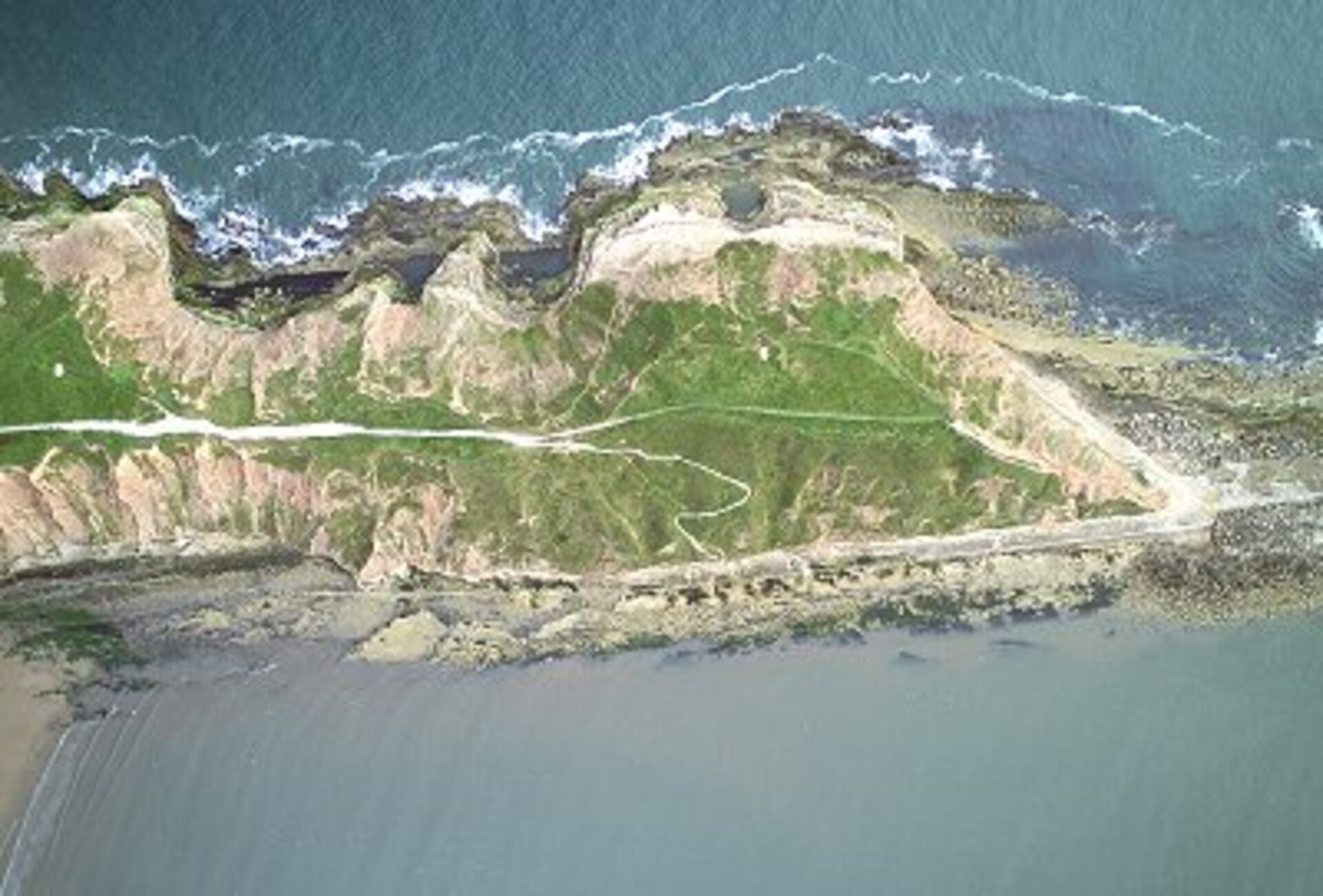
With a swelling roar, a section of cliff separates and slumps downward, an irresistible tide of earth and rock crashing into the foaming sea beneath. The incessant pounding of the North Sea breakers has claimed another metre or so of Britain's fragile coastline.
A new project using ESA satellite data and the latest digital image technology is aiming to map and eventually predict this inexorable crumbling, and provide the information that will save lives, property and money.
"Coastal management is becoming vitally important to local authorities faced with problems of erosion and subsidence, which threaten the stability of the land and safety of the people they are responsible for," explains Dr Jon Mills of the Department of Geomatics at the University of Newcastle, who is heading up a pilot project to monitor coastal erosion at Filey Bay on Britain's Yorkshire coast. Scarborough Borough Council, which is responsible for the 72 km of coast that includes Filey Bay, expects to spend £50m on coastal defences alone in the next decade. The consequences of coastal erosion can be dramatic, as the landslip which left a Scarborough hotel shattered in 1993 showed.

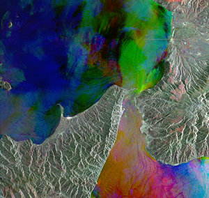
Filey Bay is disappearing into the sea at a rate of 25 centimetres every year, making it a prime candidate for monitoring. The pilot project will concentrate on combining information from the Global Positioning System (GPS), digital photogrammetry - making accurate measurements from a digital image - and synthetic aperture radar interferometry (InSAR) using data from ESA's ERS-2 satellite to create very detailed three dimensional maps of the coastline. "This will be the first time that GPS and photogrammetric observations will be combined in this way to provide the height model for use in SAR analysis", comments Mills. While today this monitoring can be performed using ERS-2 SAR data, once Envisat is launched later this year it could continue using the Envisat ASAR.

The GPS data is captured on the move - where possible using a receiver mounted on an all-terrain vehicle, but on foot where there are environmental concerns about the ATV. This GPS scan produces a framework of coordinates and heights accurate to a few centimetres. The next stage is to capture the digital images, which is done using a Kodak DCS 660 digital camera attached to a GPS receiver and carried aloft in a Thruster microlight. Finally, the airborne digital images are merged onto the GPS ground coordinates and the two are combined into a single digital terrain model (DTM).

"The combined DTM will then be used for processing of InSAR imagery," explains Mills, "InSAR data is very sensitive to changes in height of only a few centimetres, and with ERS-2 data we can monitor any particular area every 35 days. So, using this new system, we hope that we can spot shifts in the terrain that may indicate subsidence or erosion in their earliest stages, and warn the authorities in time for them to take precautions."