Envisat altimeter watches Pacific for cold tongue of La Niña
Satellite measurements of a steep difference in sea surface height between the western and eastern tropical Pacific support predictions that a La Niña event is in the offing. El Niño’s chillier sister, La Niña is linked to opposing but equally wide-ranging shifts in weather patterns.
Hundreds of years ago fishermen off the west coast of Peru noted how periodically around Christmas time the waters grew unusually warm and fish became scarce: a phenomenon they called ‘the Christ Child’ - El Niño. It begins when a mass of warmer water from the western Pacific moves east, displacing cooler, nutrient-rich waters in the vicinity. This warmer water adds moisture to the atmosphere, raises rainfall levels and disrupts atmospheric circulation on a global basis.
La Niña is an equivalent cooling event during which the warm waters shift westwards to induce upwelling of cold water, reducing rainfall in the eastern equatorial Pacific but increasing it in the west. Researchers now recognise that these twin extremes of El Niño and La Niña are ocean components of a larger phenomenon that extends to the atmosphere, called the El Niño Southern Oscillation (ENSO).

Back in the 1920s meteorologist Sir Gilbert Walker noticed seasonal fluctuations in the air pressure difference across the equatorial Pacific, which he called the Southern Oscillation, and in the 1960s the realisation came this was linked to El Niño and La Niña events. Inter-annual ENSO variations can influence weather patterns worldwide, and researcher seek to combine all available data for enhanced understanding and forecasting.
So today, as the Pacific warm pool shifts westward and La Niña‘s ‘cold tongue’ of cool water extends across the eastern Pacific, it is being monitored via a global ocean observing system that includes an important space element.
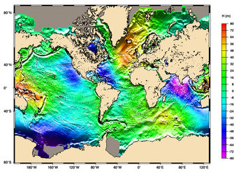
Sea surface height (SSH) is not constant but varies across the global ocean, with vertical expansion due to increased water temperature being one of the main reasons why: warm water masses can stand up to a metre higher than the surrounding sea. Satellite radar altimeters measure sea surface height down to a maximum accuracy of two centimetres.
Instruments such as the Radar Altimeter-2 (RA-2) on ESA’s Envisat bounce 1800 radar pulses per second off the Earth’s surface, measuring their return time to the nanosecond to calculate the precise signal distance travelled. The data returned over the open ocean helps to chart changes in sea surface temperature (SST). Altimetry data from Envisat and its predecessor mission ERS-2 are made available in near-real time, then blended with altimetry results from the French/US Jason-1 mission and the US GFO to ensure the best possible global ocean coverage.

Current altimetry-derived sea level anomaly measurements show differences in SSH of 60 cm between the west and east Pacific. This wide-area view provided by altimetry-derived sea level anomaly data complements other in-situ sources, including the 70 buoys of the Tropical Ocean Atmosphere (TAO) array across the equatorial Pacific, operated by the US National Oceanic and Atmospheric Administration (NOAA), the TRIangle Trans-Ocean buoy Network (TRITON) array operated by Japan’s Ministry of Education, Culture, Sports and Technology and also the more than 2000 global Argo profiling floats, which provide temperature and salinity profiles at various depths across the global ocean.
These results are then assimilated into sophisticated numerical models by weather centres worldwide, including the Reading-based European Centre for Medium Range Weather Forecasting (ECMWF) to help provide ‘initial state’ information to make seasonal forecasts of ocean states. The US NOAA Climate Prediction Center at the start of February announced that the conditions for a weak La Niña are in place - with central Pacific SST departing more than –0.5° C for the last three months - and the event is likely to last into late spring and possibly summer.
"The development of a negative anomaly does seem to be well in hand," agrees altimetry expert Christophe Maes of the Institut de Recherche pour le Développement (IRD) in New Caledonia. "It will still take a few months for the scientific community to better comprehend what is going on because the system has often surprised us in the past.
"If it is necessary to be careful in forecasting El Niño then it is all the more necessary for
The coming of La Niña is marked by shifts in global atmospheric circulation patterns, as colder than normal waters in the eastern tropical Pacific suppress rainfall in the vicinity, at the same time as increasing it to the west.
During the northern hemisphere winter, wetter than normal conditions are found over northern Australia and Indonesia. They also occur over the Philippines during the northern hemisphere summer, and Indian monsoon rainfall also increases, particularly in northwest India. Meanwhile South America’s tropical west coast undergoes drier than normal winters.
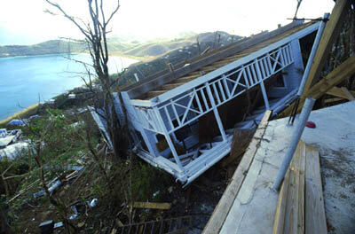
In turn these shifts affect the position and weaken the intensity of jet streams and the behaviour of storms occurring beyond the tropics in both hemispheres, including a summer decrease in hurricane activity in the eastern tropical North Pacific and a corresponding increase in the number of hurricanes in the tropical North Atlantic. The last La Niña took place during 2000-2001, a weak event compared to the previous La Niña in 1998-2000 – it, and the 1988-89 event together setting the terms of reference for a ‘standard’ La Niña.

Each week radar altimetry adds a new frame to the ongoing film being shot of the Pacific Ocean. Other satellite instrument types can gather additional detail on La Niña as it occurs: Envisat’s Advanced Along Track Scanning Radiometer (AATSR) can measure sea surface temperature (SST) to an accuracy of 0.2 °C while the Medium Resolution Imaging Spectrometer on the same spacecraft monitors changes in ocean colour due to associated shifts in marine phytoplankton concentrations.
Through a lack of observational data, the scientific community found itself blindsided by the 1982-1983 El Niño, then regarded as the ‘El Niño of the century’. Researchers’ predictive ability was improved by the international Tropical Ocean-Global Atmosphere (TOGA) programme of 1985-1989, which set up the first in-situ observing system – including the array of buoys that currently make up the TAO-TRITON network.
However this array was mostly concentrated in the equatorial Pacific, so from the early 1990s onward, radar altimeters flown on ERS-1 and TOPEX/Poseidon began to prove themselves valuable means of monitoring and analysing ENSO events on a wider scale. In particular, researchers are utilising altimetry data to monitor the exchange of warm water across the Pacific in order to evaluate different theories of the build-up to ENSO events.
ESA and altimetry
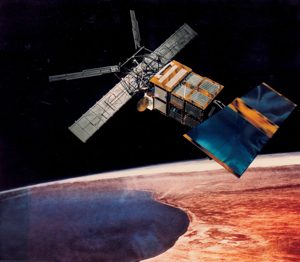
ESA has been flying radar altimeters in space ever since the launch of ERS-1 in 1991, amassing a continuous 15 year dataset that covers not only the global ocean but also freshwater bodies, land surfaces and the cryosphere. This archive will extend further into the future, with a radar altimeter set to be included on the Sentinel-3 mission planned to support operational oceanography services developed as part of the Global Monitoring for Environment and Security (GMES) initiative of the European Union and ESA.
A major scientific symposium concerning ‘15 Years of Progress in Radar Altimetry’ is taking place in Venice Lido from 13 to 18 March 2006. Jointly sponsored by ESA and the French space agency CNES, the event will include discussion of current and future scientific and operational applications of radar altimetry, and how altimetry data can be used in synergy with other satellite and in-situ results as well as computer modelling.