Arctic ice on the verge of another all-time low
Following last summer's record minimum ice cover in the Arctic, current observations from ESA's Envisat satellite suggest that the extent of polar sea-ice may again shrink to a level very close to that of last year.
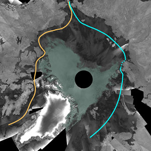
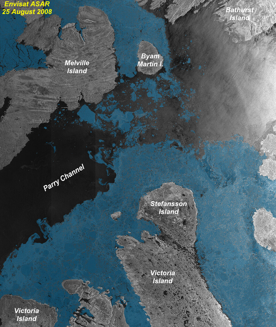
Envisat observations from mid-August depict that a new record of low sea-ice coverage could be reached in a matter of weeks. The animation above is a series of mosaics of the Arctic Ocean created from images acquired between early June and mid-August 2008 from the Advanced Synthetic Aperture Radar (ASAR) instrument aboard Envisat. The dark grey colour represents ice-free areas while blue represents areas covered with sea ice.
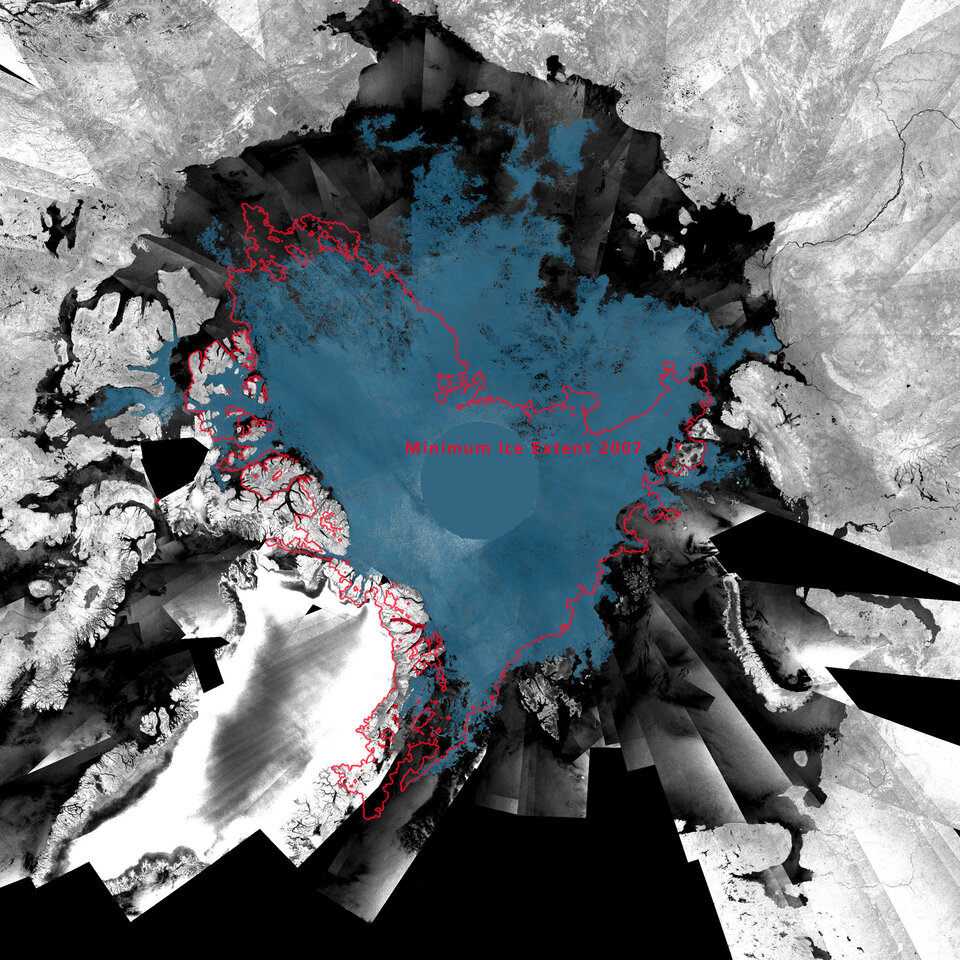
Current ice coverage in the Arctic has already reached the second absolute minimum since observations from space began 30 years ago. Because the extent of ice cover is usually at its lowest about mid-September, this year's minimum could still fall to set another record low.

Each year, the Arctic Ocean experiences the formation and then melting of vast amounts of ice that floats on the sea surface. An area of ice the size of Europe melts away every summer reaching a minimum in September. Since satellites began surveying the Arctic in 1978, there has been a regular decrease in the area covered by ice in summer – with ice cover shrinking to its lowest level on record and opening up the most direct route through the Northwest Passage in September 2007.
The direct route through the Northwest Passage - highlighted in the image above by an orange line - is currently almost free of ice, while the indirect route, called the Amundsen Northwest Passage, has been passable for almost a month. This is the second year in a row that the most direct route through the Northwest Passage has opened up.
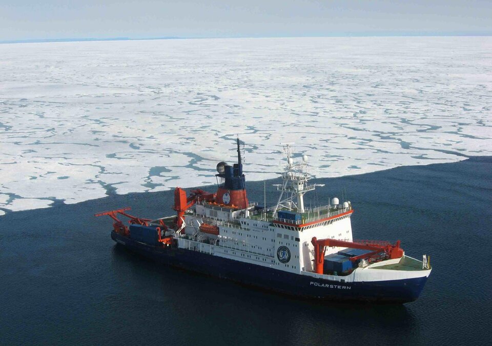
Prof. Heinrich Miller from the Alfred Wegener Institute (AWI) in Bremerhaven, Germany commented that, "Our ice-breaking research vessel 'Polarstern' is currently on a scientific mission in the Arctic Ocean. Departing from Iceland, the route has taken the ship through the Northwest Passage into the Canadian Basin where geophysical and geological studies will be carried out along profiles into the Makarov Basin to study the tectonic history and submarine geology of the central Arctic Ocean. In addition, oceanographic as well as biological studies will be carried out. Polarstern will circumnavigate the whole Arctic Ocean and exit through the Northeast Passage."
Regarding the use of satellite data for polar research Miller continues, "The polar regions, especially the Arctic, are very sensitive indicators of climate change. The UN’s Intergovernmental Panel on Climate Change has shown that these regions are highly vulnerable to rising temperatures and predicted that the Arctic would be virtually ice-free in the summer months by 2070. Other scientists claim it could become ice-free as early as 2040. Latest satellite observations suggest that the Arctic could be mainly ice-free even earlier."
Miller added, "At AWI we place particular emphasis on studying Arctic sea-ice, and along with in-situ studies of sea-ice thickness change satellite data have been used extensively - not only for the regular observation of changes in the Arctic and Antarctic, but also for optimising the operation of Polarstern in regions covered by sea ice."
The Arctic is one of the most inaccessible regions on Earth, so obtaining measurements of sea ice was difficult before the advent of satellites. For more than 20 years, ESA has been providing satellite data for the study of the cryosphere and hence revolutionising our understanding of the polar regions.
Satellite measurements from radar instruments can acquire images through clouds and also at night. This capability is especially important in areas prone to long periods of bad weather and extended darkness – conditions frequently encountered in the polar regions.
By making available a comprehensive dataset from its Earth Observation satellites and other ground and air-based capabilities, ESA is currently also contributing to one of the most ambitious coordinated science programme ever undertaken in the Arctic and Antarctic - the International Polar Year 2007-2008.
Further exploitation of data collected over the Arctic since 1991 is part of an ESA Initiative on Climate Change that will be proposed to the ESA Member States at its Ministerial Conference in November 2008. The proposal aims to ensure delivery of appropriate information on climate variables derived from satellites.
In 2009, ESA will make another significant contribution research into the cryosphere with the launch of CryoSat-2. The observations made over the three-year lifetime of the mission will provide conclusive evidence on the rates at which ice thickness and cover is diminishing.