Nereidum Montes helps unlock Mars’ glacial past
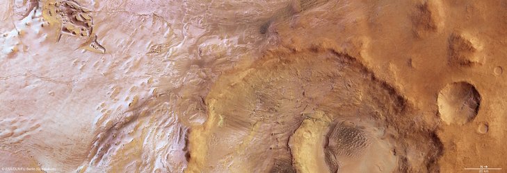
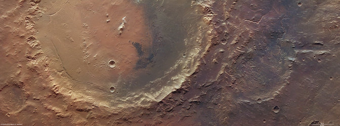
On 6 June, the high-resolution stereo camera on ESA’s Mars Express revisited the Argyre basin as featured in our October release, but this time aiming at Nereidum Montes, some 380 km northeast of Hooke crater.
The stunning rugged terrain of Nereidum Montes marks the far northern extent of Argyre, one of the largest impact basins on Mars.
Nereidum Montes stretches almost 1150 km and was named by the noted Greek astronomer Eugène Michel Antoniadi (1870–1944).
Based on his extensive observations of Mars, Antoniadi famously concluded that the ‘canals’ on Mars reported by Percival Lowell were, in fact, just an optical illusion.
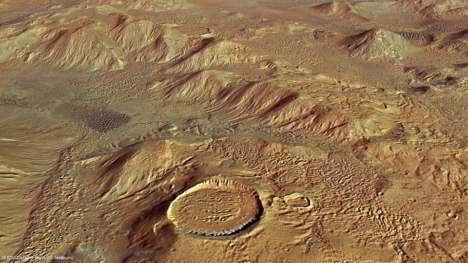
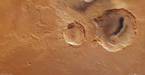
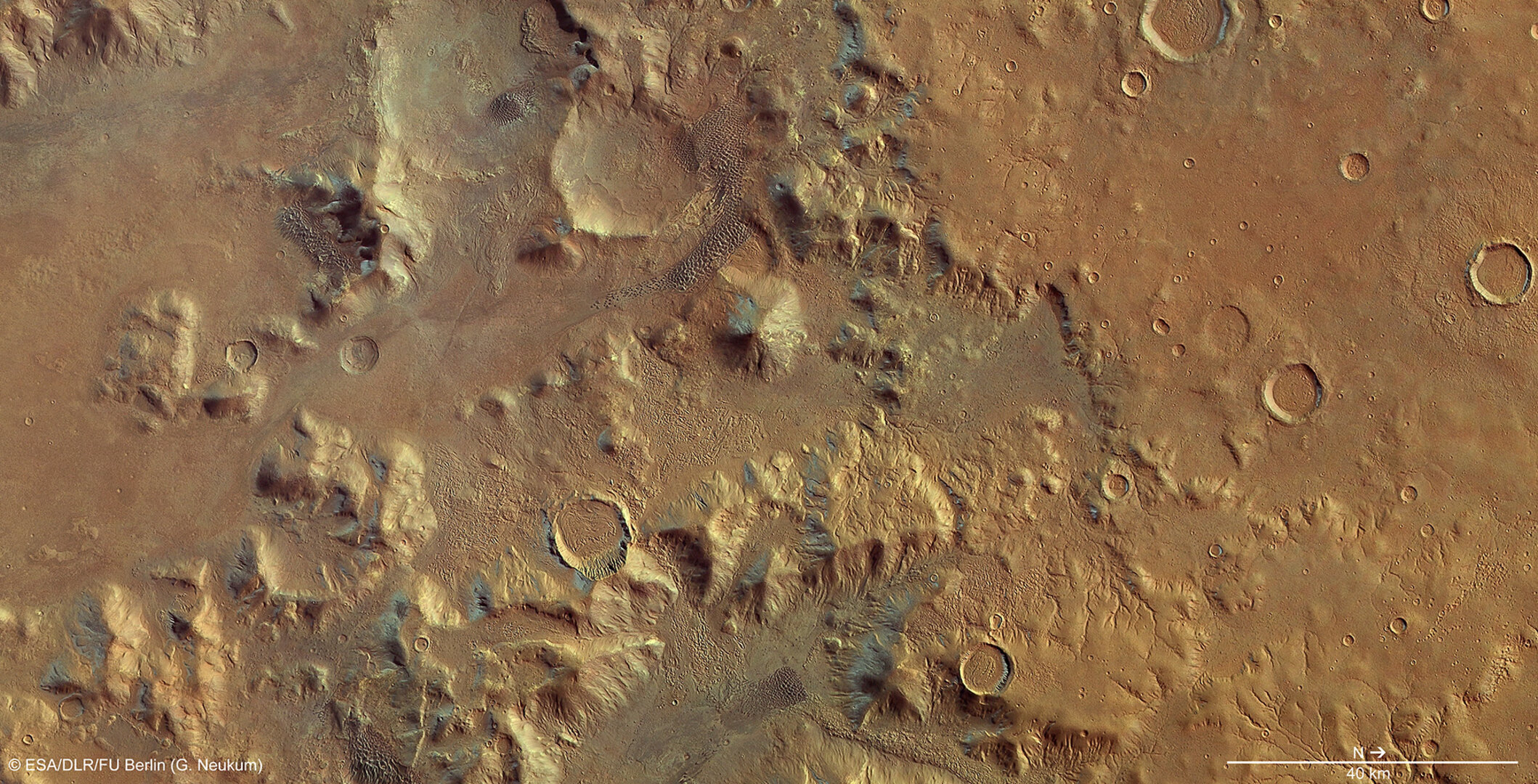
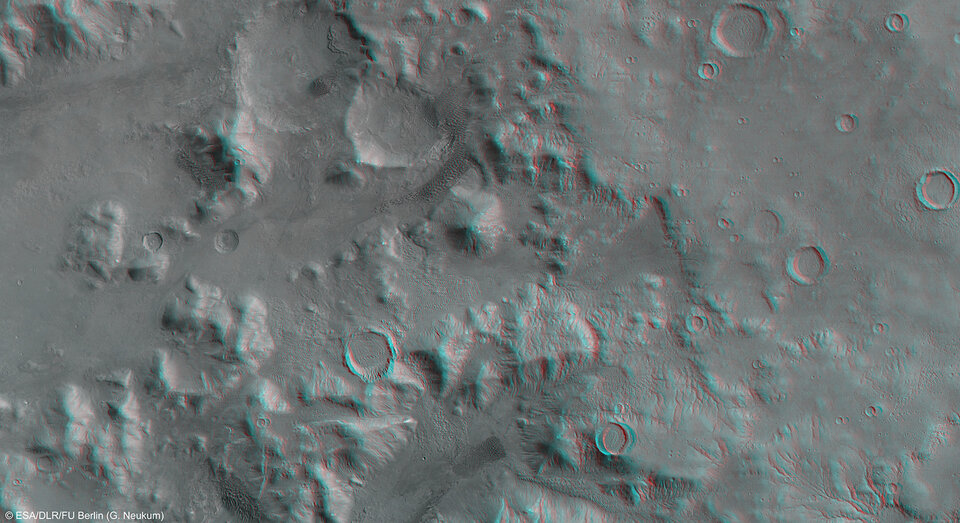
The images captured by Mars Express show a portion of the region, displaying multiple fluvial, glacial and wind-driven features.
Extensive dendritic drainage patterns, seen towards the north (lower right side) of the first and topographic images, were formed when liquid water drained into deeper regions within the area.
On Earth, tree-like channels of this kind are usually formed by surface runoff after significant rainfall, or when snow or ice melts. Similar processes are thought to have occurred on Mars in the distant past, when scientists now know there to have been water on the surface of the Red Planet.
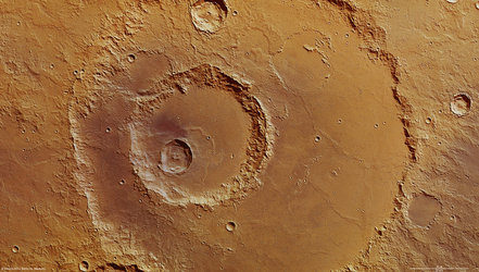
Several of the craters within the region, particularly in eastern parts (lower section) of the first image, show concentric crater fill, a distinctive martian process marked by rings of surface fluctuations within a crater rim.
The ratios between the diameter and depth of the filled craters suggest that there may still be water ice, possibly in the form of ancient glaciers, present below the dry surface debris cover.

Scientists have estimated that the water-ice depth in these craters varies from several tens up to hundreds of metres.
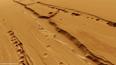
The largest crater on the south western side (top-left half) of the first and topographic images appears to have spilled out a glacier-like formation towards lower-lying parts of the region (shown as blue in the topographic image).

A smooth area to the east of (below) the glacial feature appears to be the youngest within the image, evidenced by an almost complete lack of cratering.
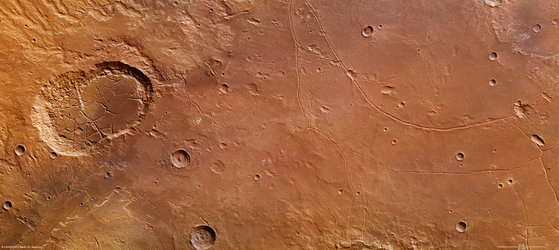
Another indication of subsurface water is seen in the fluidised ejecta blanket surrounding the crater at the northern edge (right-hand side) of the first and topographic images.
These ejecta structures can develop when a comet or asteroid hits a surface saturated with water or water ice.

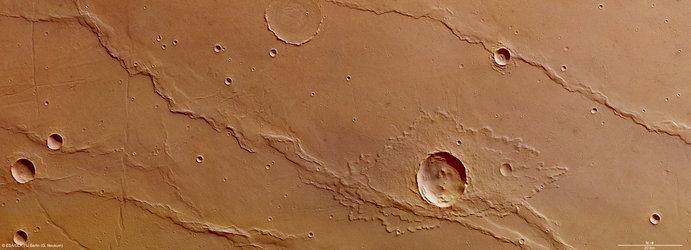
Finally, throughout the images and often near the wind-sheltered sides of mounds and canyons, extensive rippling sand dune fields are seen to have formed.
In-depth studies of regions such as Nereidum Montes play an essential role in unlocking the geological past of our terrestrial neighbour, as well as helping to find exciting regions for future robotic and human explorers to visit.