Even the Antarctic winter cannot protect Wilkins Ice Shelf
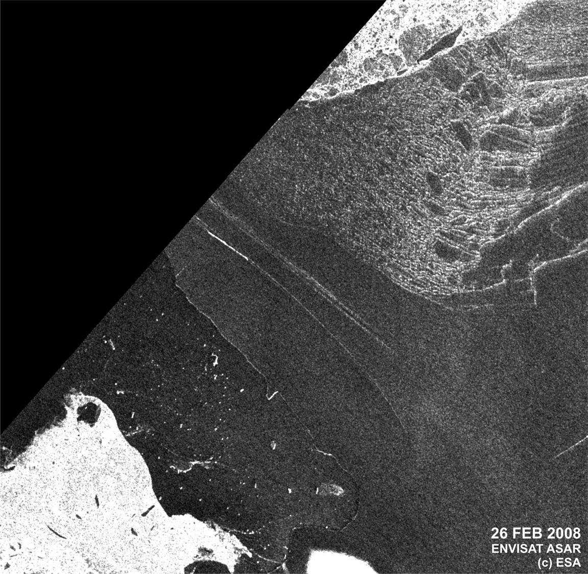
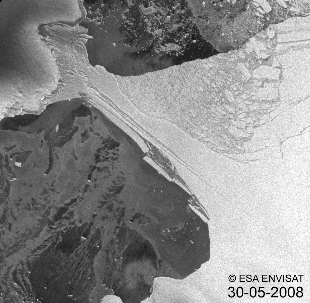
Wilkins Ice Shelf has experienced further break-up with an area of about 160 km² breaking off from 30 May to 31 May 2008. ESA’s Envisat satellite captured the event – the first ever-documented episode to occur in winter.
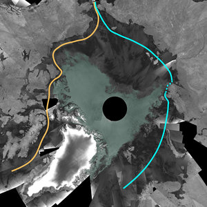
Wilkins Ice Shelf, a broad plate of floating ice south of South America on the Antarctic Peninsula, is connected to two islands, Charcot and Latady. In February 2008, an area of about 400 km² broke off from the ice shelf, narrowing the connection down to a 6 km strip; this latest event in May has further reduced the strip to just 2.7 km.
This animation, comprised of images acquired by Envisat’s Advanced Synthetic Aperture Radar (ASAR) between 30 May and 9 June, highlights the rapidly dwindling strip of ice that is protecting thousands of kilometres of the ice shelf from further break-up.
According to Dr Matthias Braun from the Center for Remote Sensing of Land Surfaces, Bonn University, and Dr Angelika Humbert from the Institute of Geophysics, Münster University, who have been investigating the dynamics of Wilkins Ice Shelf for months, this break-up has not yet finished.
"The remaining plate has an arched fracture at its narrowest position, making it very likely that the connection will break completely in the coming days," Braun and Humbert said.
Braun and Humbert are monitoring the ice sheet daily via Envisat acquisitions as part of their contribution to the International Polar Year (IPY) 2007-2008, a large worldwide science programme focused on the Arctic and Antarctic.

The ASAR images used to compile these animations were acquired as part of ESA’s support to IPY. ESA is helping scientists during IPY to collect an increasing amount of satellite information, particularly to understand recent and current distributions and variations in snow and ice and changes in the global ice sheets.
ESA is also co-leading a large IPY project – the Global Interagency IPY Polar Snapshot Year (GIIPSY) – with the Byrd Polar Research Centre. The goal of GIIPSY is to make the most efficient use of Earth-observing satellites to capture essential snapshots that will serve as benchmarks for gauging past and future changes in the environment of the polar regions.
ASAR is extremely useful for tracking changes in ice sheets because it is able to see through clouds and darkness – conditions often found in polar regions.
Long-term satellite monitoring over Antarctica is important because it provides authoritative evidence of trends and allows scientists to make predictions. Ice shelves on the Antarctic Peninsula are important indicators for on-going climate change because they are sandwiched by extraordinarily raising surface air temperatures and a warming ocean.
The Antarctic Peninsula has experienced extraordinary warming in the past 50 years of 2.5°C, Braun and Humbert explained. In the past 20 years, seven ice shelves along the peninsula have retreated or disintegrated, including the most spectacular break-up of the Larsen B Ice Shelf in 2002, which Envisat captured within days of its launch.