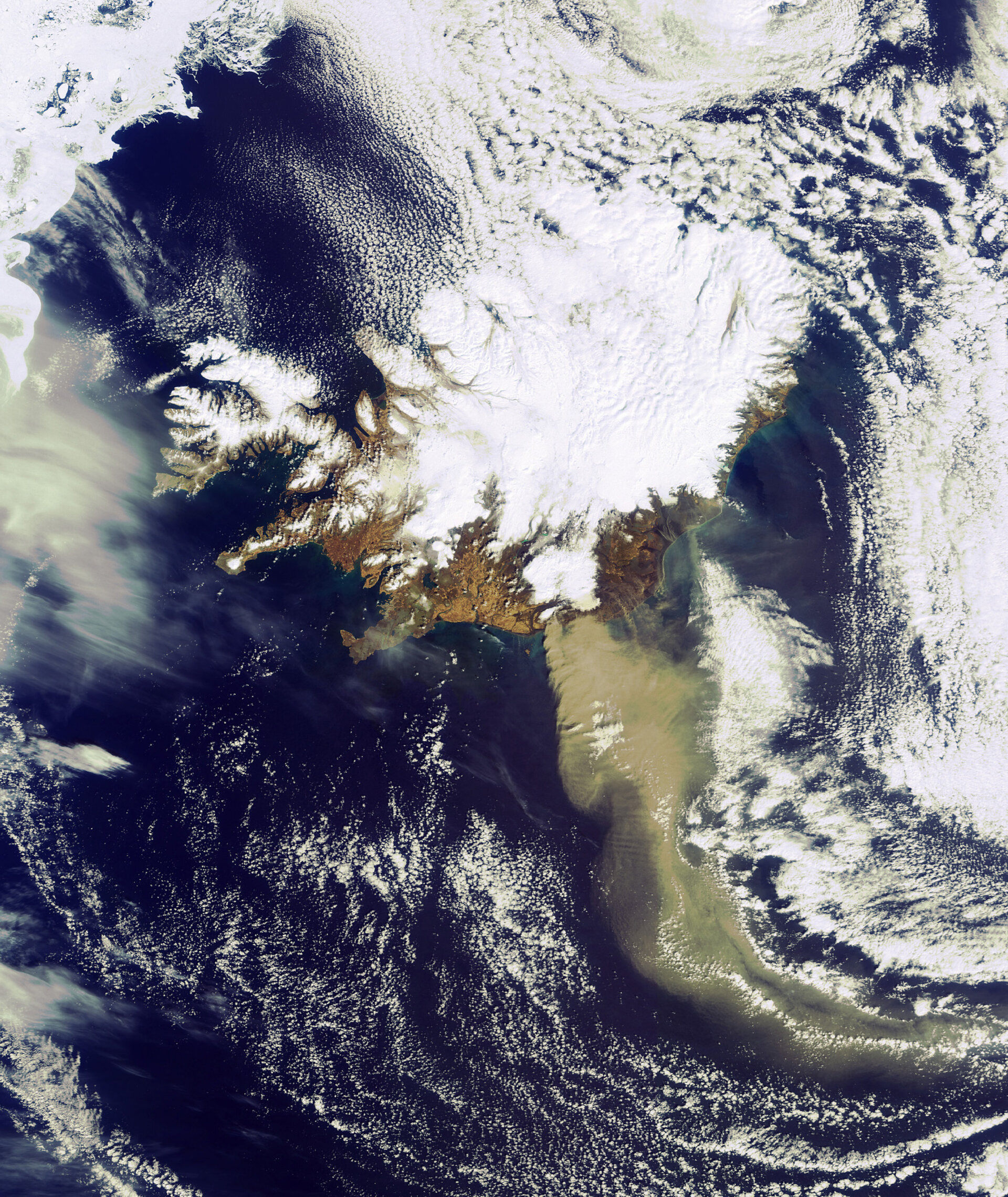
New satellite image of ash spewing from Iceland’s volcano
In this image taken just under two hours ago (14:45 CET) by ESA’s Envisat satellite, a heavy plume of ash from the Eyjafjallajoekull Volcano is seen travelling in a roughly southeasterly direction.
The volcano has been emitting steam and ash since its recent eruptions began on 20 March, and as observable, the emissions continue. The plume, visible in brownish-grey, is approximately 400 km long.
Envisat’s Medium Resolution Imaging Spectrometer instrument (MERIS) acquired this image on 19 April, while working in Full Resolution Mode to provide a spatial resolution of 300 m.
Envisat will continue to monitor the situation. To see the latest satellite images over the area, simply visit our MIRAVI website. MIRAVI, which is free and requires no registration, generates images from the raw data collected by MERIS and provides them online within two hours.