Preparing to monitor coniferous forests with Sentinel-2
Within the Global Monitoring for Environment and Security (GMES) framework, sustainable management of forests is recognised as an important challenge - one objective that will be addressed with the planned Sentinel-2 mission.
As part of the mission's preparatory activities, scientists have been conducting experiments in a mountainous region of the Czech Republic to help design a new procedure for retrieving precise data on the health of spruce forests.
Since the spring of 2005, scientists working for the Institute of Systems Biology and Ecology (ISBE) from the Czech Academy of Sciences have been focusing on research aimed at designing a physically-based algorithm to scale spectral and spatial data on vegetation, which is relevant to the development of the Sentinel-2 mission.
As one of a series of operational Earth Observation satellites planned as the space segment of GMES, Sentinel-2 will be a multispectral optical imaging mission for terrestrial applications and will provide continuity to the current Landsat and Spot satellites guaranteeing the availability of data to service providers and users. Formulating algorithms so that the eventual retrieved data is of optimum use is an important part of this new mission's preparatory activities.
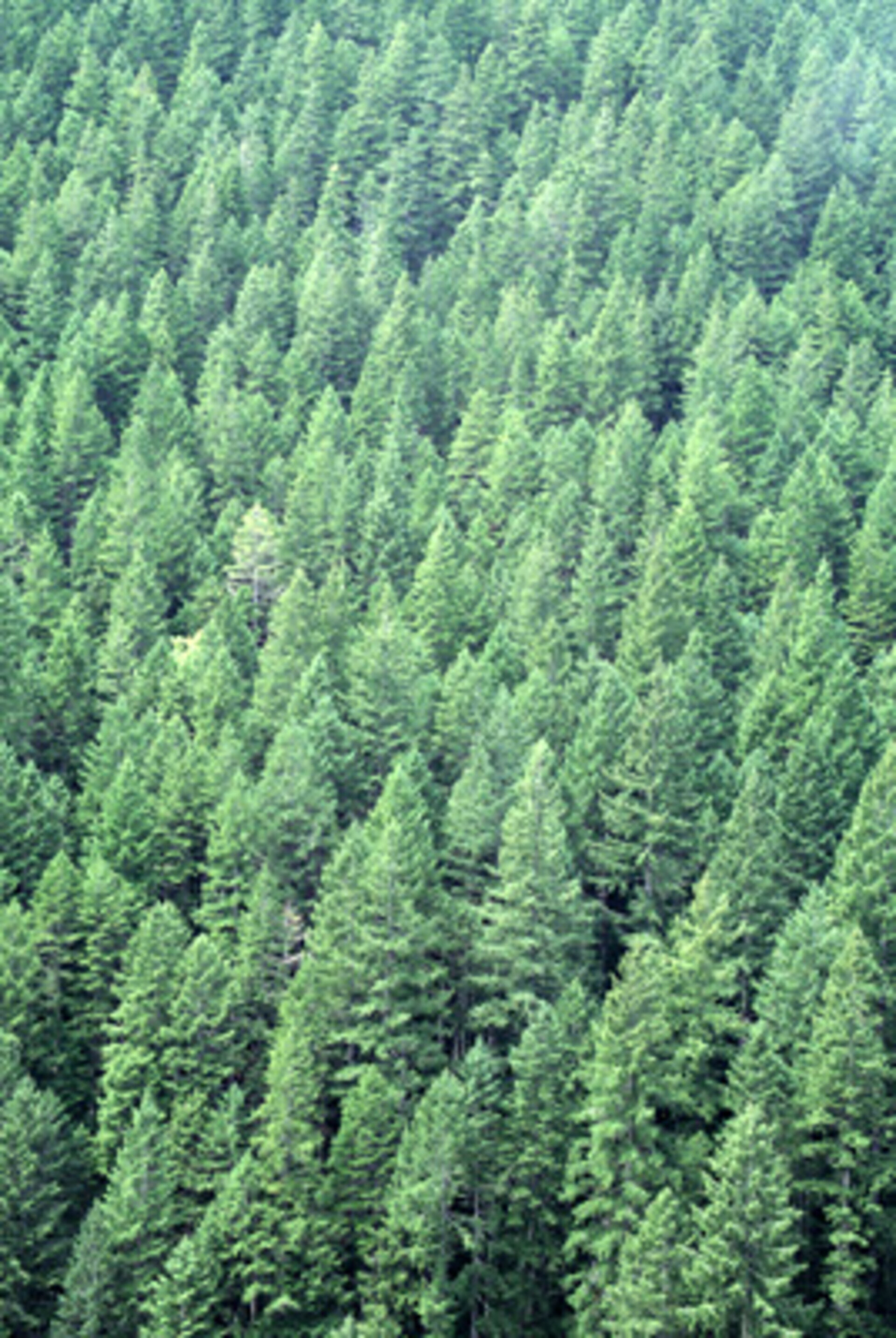
The research into this new algorithm is focused on the forests of Norwegian spruce (Picea abies (L.) Karst.) growing within montane and boreal ecosystems. Boreal forest is one of the largest types of biomass on Earth, therefore, research into the dynamics of the carbon cycle within this ecosystem and forest management are of scientific and economic importance. It is expected that the research carried out in the Czech Republic will result in a clearly defined procedure for retrieving chlorophyll content and Leaf Area Index (LAI) from optical imagery at high spatial resolution, as will be realised from the Sentinel-2 mission.
This activity also falls within the framework of ESA's Plan for European Cooperating States (PECS). The aim of PECS is to stimulate relations with interested European parties to increase the synergy between ESA programmes and the future plans in the space field for four East European countries - Hungary, the Czech Republic, Romania and Poland. Joining in 2004, the Czech Republic was the second country to sign the European Cooperating State Charter with ESA. Hungary also signed the Charter in 2004 and Romania signed the first European Cooperating State Agreement in 2006.
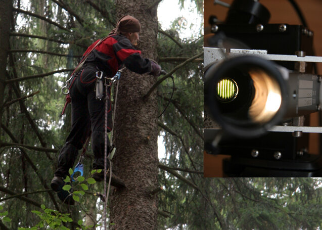
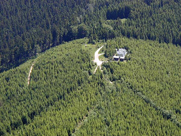
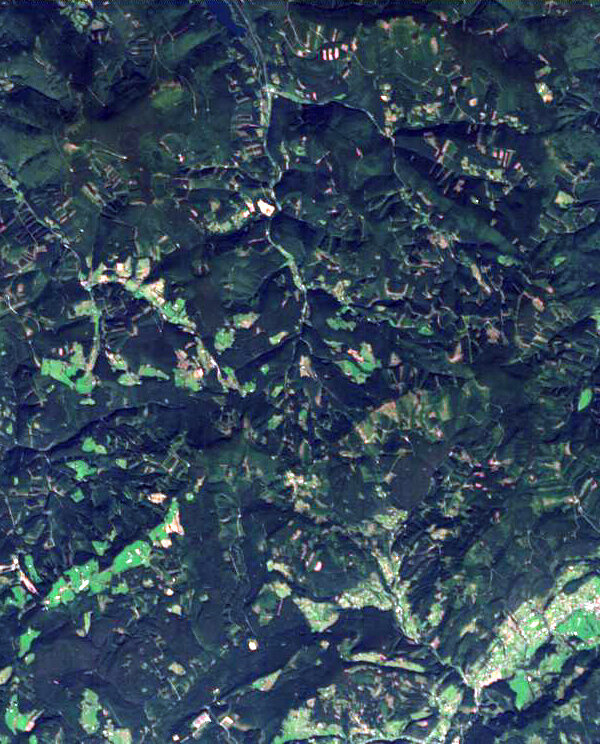
As part of the process to define these new algorithms, a complex campaign named HYPERspectral ThREE Scalse (HYPERTREES) was carried out in August and September 2006. Data from three levels – ground, airborne and satellite level – were simultaneously collected at an experimental research site called Bily Kris (White Cross), located in the Moravian-Silesian Beskydy mountains in the eastern part of the Czech Republic. The test site is equipped with a sophisticated ground system for monitoring basic Norwegian spruce ecosystems, and includes the facilities to measure carbon dioxide fluxes with an Eddy-covariance flux tower. Three structurally different plots of the spruce were studied within the test site - one which represented a relatively young (29 year old) homogenous monoculture growing in regular patterns, and two other plots with mature forest dominated by adult spruce trees (between 75 and 110 years old) growing irregularly.
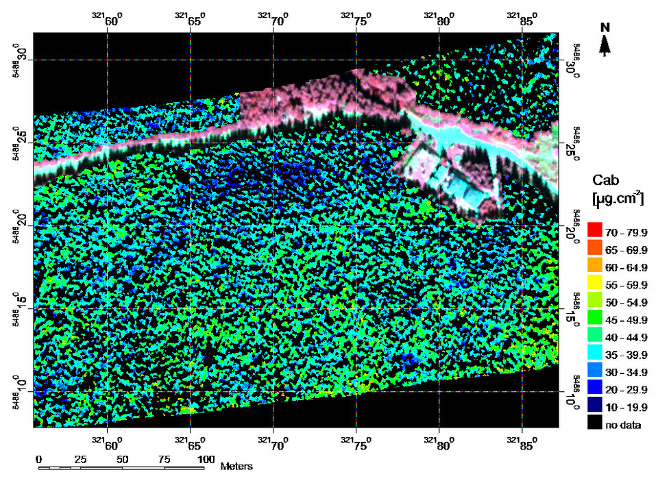
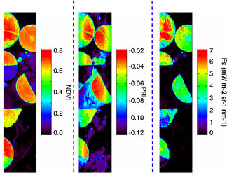
The ground-level part of the campaign involved the collection of data required to parameterize the radiative transfer models, as well as data needed to assess the quality of the final remote-sensing map products. When parameterizing high spatial resolution radiative transfer through spruce forest, careful attention has to be paid to the optical and geometric inputs. To this end, the optical properties of the spruce needles were measured in the field, taking their age and growing irradiation conditions into consideration. The same needle sets were used to determine their chlorophyll content in the laboratory in order to validate the later remotely-sensed chlorophyll estimations. With respect to the geometrical parameters, the spatial distribution of the trees within the plots, the shape of their crowns, their height and other characteristics were mapped. Finally, the LAI for all three plots measured.
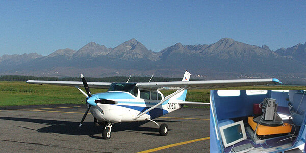
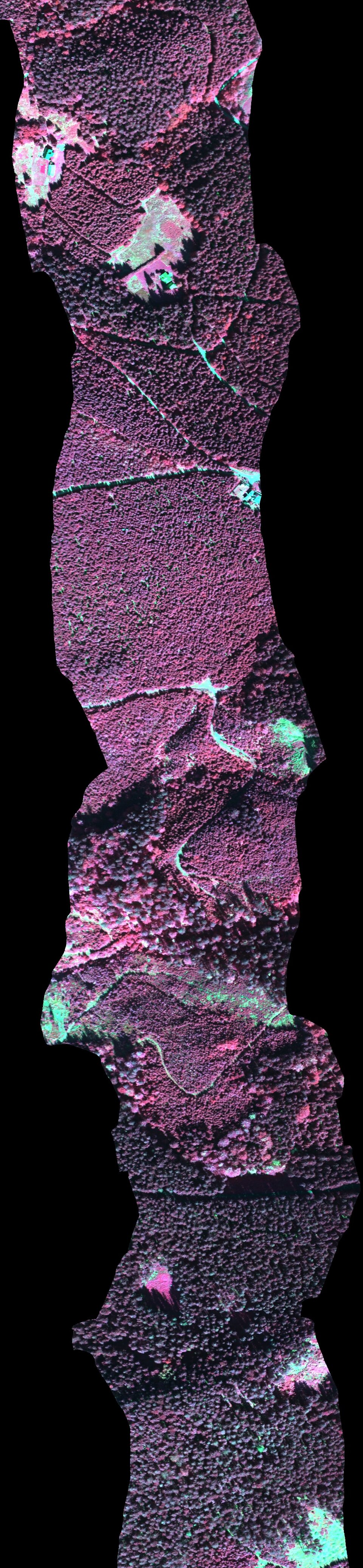
The airborne part of the campaign involved acquiring hyperspectral images with a Very Near Infrared Radiometer (VNIR) system AISA Eagle operated from a photogrammetric Cessna TU 206 F aircraft. A total of 28 flights were taken at three altitudes to achieve three different spatial resolutions. The spaceborne part of the campaign was accomplished by the Compact High Resolution Imaging Spectrometer (CHRIS) carried on the Project for On-Board Autonomy (PROBA) satellite. Three acquisitions were realised over the research site where each acquisition comprised five multi-angular hyperspectral scenes. These scenes will be crucial for testing the newly-developed algorithms.
All the acquired data sets are currently being processed by researchers from ISBE in cooperation with scientists from Charles University, Prague, Czech Republic. After the appropriate pre-processing, the data will be used develop the up-scaling methods that allow the quantitative estimation of the total chlorophyll content and LAI of Norwegian spruce forests using optical satellite images of high spatial resolution such as CHRIS/PROBA and Sentinel-2.