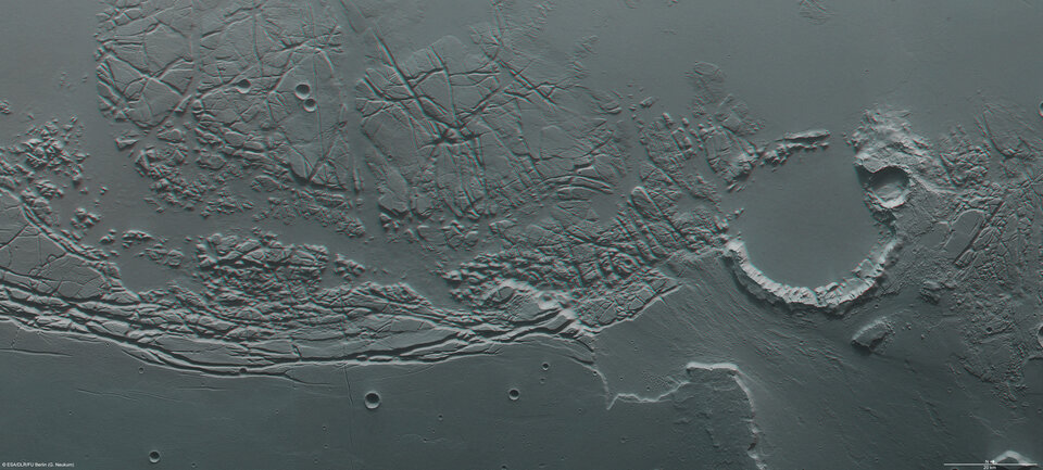
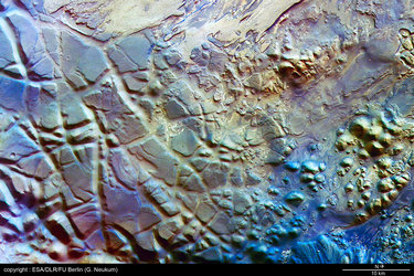
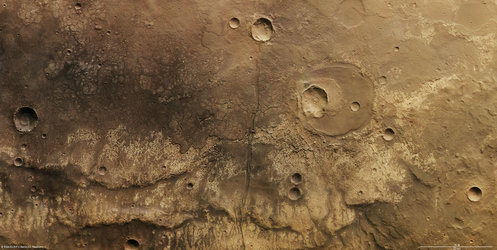
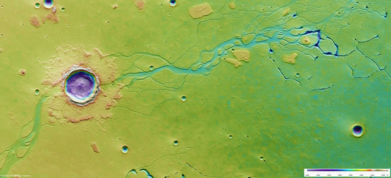
Chaotic terrain between Kasei Valles and Sacra Fossae
Mars Express flew over the boundary between Kasei Valles and Sacra Fossae and imaged the region, acquiring spectacular views of the chaotic terrain in the area.
The images, obtained by the High Resolution Stereo Camera (HRSC), are centred at 12°N / 285°E and have a ground resolution of about 21 m/pixel. They cover 225 x 95 km or 21.375 sq km, an area roughly half the size of the Netherlands.

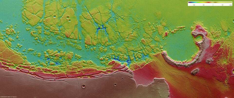
The upper portion of the image swath shows the eastern margin of Kasei Valles and the western margin of the Lunae Planum plateau and the adjoining Sacra Fossae. Kasei Valles is one of the largest outflow channels on Mars, spanning 3000 km, from the Chryse Planitia basin in the north to Echus Chasma to the south.

Sacra Fossae is a fault system that extends for more than 1000 km. It is several hundred metres deep and separates Kasei Valles to the south and west from Lunae Planum. It was named after Isola Sacra, an island at the estuary of the river Tiber in Italy.

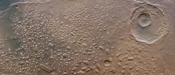
The images show an old 35 km-diameter impact crater in the north. The crater’s south-western rim is eroded strongly. The erosion is caused mostly by flowing water. The source of the water was located in Echus Chasma, which lies roughly 850 km to the southwest.
The crater floor and the northwestern part of the imaged region are remarkably flat and have been formed by sediments and basaltic lava flows originating from the Tharsis volcanic region.

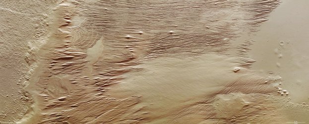
The lower part of the image clearly shows the boundary between the heavily cratered plain and the area with numerous fracture zones. Most of the fractures along the boundary are parallel to the edge of the Lunae Planum.
It is likely that the entire region experienced tectonic stresses as well as ‘subrosion’ — a process where subsurface rocks are dissolved and removed by water — causing overlying strata to collapse partially and form chaotic terrain.

Several fracture zones are also visible in the western part. Up to 10-km large areas that experienced ‘subsidence’ (gradual compaction and sinking owing to the weight of the layers) are still intact.
Comparable processes that form chaotic terrain were described in an earlier article on Aram Chaos (see links to the right).

The colour scenes were derived from the three HRSC-colour channels and the nadir channel. The perspective views were calculated from the digital terrain model derived from the stereo channels. The anaglyph image was derived from the nadir channel and one stereo channel. The black and white high-resolution images were derived from the nadir channel, which provides the greatest detail of all channels.

For more information on Mars Express HRSC images, please read our updated FAQ (frequently asked questions).