
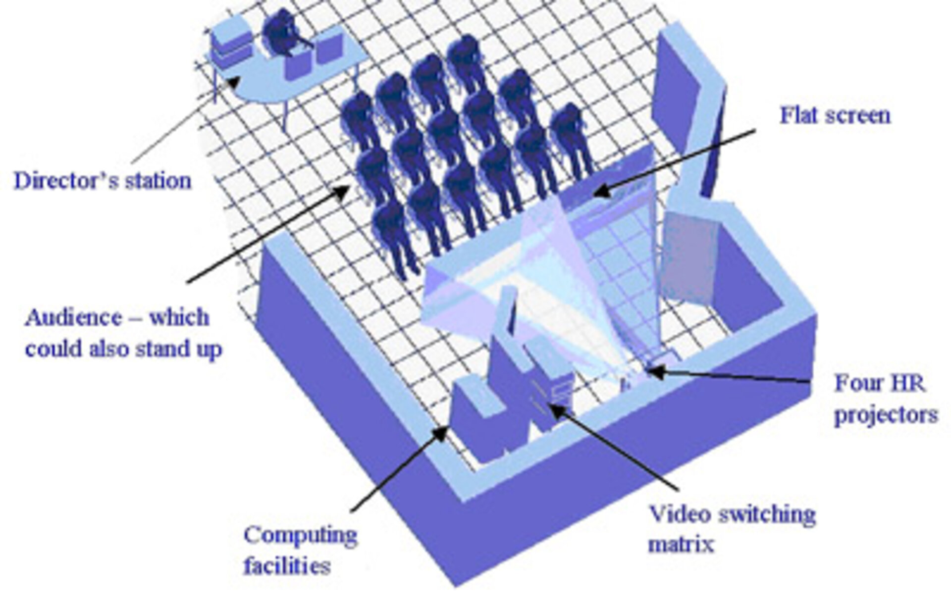
Virtual Reality Theatre
Explaining and understanding the practical uses of Earth Observation data can be difficult, and even specialists may have problems visualising a complex data set. To address these issues, in 2004 a Virtual Reality Theatre was built at ESRIN. Here, complex Earth Observation and geographical data are made into visual presentations so they can be grasped more readily by laypeople and specialists.
The theatre is equipped with a large rear-projection screen, a projection system that supports also stereoscopy, a sound system and a DVD player. It also has a director’s station to allow all the equipment to be controlled from a single location. The technology used for the real time visualization is largely inherited from that developed for video games.
Stereoscopy, a technique that allows to create an impression of 'depth' in the image, is used to make presentations that give the impression of 3-D. In the small theatre, designed for an audience of 10-15 people, special glasses with circular polarisation allow visitors to see the presentations in 3-D.
The Virtual Reality team have made a number of presentations to illustrate how satellite data can be used. With virtual reality technology it is possible to create 3-D animations and time-series visualisation of practically every type of geographical and atmospheric data used in the domain of Earth Observation and of many others, and to navigate in the data in real time. Rear-projection allows users to walk up to the screen and point out areas of particular interest without casting a shadow on the screen, thus allowing more active participation by the audience.
The theatre can be extremely useful in disaster management and environmental impact studies, or in other applications that require the cooperation of experts in different disciplines. Recent presentations have shown, to mention a few, how Earth Observation data can be used to monitor flooding of the River Elbe in Germany, the deformation between eruptions of the volcano Etna in Italy and the evolution of the El Nino phenomenon.
Presentations demonstrating Earth Observation applications have been shown to, among others, visiting scientists, civil protection authorities, insurance personnel assessing risk management and, of course, to ESA staff.
The ESRIN Communications Office also makes good use of the Virtual Reality Theatre. 3-D presentations allow to explain to visiting groups, including students, the many ways in which multiple data sets, collected by satellites or otherwise, can be used to study or explain complex interacting phenomena.
