

Call for ideas to augment satnav with imaging sensors & 3D maps
Update: NAVISP webinar replay now added below
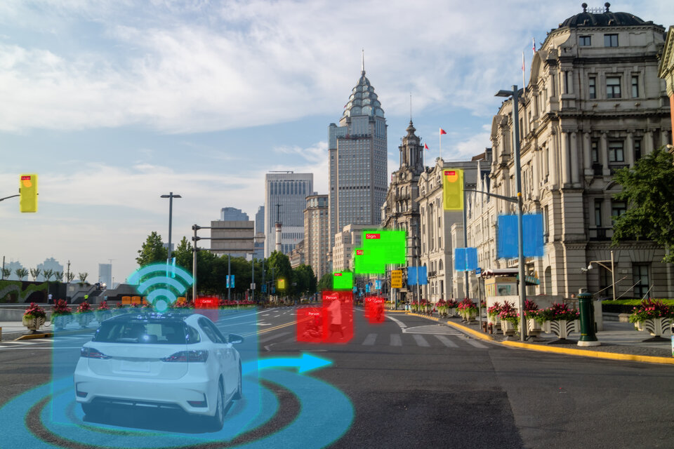
Busy urban centres represent key areas of demand for satellite navigation services, but dense concentrations of high buildings mean that satnav signal reception may sometimes fall short. So ESA is issuing a call for ideas to make up for such service gaps through the use of imaging and 3D mapping technology – ahead of a dedicated workshop on 6 July.
ESA’s dedicated navigation innovation and support programme, NAVISP, is looking into assisted satnav harnessing image sensors and 3D urban models and seeking out prospects for demonstration projects involving mobility applications from road to maritime transport – and even drones.

Signals from Global Navigation Satellite Systems (GNSS) such as Europe’s Galileo cannot reach everywhere they are needed. In urban centres for instance, high buildings form ‘urban canyons’ that shrink down receivers’ view of the sky, or artificial structures can reflect GNSS signals, called ‘multipath’.
But the growing availability of high-quality image sensors and high-fidelity 3D maps – such as those within smartphone mapping apps – offer a promising way to shrink this performance gap for future mobility applications in terms of ubiquity, reliability and resilience.
ESA’s Navigation Innovation and Support Programme, NAVISP, advancing innovation in the fields of Positioning, Navigation and Timing (PNT) is opening a thematic window dedicated to ‘Assisted GNSS with Imaging Sensors and 3-D models for Mobility Applications’, calling for proof-of-concept demonstration projects or national testbeds to facilitate the introduction of this technology into commercial products.

The use cases to be addressed revolve around private or public autonomous transportation in cities, and other satellite-visibility constrained environments, where augmentation technologies can make a big difference. The targeted mobility classes include cars, trams, scooters, bikes, urban ferries, harbours, narrow waterways navigation and future passenger drones.
Imaging sensors can be used to map the surrounding of the vehicle and might also be used to identify features of the environment recorded in 3D maps.
High fidelity 3D city models can also be used to predict satellite position and enhance signal reception conditions to improve the user position. Some of the techniques require processing of vast amount of data. However this challenge could be surmounted using AI algorithms, and by performing the bulk of heavy computations in the cloud.
Commercial products exploiting these capabilities are already being introduced and with this Thematic Window, the Agency aims to further support this potentially high-growth application area.
NAVISP’s new Thematic Window opened on 10 June and will close on the 31 October 2021. During its duration, ESA is offering dedicated support to the companies interested in participating in the projects and submitting outline proposals.

On 6 July, the Agency is organising a workshop with interested stakeholders in order to raise general awareness about the initiative and clarify any issues the interested companies may have. At this webinar, ESA will present the requirements of this Thematic Window as well as the application process. The Webinar will include presentations from high-level experts covering market perspectives, the various techniques involved in the use of 3D models and imaging sensors, the state of the art of these technologies and latest advances in visual navigation and artificial intelligence applied to mobility applications.
The agenda of the workshop can be found here. To register, click here.