

ESA technology for safer, smarter European roads
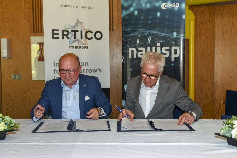
An agreement signed yesterday looks to extend the use of ESA space technology along European roads. The Agency’s Navigation Directorate has finalised a Memorandum of Intent with ERTICO, the organisation for the European Road Transport Telematics Implementation Coordination, a public-private partnership focused on the development, promotion and connection of intelligent road systems and services.
The collaboration between ESA and ERTICO is intended to support and promote the development and commercialisation of future, more sustainable technologies in the transport and mobility sector. Achieving a green transition in this sector is particularly important, as it accounts for about 23% of global CO2 emissions, of which almost half (45%) are coming from cars and another 30% from trucks. Increasing the use of space for a green future is part of ESA’s strategy to accelerate the use of space.
“Today’s memorandum represents a big step towards a more efficient, safer and sustainable transport sector in Europe by the use of space-based applications and services,” comments Javier Benedicto, ESA’s Director of Navigation. “Through various activities including European co-funded projects, innovation platforms and international cooperation advocacy, the partner members of ERTICO have been advancing the state of the art in transport for more than two decades.
“ERTICO’s comprehensive roadmap defines a future where vehicles communicate with each other, the roads they drive on and other infrastructure – but also highlights the fundamental need for ubiquitous, precise, and reliable positioning, navigation, and timing information – PNT. This is the very focus of ESA’s Navigation Innovation and Support Programme, NAVISP, so the potential for synergy is evident and enormous.”
Involving many of the engineers who oversaw the development of Europe’s Galileo satnav system, NAVISP is looking into all kinds of clever ideas about the future of navigation: ways to improve satellite navigation, alternative positioning systems and new navigation services and applications. The programme is divided between a trio of elements: NAVISP Element 1 supports innovation in PNT, with Element 2 focusing on industrial competitiveness, including novel technologies and services and Element 3 devoted to supporting participating Member State priorities, such as developing national PNT test areas.
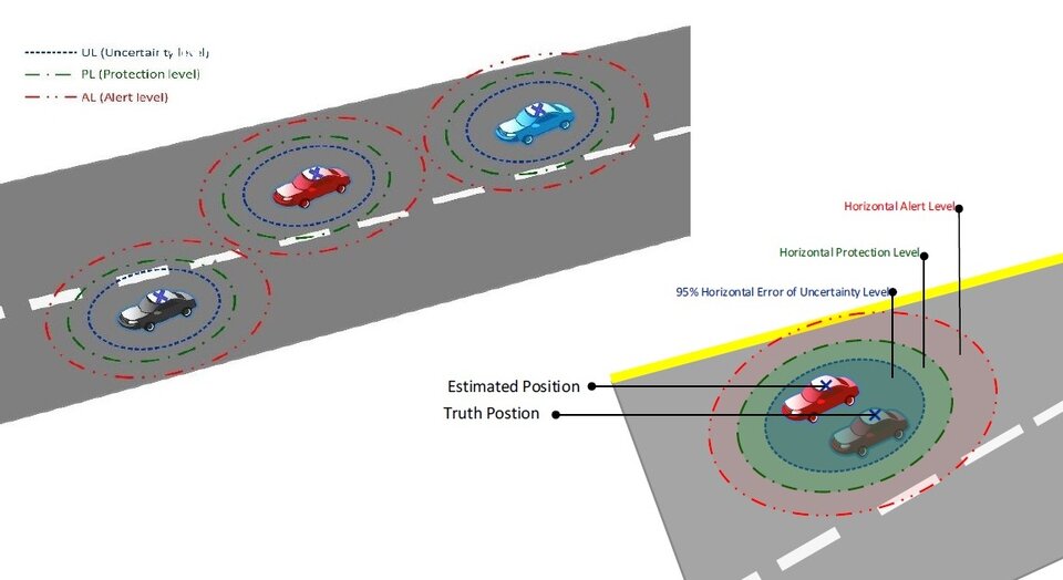
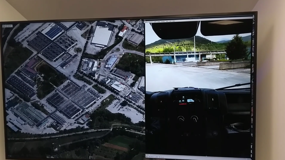
NAVISP projects have already addressed intelligent road systems and services across all three programme elements. With aviation the safest mode of transport, Element 1’s IMPACARS project looked into extending the aviation-based concept of ‘integrity’ to automobiles. Element 2’s Road Sounder project involved low-cost devices that can be placed aboard vehicles to monitor the status of road surfaces, while Element 3’s P-CAR is supporting the development of a laboratory for autonomous driving in Italy.
“There is still much more to do in supporting the transition to safer and more sustainable traffic systems in the future, and today’s new cooperation effort helps make that possible,” adds Rafael Lucas, Head of NAVISP’s Technicial Programme Office.
“Because ERTICO bridges so many different actors – service providers, transport companies, research institutions, universities, public authorities and the connectivity industry as well as vehicle manufacturers – this cooperation opens up a huge number of unique starting points for future research, bringing our work closer to the market and increasing opportunities for commercialization of space-based applications.”
ERTICO – founded in 1991 at the initiative of several industry leaders and the European Commission – is a public-private partnership organisation with close to 120 members, connecting different sectors in the intelligent transportation system community.

“Our ‘Cooperative, Connected and Automated Mobility’ (CCAM) roadmap is a major focus area for us,” explains Joost Vantomme, CEO of ERTICO. “It will enable the reduction of human error – by far the largest cause of road accidents – through features such as collision avoidance, lane departure warnings and auto-parking, as well as the regulation of traffic flow to maximise the efficient use of fuel and prevent the otherwise inevitable congestion of European roads.”
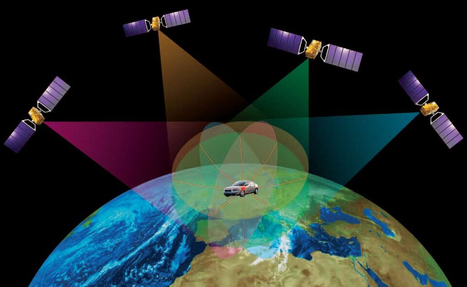
An assisted or automated vehicle must fuse together data from multiple sensors – such as video cameras, lidar, radar, inertial measurement units and odometers – along with wi-fi, 5G and other communication links. For an objective measurement of its location it also requires ubiquitous, continuous PNT information.

Satellite navigation is most often used for PNT but in some environments, such as busy city centres, the signals can be cut off by tall buildings, low underpasses or unwanted reflections called ‘multipath’ – so positioning information can be lost just when it most required. Multiple NAVISP projects are therefore looking into augmenting satnav with a variety of additional PNT sources.
About NAVISP
Many of the experts that designed and oversaw the Galileo satnav system are now supporting cutting-edge European companies in the development of new navigation technologies and services. The result is ESA’s Navigation Innovation and Support Programme, NAVISP.
NAVISP is looking into all kinds of clever ideas about the future of navigation: ways to improve satellite navigation, alternative positioning systems and, new navigation services and applications.
Working in partnership with European industry and researchers, more than 200 NAVISP projects have been initiated so far.


Access the video