
Europe’s approach
The European Space Agency and European Commission are working together to design and develop Europe’s own satellite navigation system, Galileo.
Europe has no control over the American and Russian systems, Global Positioning System (GPS) and Global Orbiting Navigation Satellite System (GLONASS), which were developed for military purposes. The European Galileo system is being built for civilian purposes and will offer a guaranteed service, allowing Europe to develop its own integrated transport system. It will also allow the European economy to benefit from the enormous growth expected in value-added services and equipment for navigation systems.
Europe’s first venture into satellite navigation, however, will be the European Geostationary Navigation Overlay Service (EGNOS), a system to improve the reliability of GPS and GLONASS to the point where they can be used for safety critical applications, such as navigating ships through narrow channels, or helping pilots to land planes safely. ESA engineers first developed plans for a GPS and GLONASS augmentation system in the late 1980s. The Agency, working in close cooperation with the European Commission and the European Organisation for the Safety of Air Navigation (Eurocontrol), later adopted the plans as the EGNOS programme.
EGNOS becomes operational in 2005, for non-safety critical applications. It is Europe’s contribution to the first stage of the Global Navigation Satellite System, which also includes similar enhancements under development in the US (WAAS) and Japan (MSAS). The fact that all these augmentation systems will be compatible means that the same receiver can be used for each of these systems. For example, when flying over the Atlantic the same equipment could be set to being WAAS or EGNOS enabled.
The European Union, however, recognised the need for Europe to have control over its own completely independent global satellite navigation system. Consultations began in 1994 and four years later plans for a fully European system were drawn up. Early in 1999, the EC announced Galileo, which is to be implemented as a civil system under European control. It will complement GPS and GLONASS and will be compatible and inter-operable with them.
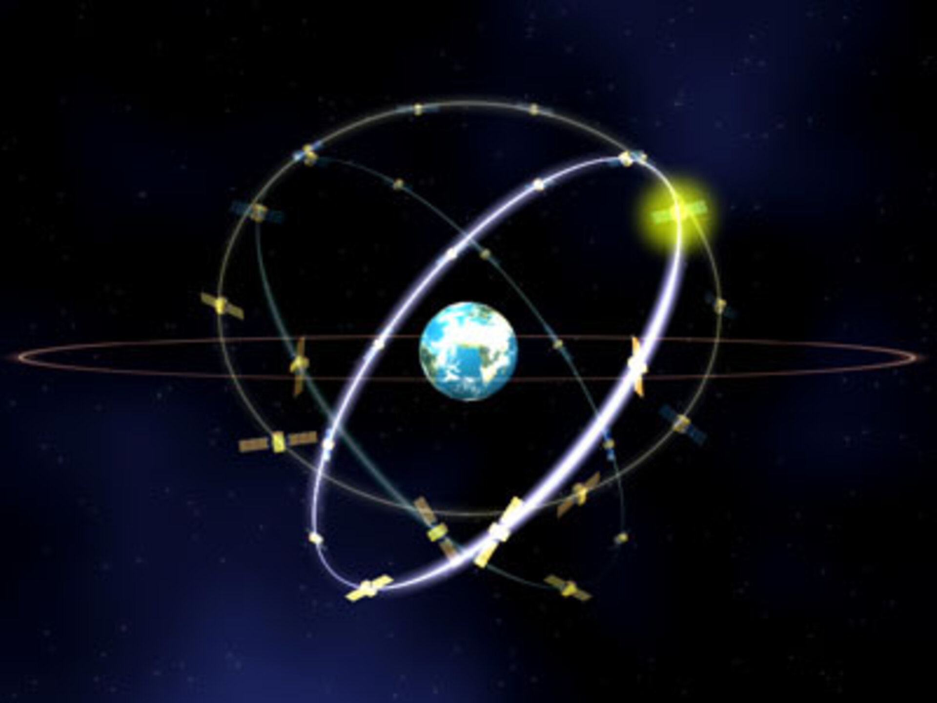
Galileo will consist of about 30 satellites, a global network of tracking stations and central control facilities in Europe. It is Europe’s contribution to the second stage of the Global navigation Satellite System, which will use the GPS, GLONASS and Galileo systems to provide an integrated satellite navigation service of unprecedented accuracy and global coverage under civilian control.
The Galileo Programme is being implemented in three phases:
- Definition phase
- Development and in-orbit validation
- Full Deployment and Operations
The Definition phase was completed in 2003 resulting in the basic specifications for the system.
The Development and In-Orbit Validation phase was initiated in late 2003. This phase aims to perform an in-orbit validation of the system with a reduced constellation of four satellites, the minimum number to guarantee the provision of exact positioning and time at test locations. Early in this phase, an experimental satellite will also be launched, to secure the Galileo frequency filings, to characterize the orbits to be used by the in-orbit validation satellites and to test some of the critical technologies, such as the atomic clocks.
The experimental satellite will be launched before the end of 2005. The in-orbit validation will then start.
The Development and In-Orbit Validation phase will be followed by the Full Deployment phase which will cover the manufacturing and launch of the remaining satellites and the completion of the ground segment. Once all satellites have been fully deployed, the operation will initiate with the complete constellation of 27 operational satellites and three in reserve, all stationed on three circular Medium Earth Orbits (MEOs) at an altitude of 23616 km and with an inclination of 56º to the equator. To support this there will be an extensive network of ground stations, and local and regional service centres.
The Galileo Joint Undertaking, created jointly by the European Commission and ESA, started the process for choosing the concessionaire, the future “Galileo Operating Company” which will take charge of the final deployment then the operations.
