

Ten years of safer skies with Europe’s other satnav system
With 26 satellites in orbit and more than two billion receivers in use, Europe’s Galileo satellite navigation system has made a massive impact. But our continent has another satnav system that has been providing safety-of-life services for ten years now – chances are that you’ve benefited from it without noticing.

Its name is EGNOS, the European Geostationary Navigation Overlay Service. Transmitting signals from a duo of satellite transponders in geostationary orbit, EGNOS gives additional precision to US GPS signals – delivering an average precision of 1.5 metres over European territory, a tenfold improvement over un-augmented signals in the worst-case – and also confirmation of their ‘integrity’ – or reliability – through additional messaging identifying any residual errors.
While its Open Service has been in general operation since 2009, EGNOS began its EU-guaranteed safety-of-life service in March 2011.

ESA designed EGNOS as the European equivalent of the US WAAS, Wide Area Augmentation System, working closely with the European air traffic management agency Eurocontrol, passing it to the European GNSS Agency, GSA, to run operationally.
Guiding airliners down
First and foremost its primary customer is aircraft. Imagine an airliner coming into land at Charles de Gaulle, or another major European airport, in bad weather. The pilots cannot see their runway through clouds and rain, but without needing any guidance from the ground they can still confidently descend all the way down to just 60 metres’ altitude before needing to make visual contact with the tarmac – thanks to EGNOS.
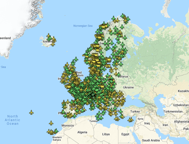
France’s Pau Pyrénées Airport was the first airport to utilize EGNOS, on 17 March 2011. Today, more than 385 airports and helipads and 60 airlines across Europe are today utilising such EGNOS-based LPV-200 approaches, short for ‘Localizer Performance with Vertical guidance – 200 ft (60 m)’. The freely-available EGNOS service requires no ground equipment whatsoever, replacing the radio guidance beamed upward by traditional CAT I Instrument Landing System (ILS) infrastructure with no decrease in performance.
EGNOS serving drones
Having guided hundreds of thousands of passengers down safely during the past decade – and employed widely in additional sectors such as maritime navigation – EGNOS is now being eyed as the enabler of smaller aerial vehicles making safe use of airspace, in the shape of autonomous drones.

The GSA has supported numerous trials of ‘remotely piloted aircraft systems’ equipped with EGNOS as well as Galileo through its EGNSS4RPAS project. The projection is that crewed aircraft will be vastly outnumbered in our skies by all kinds of automated aerial vehicles, employed for everything from weather and environmental monitoring to personalised delivery services.
The traditional person-based traditional air traffic control model will need to evolve to accommodate such a shift, based on automated monitoring, traffic management and collision avoidance. This highly automated version of air traffic control is termed ‘U-space’.
EGNOS’s safety-of-life service is seen as essential to making this happen, moving from today’s situation where drones are limited to specific air corridors and line-of-sight operations to let them roam freely but safely in busy airspace and built-up areas.

“The whole idea behind EGNOS’s safety-of-life has been to render satellite navigation sufficiently reliable for any kind of use,” explains Didier Flament, leading ESA’s EGNOS team. “After ten years of faultless operations, new applications are becoming plain: drone flight is one example, and EGNOS is also being evaluated for train positioning as well as assisted and autonomous automobile driving.”
New generation of service
ESA retains responsibility for the system’s future evolution, and the middle of this decade should see the debut of its new generation, known as ‘EGNOS v3’.
Didier adds: “While the current system only works with single-frequency GPS signals, EGNOS v3 will operate on a multi-frequency, multi-constellation basis, able to augment all available satellite signals in both L1 and L5 bands, including Galileo. The result will be far enhanced performance and reliability.
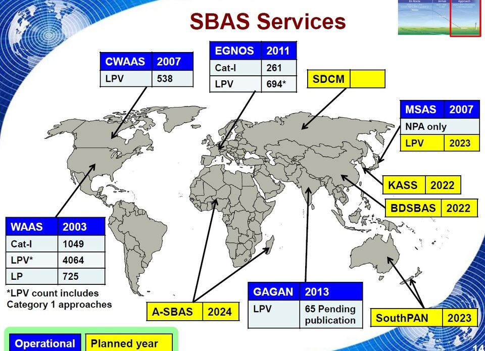
“In addition, we are working with developers of other satellite-based augmentation systems around the globe to ensure they stay fully interoperable so for instance EGNOS-equipped aircraft can fly between continents on a seamless basis. Such Interoperability combined with the arrival of the other SBAS systems under development in other regions will lead to a quasi-global worldwide safety of life service coverage in the year 2030.”